
Guaranteed Group Departures 2026


Hiking trips without a guide and a group with overnight stays in mountain huts
Hiking trips with scheduled group departures – local mountain guides and groups of 6 to 8 members
Individually planned private hiking trips on the dates of your choice
Guided custom day hikes and excursions
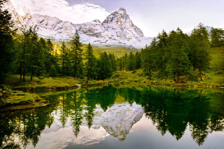
All Dolomites, including Tre Cime, Lagazuoi, Cinque Torri, Sella, Marmolada, Cortina d'Ampezzo and more
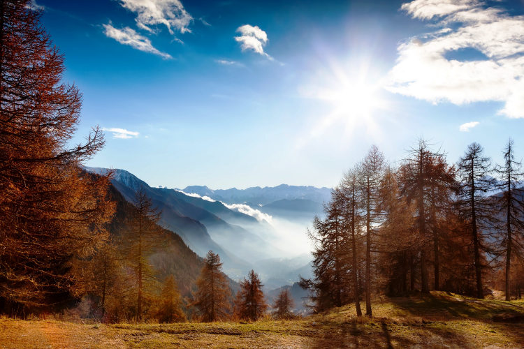
Pennine Alps, Graian Alps including Gran Paradiso, and Aiguilles Rouges
Stelvio National Park, Ortler, Cevedale, Adamello, Bernina, Texel
Ranges of northern Garda, Monte Baldo, lake Ledro, Monte Bondone
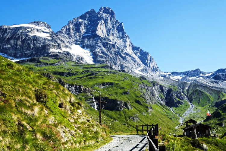
Home/Mont Blanc and Matterhorn Hiking Tours/Alta Via 1 Aosta
Explore the Pennines – one of the highest mountain ranges of the Alps
Enjoy great views of Monte Rosa, Matterhorn and Mont Blanc from your trail
Hike on the sunny southern slopes of the Pennine Alps away from crowded trails
Enjoy higher than average comfort of huts and mountain hotels
See impressive works of Roman architecture in the basecamp locations Aosta and Pont-St-Martin
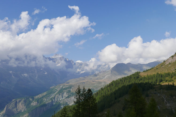
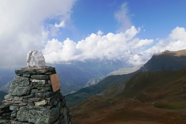
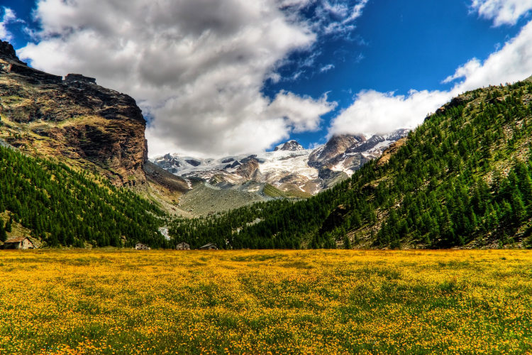
The Alta Via N.1 takes you through the sunny southern offshoots of the Pennine Alps from Monte Rosa through Matterhorn to Mont Blanc. Exactly one half of the Alps' 22 four-thousanders are in the Pennines, and you will see most of them from your trail. The sweeping panoramas of the inaccessible snow-covered peaks of the main Pennine ridge are sure to impress even the seasoned mountain hikers who have seen it all.
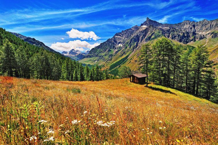
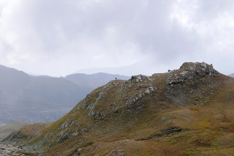
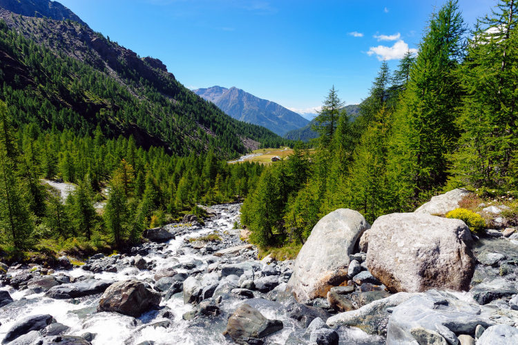
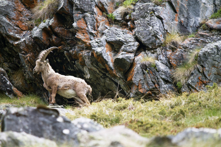
The classic Alta Via N.1 is a lengthy high-altitude hiking itinerary of at least 10 trek days. This High Route features steep ascents to high mountain passes and descents into valleys, which is typical of the Pennine Alps terrain. Mountain huts are few in this part of the Alps, so we have arranged for a couple of night stays down in the valleys. On the whole, there is basically no infrastructure available outside the valleys. Throughout the little-traveled trails of the Alta Via N.1, it is not uncommon to encounter wild animals, including chamois, Alpine ibices, groundhogs, and foxes.
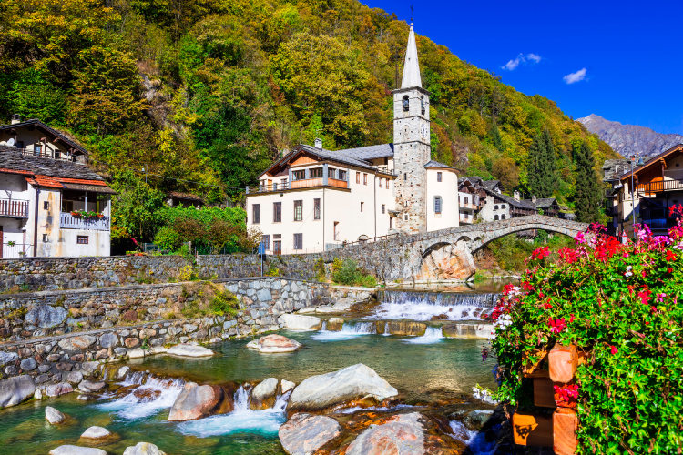
The basecamps of the hike are Aosta and Pont-Saint-Martin, both are easy to reach from the airports. You will be overnighting in well-maintained mountain huts and alpine hotels, sure to provide you with a wholesome meal and a comfortable night's sleep. The Alta Via N.1 is available as a guided or self-guided hiking trip. We planned several variants of the itinerary that vary in length but remain within the same Level 4 difficulty category. All route variants feature relatively long daytime treks with significant elevation gain and loss. The Pennine Alps being a challenging hiking area, we recommend this itinerary to hikers with previous experience of hiking through the Alps or similar mountains.
StyleHut to Hut Hiking
DifficultyLevel 4![]()
Activity4 - 10 hiking days![]()
Tour Duration6 - 12 days / 5 - 11 nights
Start / FinishPont-Saint-Martin / Aosta
Validity of prices: Summer 2026. The prices are subject to change without notice.
Private guided tour: the price is based on a minimum of 4 participants.
Private guided and self-guided tours are private tours on the dates of your choice.
See tab Prices for minimum and maximum group size, included services, single supplements and other details.
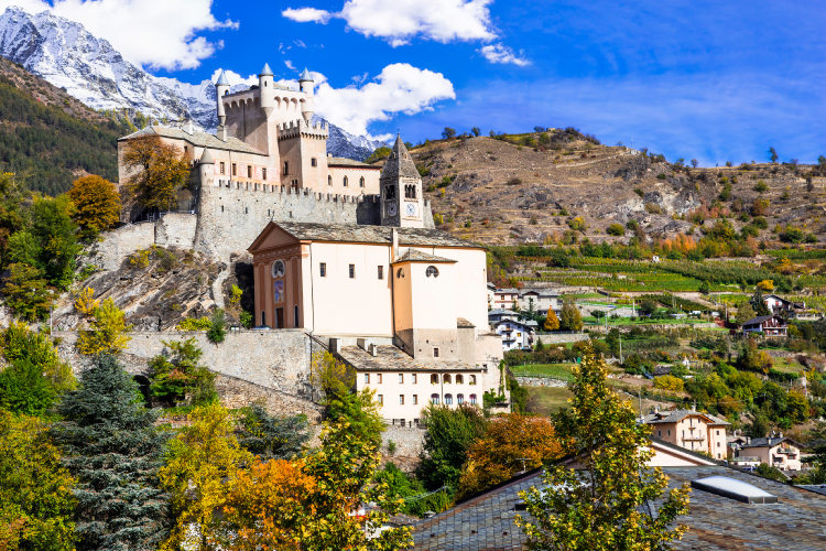
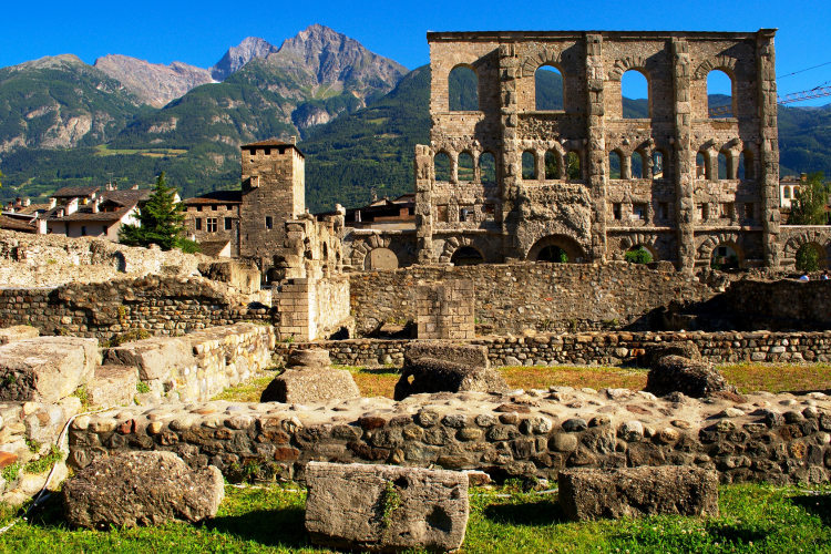
Day 1: Aosta ValleyThe basecamp locations of the hike are Aosta and Pont-Saint-Martin. Both towns are easy to reach from the airports. Aosta the central city of the Italian province of the same name with many attractions for an enjoyable evening ahead of the hike or after you complete your journey. Aosta is set in a valley about 600 meters above sea level. Its charming historic center features several Roman era buildings, well preserved to this day. Time permitting, we recommend you to discover the impressive Praetorian Gate and the Roman Treater the day you arrive. Pont-Saint-Martin is a more convenient basecamp location to start your hike. It is an ancient village with its origins dating back over 2,000 years when the Romans built a bridge in this place to allow crossing of the river Lys. This is a notable 23-meter high segmental arch bridge that survived to these days. Moreover, it remained in service until the XIX century as the only river Lys crossing point giving access to the Aosta valley. |
Day 2: Pinter PassAscent 1360 m. Descent 850 m. Altitude 1390 - 2800 m. Distance 11 km. Walking time 7 hours. The first hiking day will be remembered for one of the route's longest ascents. From the Gressoney valley you ascend a ridge running southward from Monte Rosa and cross it at a 2,777 m high mountain saddle. Early in the day you will pass a notable old farmstead of Grossalbezzo, which is worth a brief stop. There are about ten buildings and no permanent residents here. Frozen in time, the place has not changed a bit over the past 200-300 years. The meadows above the farmstead offer a scenic view of the snow-covered slopes of Monte Rosa and all of the Gressoney valley below. As you hike across the saddle, you will see snow patches – after snowy winters, these can survive almost till the end of summer at these altitudes. Following a descent from the ridge, you will stay for the night at a conveniently located mountain hut with a panoramic view of the Val d’Ayas valley. |
Day 3: Grand TournalinAscent 1170 m. Descent 560m. Altitude 1700 - 2600 m. Distance 12 km. Walking time 6 hours. Today the itinerary will offer majestic panoramas of the Pennine Alps. You will see the whole chain of the main ridge peaks, including the Matterhorn and Monte Rosa. For that you need to scale one more ridge, known for its tallest peak called Grand Tournalin. Leaving your stuff at the mountain hut at the foot of Grand Tournalin, in the afternoon you may embark on a loop hike to the summit of Monte Croce, which will reward you with a spectacular panorama of the Pennines. According to the hiking schedule, you should reach the summit at around 5 PM. The sunset still quite far away, the snow-covered peaks will already be veiled in the beautiful soft colors photographers appreciate so much. This optional loop hike will take an extra 2 hours. |
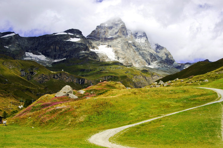
Day 4: Matterhorn and Lake CignanaAscent 980 m. Descent 1370 m. Altitude 1530 - 2780 m. Distance 13 km. Walking time 7 hours. The trail takes you to Cignana Lake today for a night's stay at a waterfront hut. To reach the lake, you need to cross a pass below the Grand Tournalin peak, descend into the Valtournenche valley and scale yet another ridge. All the large lakes in this highland area are man-made. Cignana Lake was formed by a dam built back in 1925-1928 at an altitude of 2,158 м. Non-typically for high altitude, the air near the lake is quite humid – especially evenings and mornings. The lake is walled off from the Valtournenche valley by the Monte Pancherot mountain. On its way from the lake to the summit the trail ascends 550 m. You may hike it light, leaving your backpacks at the hut. The effort will pay off: the mountain offers an excellent panorama of the main Pennine Alps ridge with an impressive view of the Matterhorn. |
Day 5: Saint Barthelemy HighlandAscent 1350 m. Descent 870 m. Altitude 1990 - 2780 m. Distance 16 km. Walking time 8 hours. Today your path dives into the high-altitude areas of a broad Pennine offshoot named after the Saint Barthelemy valley, cutting into it. There are few hikers on its wild trails. In the morning and evening you are almost sure to see chamois or perhaps Alpine ibices, too. The Saint Barthelemy highland is famous for its beautiful lakes. The two most recognizable ones – the Tzan and Luseni lakes – make part of the itinerary. One of the shores of the Tzan Lake features a sandy beach made of sand washed up by a mountain stream – an uncommon thing for high-altitude lakes. A scree of loose red rock descends into the Luseni Lake on one side. On the other, the water surface extends up to the horizon: there is an abrupt drop behind the lake. |
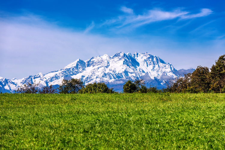
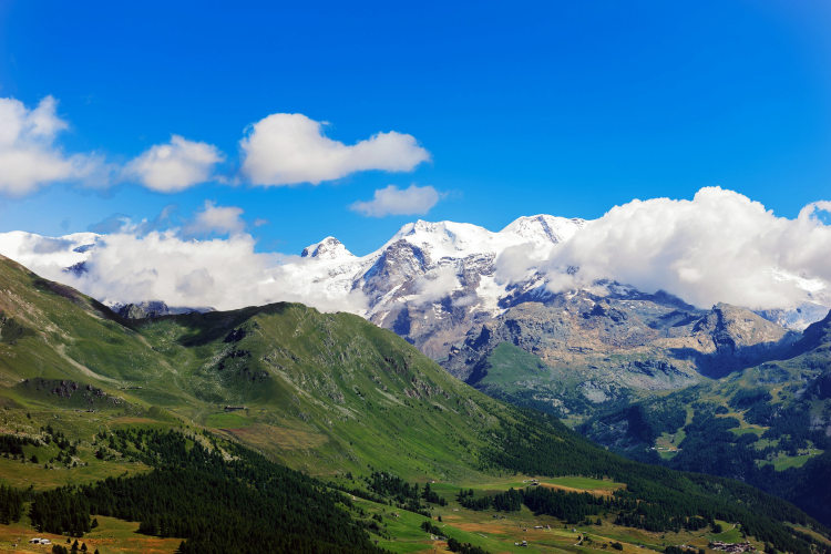
Day 6: ValpellineAscent 560 m. Descent 1640 m. Altitude 1460 - 2790 m. Distance 15 km. Walking time 6 hours. This is the mid-point of your itinerary – time for a bit of rest after high-intensity treks. Today's leg will be long but easy, taking you down into the Valpelline valley. For about three hours the path winds through the rocky highlands. There are no pronounced elevation changes but plenty of high altitude scenery. For the first time in your hike from the Vessona saddle you will enjoy a good view of the Mont Blanc massif. It is easy to recognize – it will appear as a mass of white mountains directly to the west. The saddle offers a view of the tallest part of the Mont Blanc massif dominated by the 4,810 m high Mont Blanc summit. Once down in the valley you reach your hotel in a small nearby village and rest. |
Day 7: At the Foot of Grand CombinAscent 1170 m. Descent 1120 m. Altitude 1390 - 2490 m. Distance 12 km. Walking time 6 hours. Today you cross another branch of the Pennines and reach Valle di Ollomont – a narrow valley at the foot of Grand Combin. The trek is relatively easy for Level 4, although it offers you an ascent around 1,000 m and the same descent which close to the average for day crossings of Alta Via N.1. Gran Combin is the major landmark of this region. You will see it when you are down in the Ollomont valley in the afternoon. Gran Combin is an isolated massif hosting several snow-capped summits above 4,000 m. You will see its south facing slopes which are very steep and catch relatively little snow. Beyond the crest, the northern part of Grand Combin accommodates glaciers that cover substantial areas even these days. Today you stay overnight in a hotel in Valle di Ollomont. |
Day 8: ChampillonAscent 1150 m. Descent 50 m. Altitude 1390 - 2465 m. Distance 6 km. Walking time 3 hours. You can choose today whether it is time for a bit of rest after high-intensity treks or you continue hiking as of a Level 4 trip schedule. Even the light route will require some strength – you need to ascend more than 1,000 m on your way to the hut. It will take a little more than 3 hours. The slopes along your ascent offer a good view of the Grand Combin massif and another distinctive summit of the Pennine Alps – Mont Gele. A more challenging alternative is to go off the classic Alta Via N.1 route and walk towards Grand Combin before reaching the hut on a panoramic “balcony” trail. This optional trek takes 6 hours. |
Day 9: Grand Saint Bernard ValleyAscent 510 m. Descent 1300 m. Altitude 1500b -2650 m. Distance 15 km. Walking time 6 hours. After the effortless day before, today's trek will be a long one but without uphill for much of the way. You need to scale another range and thus you start the day with an ascent to a saddle 350 m above the hut where you stayed overnight. Once the saddle is crossed, you walk downhill to the Val di Grand Saint Bernard valley rising towards the famous pass. In the afternoon, you will complete a gradual descent into the valley through Alpine meadows, enjoying excellent views along your way. |
Day 10: Towards Mont BlancAscent 1430 m. Descent 940 m. Altitude 1500 - 2540 m. Distance 16 km. Walking time 7 hours. The new day begins with a lengthy upslope trek through a gorge towards the Malatra saddle. This 2,925 m high mountain saddle is the highest point of the itinerary. The ridge you are crossing today is the last one in your hike to Mont Blanc. The massif will be well within view as soon as you reach the saddle. If viewed from the hut location, Mont Blanc closes off the western horizon completely, so dusk comes early here. Almost all of today's trek will run at high altitudes with an exception of the first hour when you cross the Val di Grand Saint Bernard valley. The eastern slopes of the ridge are less steep, except for the approach to the saddle; but the western ones feature very steep drop-offs – here the trail cuts into the slope for a gradual descent to the hut. Today your accommodation will be quite a bit more crowded than on previous days: the Mont Blanc side hut is a part of the super popular hiking route around Mont Blanc. |
Day 11: Mont Blanc Panoramic TrailAscent 270 m. Descent 1070 m. Altitude 1230 - 2930 m. Distance 12 km. Walking time 4 hours. On the last day your trail traverses the flank of the ridge above the Val Ferret valley at an average altitude of 2,000 m. You cross several gorges and mountain streams without losing sight of Mont Blanc, towering just across the valley. Today you can make excellent pictures right from the trail, especially in the morning. You will be passing the peaks of Grand Jorasses and Dente del Gigante, the white peak of Mont Blanc looming out ahead. There will be a few gorges offering a “look inside” of Mont Blanc. The hike ends with a descent to Courmayeur, from where you take a bus back to the basecamp in Aosta or Pont-Saint-Martin. |
Day 12: Aosta ValleyThe trip has come to an end. You have walked on some of the least-travelled trails at the foot of the four-thousanders of the Pennine Alps. If you have time today, there are many historical sites along the Aosta valley, such as the Fort Bard with its Museum of the Alps. |
The Alta Via N.1 from Monte Rosa to Matterhorn The 6 Day Tour covers the area between Monte Rosa and Matterhorn. There are 4 full hiking days. This route ends in Breuil-Cervinia at the foot of Matterhorn from where you go back to your basecamp hotel by bus (self-guided trip) or with a private transfer (guided trip). On this trip you will walk on some of the least-travelled trails of the Alta Via N.1 with excellent vistas of the most famous four-thousanders of the Pennine Alps. We categorize the 6 Day Tour as a slightly easier hike because this itinerary does not include the longest legs of the Alta Via N.1. We recommend Pont-Saint-Martin as the most convenient basecamp location for the 6 Day Tour. |
The eastern half of the Alta Via N.1 The 7 Day Tour itinerary reaches the Valpelline valley from where you travel back to the basecamp. This route corresponds to the Days 1 to 6 of the primary Alta Via N.1 itinerary. It takes you from the area od Monte Rosa towards Matterhorn where the trail turns south-west and crosses the high-altitude area of Saint Barthelemy before descending to Valle di Valpelline. There are 5 full hiking days on this itinerary. |
The classic Alta Via N.1 from Monte Rosa to Grand Combin The 8 Day Tour route covers the eastern part of the classic Alta Via N.1 and ends in the Valle di Ollomont in the area of Grand Combin. This is an itinerary with 6 full hiking days that are the Days 2 to 7 of the primary itinerary. |
The classic Alta Via N.1 without the Mont Blanc trails The 10 Day Tour route runs from below the Monte Rosa plateau through the entire Pennine Alps range to its western extremity. After following the classic Alta Via N.1 for 8 days, this route ends in the Val di Grand Saint Bernard valley without entering the Mont Blanc area. The 10 Day Tour is a good choice for those hikers who would like to walk the classic Alta Via N.1 but stay away from the crowded trails of Mont Blanc. If you have already walked the Tour du Mont Blanc, we recommend this variant of Alta Via N.1 instead of the 12 Day Tour. |
Validity of prices: Summer 2026.
The prices are per person and include the VAT tax.
The prices are subject to change without notice.
Private guided and self-guided treks are private tours on the dates of your choice.
The indicated tour duration includes the days of arrival and departure. Hotel accommodation on the day of arrival and night before departure is included in the price.
Self-guided tour. Supplement for trips for solo hikers:
6 Day Self Guided Tour | Solo supplement € 170
7 Day Self Guided Tour | Solo supplement € 170
8 Day Self Guided Tour | Solo supplement € 170
10 Day Self Guided Tour | Solo supplement € 170
12 Day Self Guided Tour | Solo supplement € 170
Private guided tours are only open to your group. The price listed on the tour page is for groups of 4 members. You can set a larger or a smaller group – please contact us for a price.
Validity of prices: Summer 2027.
The prices are per person and include the VAT tax.
The prices are subject to change without notice.
Private guided and self-guided treks are private tours on the dates of your choice.
The indicated tour duration includes the days of arrival and departure. Hotel accommodation on the day of arrival and night before departure is included in the price.
Self-guided tour. Supplement for trips for solo hikers:
6 Day Self Guided Tour | Solo supplement € 170
7 Day Self Guided Tour | Solo supplement € 170
8 Day Self Guided Tour | Solo supplement € 170
10 Day Self Guided Tour | Solo supplement € 170
12 Day Self Guided Tour | Solo supplement € 170
Private guided tours are only open to your group. The price listed on the tour page is for groups of 4 members. You can set a larger or a smaller group – please contact us for a price.
The basecamp locations for this trip are Aosta and Pont-Saint-Martin. Aosta is a larger town with a larger number of tourist attractions. Pont-Saint-Martin is more convenient as the starting point of the first hiking day.
Both basecamp locations have train and bus connections with the airports of the region. While Turin is the closest airport, slightly more distant Milan Malpensa is served by a significantly larger number of airlines. It takes around 4 hours to reach Aosta from Milan Malpensa by train and/or bus. Travel time from Turin Airport to Aosta is in a range of 2h30m to 3 hours. You may also choose the Milan Bergamo airport that is served by numerous low-cost airlines: travel time to Aosta from this airport is around 5 hours. Pont-Saint-Martin is 45 min closer to the airports than Aosta.
We can help you plan the logistics and provide you with train and bus schedules: please contact us before you buy the plane tickets.
Proper hiking boots are a must for the mountains. We recommend high boots because they support the ankle better than any low boots and provide better stability on a rocky terrain. The weather conditions in Pennine Alps, Graian Alps, and especially in the Mont Blanc area, change rapidly: you must have warm clothes with you even in the middle of the summer: waterproof and windproof jacket, fleece jacket, long trekking pants and a cap. A raincoat, poncho or other type of rainwear is necessary. Other necessary items are the toiletries, light clean footwear to use in the huts, sunglasses and water bottles or bladders for a total capacity of 2-3 liters. Your trip documents will include a detailed packing list specifically prepared for your itinerary. We kindly ask everyone to read it carefully and be properly prepared for the hiking trip.
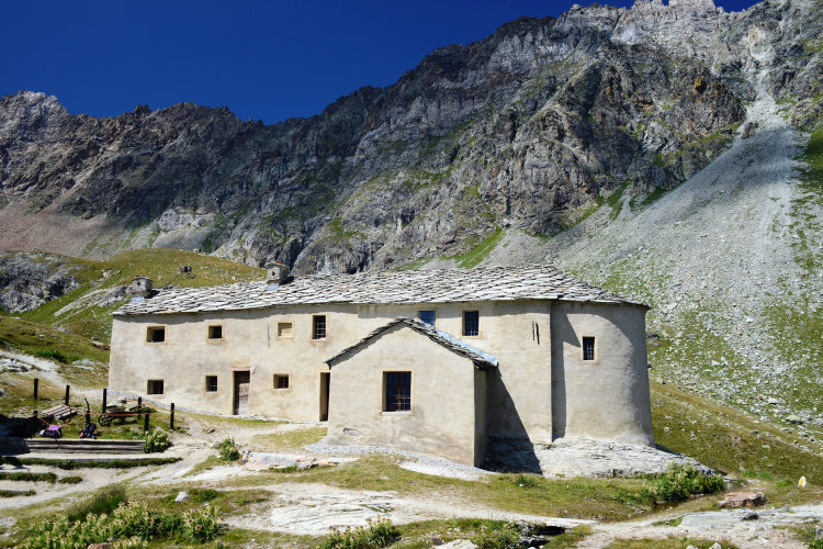
The first and last nights of your trip are in one of our basecamp hotels. While hiking, you will stay overnight in the mountain huts. You can count on the following services in the mountain huts: a bed in a shared room or in a private room (must be booked in advance), shower with hot water, toilets, meals, and a possibility to buy take away water and snacks such as sandwiches and chocolate. Shared rooms are equipped with bunk beds with mattresses, pillows and blankets. Bed linen is not provided in shared bedrooms: you must have a sleeping bag liner with you. Typically, it is a light cotton bag. Warm sleeping bag is unnecessary, since there are blankets in the bedrooms. In private rooms you are often offered bed linen, thus a sleeping bag liner is not required. If you book private rooms, we inform you on whether you need to bring a sleeping bag liner. Most huts have a heating system, but it is normally not required in the summer months. You will need clean footwear for the huts: light slides are an ideal solution. For detailed information on the huts please read Mountain Huts in the Alps.
In hut-to-hut hiking tours you are served a breakfast and a dinner in the huts and mountain hotels on the route.
Normally, the breakfast is served from 7am to 9am. It usually includes an unlimited quantity of coffee and tea, bread, butter, jam, honey and chocolate spread. In addition, some huts offer ham, cheese and muesli for breakfast. After breakfast we recommend filling your thermos with hot water or tea: ask the staff, and it will be for free in most huts.
The dinner time in the mountain huts is 7pm or 7:30pm for all guests. A typical dinner in a hut is very rich and includes a starter, the first course (such as pasta, risotto, dumplings), the second course (meat with a side dish) and a dessert. Any drinks at dinner (water, wine, beer, tea, coffee) are not free and should be ordered and paid separately.
Lunch. During most day crossings there will be no huts on the way where you could stop for lunch. We recommend taking a packed lunch from the hut in the morning. A typical packed lunch includes 1 or 2 sandwiches, yoghurt, chocolate bar, water, and it normally costs 7 - 8 euros. Tell the staff in the evening that you would like to take a packed lunch. Alternatively, on some days of the route, you can reach the next mountain hut in 4-5 hours and have lunch there.
Our guided hiking tours are led by professional guides, each with years of guiding and wilderness experience and with passion for mountains. They permanently work in the region of the exact hiking tour, have professional licenses, are experts in emergency situations, regularly upgrade their qualifications and work in accordance with national regulations.
For self-guided hiking, it is necessary to be properly dressed, follow the safety rules and make realistic time calculation for day crossings – preferably according to the hiking schedule that we provide. Our self-guided hiking trips are planned so that they do not require specific skills or gear, unless it is clearly specified in the tour description. You can expect well-maintained trails equipped with direction signs. Exposed sections of the trail are secured on the self-guided routes: it makes them safe provided that you follow the basic safety rules for hiking in the mountains.
Mountains are a natural environment with a high level of risk, so we insistently ask all participants to read the safety rules and emergency procedures: Safety Considerations. If you have questions about the safety rules, please contact us +39 0463 63 60 80.
Insurance. It is important to have an appropriate insurance that covers the hiking activity. You don't need to include the climbing activity in your insurance, unless you are planning to climb during the hike.
Visa. We will provide you with a booking confirmation for all days of your trip. If you need the Italian visa, you can enclose this document with your visa application.
Good weather conditions for trekking in the Pennine Alps which include the Aosta valley are formed at the beginning of July. The most stable weather is in the second part of July and August. Even in a warm summer there can remain snow on the passes and in some shady areas. In September the weather is less predictable, that’s why in mid-September the hiking season in the Pennine Alps finishes and most of the mountain huts are closed.
Being a high mountain environment, the Pennine Alps are prone to sudden temperature and weather shifts. At an elevation of 2,000 – 3,000 m (6,560 – 9,840 ft) the air warms up to 12-17° C (54-62° F). The maximum temperature in the valleys at the level of 1,000 – 1,600 m (3,280 – 5,250 ft) doesn’t exceed 25° C (77° F).
Generally, in the middle of the day in summer clouds appear above the summits what causes rain and even thunderstorm. It is often windy in the open areas of the highlands. In the evening and in the morning at the highlands it is rather chilly, meanwhile in the valleys it is fresh.