
Guaranteed Group Departures 2026


Hiking trips without a guide and a group with overnight stays in mountain huts
Hiking trips with scheduled group departures – local mountain guides and groups of 6 to 8 members
Individually planned private hiking trips on the dates of your choice
Guided custom day hikes and excursions
All Dolomites, including Tre Cime, Lagazuoi, Cinque Torri, Sella, Marmolada, Cortina d'Ampezzo and more
Pennine Alps, Graian Alps including Gran Paradiso, and Aiguilles Rouges
Stelvio National Park, Ortler, Cevedale, Adamello, Bernina, Texel
Ranges of northern Garda, Monte Baldo, lake Ledro, Monte Bondone
Home/Mont Blanc and Matterhorn Hiking Tours/Tour du Mont Blanc Classic
Explore the full classic TMB route
Walk at your own pace with a moderate hiking schedule
Choose between staying in huts or inns and hotels with private rooms
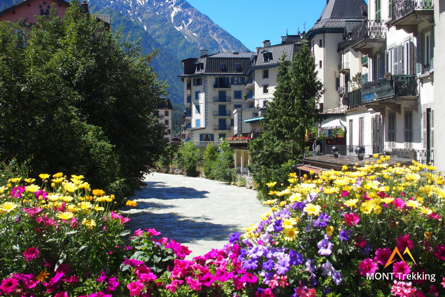
Start in Chamonix or Courmayeur at your choice
This is a classic trekking route around Mont Blanc with an itinerary that consists of 11 days of walking 5 - 7 hours per day. With such a schedule, most hikers can complete the full Tour du Mont Blanc at a comfortable pace, while also avoiding cutting the route short or having to use bus transfers.
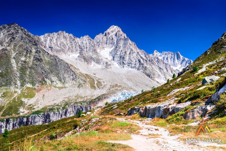
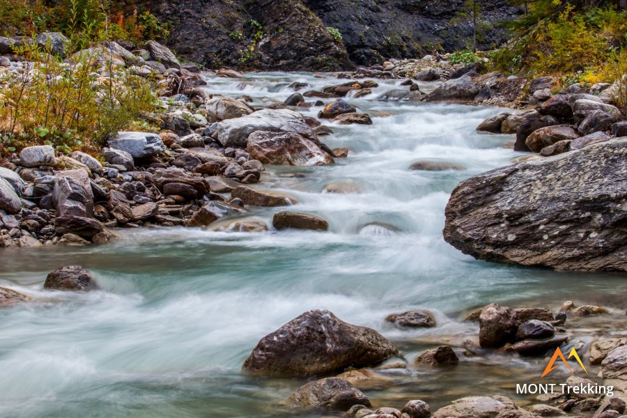
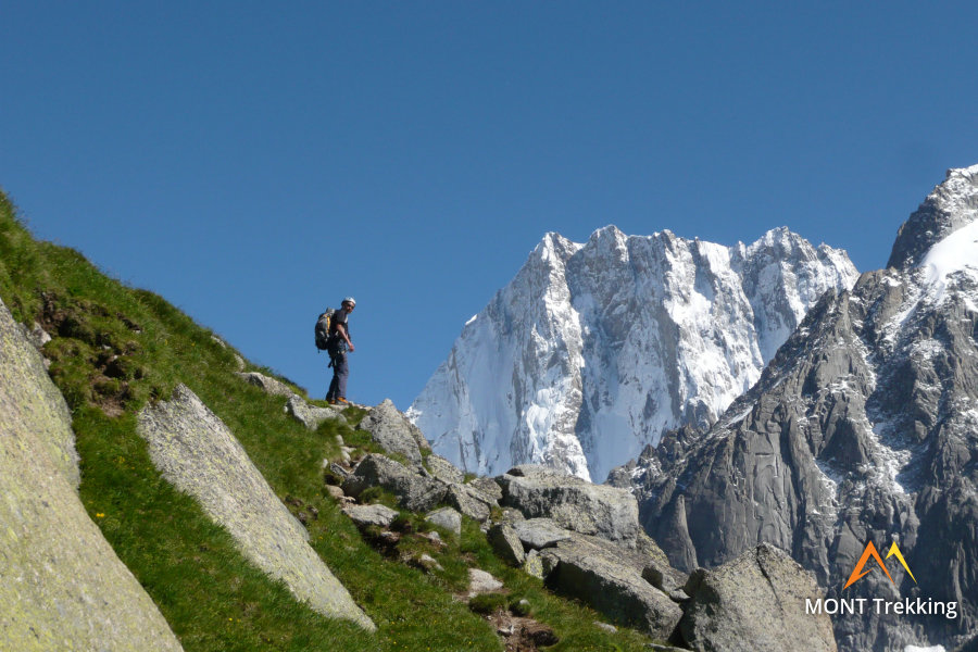
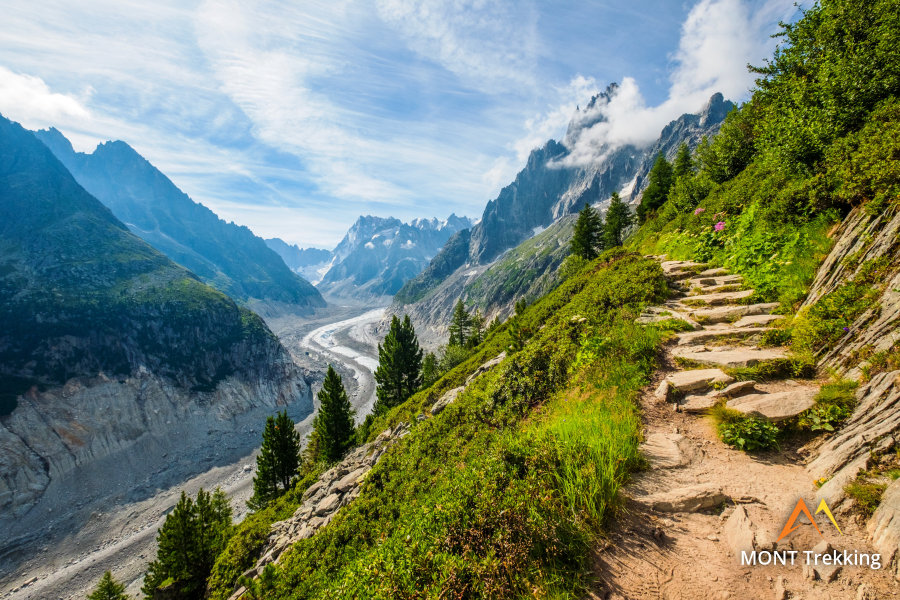
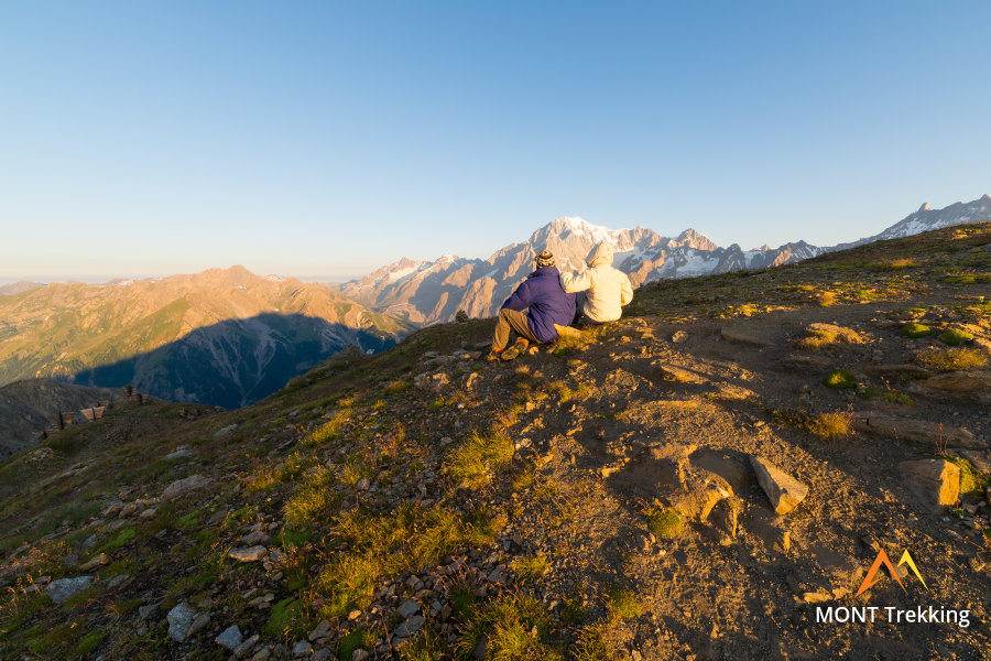
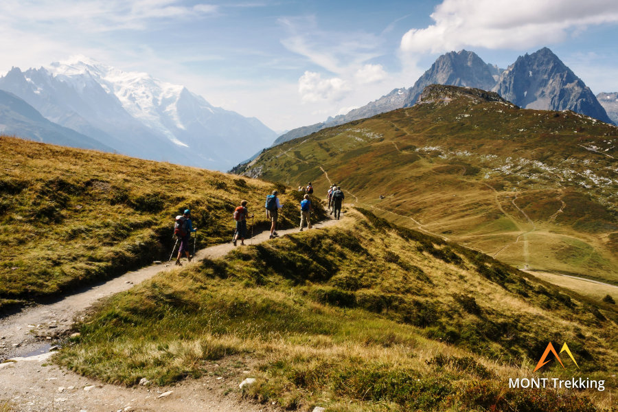
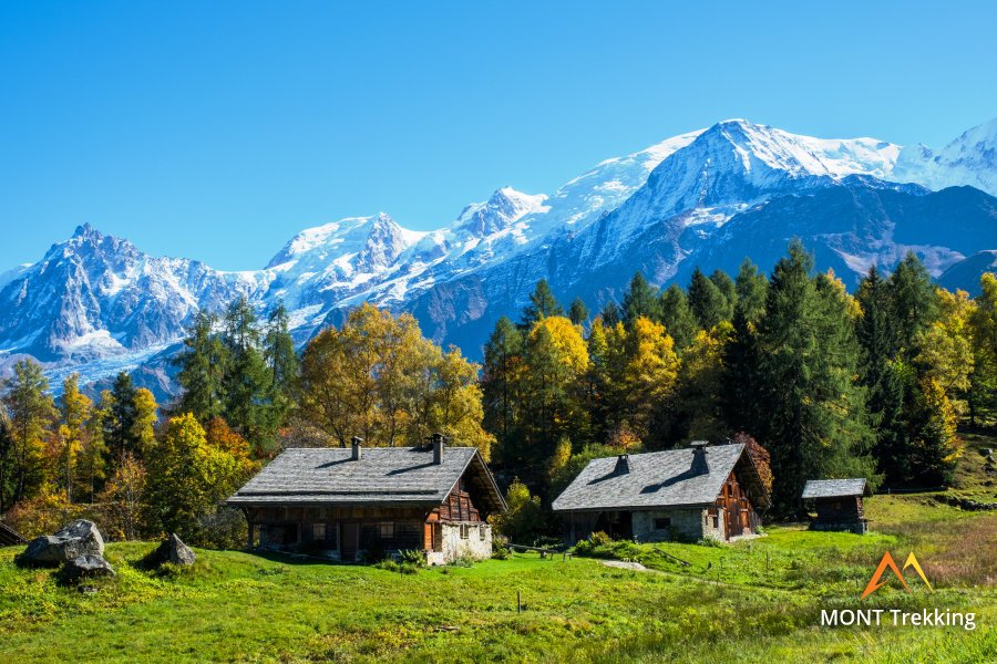
On this trip you will be able to see the Mont Blanc massif from all angles and travel around 130 km in three countries: France, Italy, and Switzerland. The route traverses most of the landscapes that are characteristic of the Alps at an altitude of 1200 – 2700 m. The predominant type of landscape encountered on the path are the alpine meadows above the forest belt at 1800 – 2300 m. In addition, the route passes through the forest on mountain slopes, through the highlands to a lesser extent, as well as through valleys for significantly long sections. There are beautiful lakes along the route, including a major one: the Lac de Champex, where you will stay overnight. In the highlands of the Aiguilles Rouges massif you will pass Lac Blanc, a place famous for its spectacular views of Mont Blanc.
Tour du Mont Blanc is a circular route. You can begin the hike from Courmayeur, on the Italian side, or from Chamonix, on the French side. Your choice of start point does not affect the profile of the route: you can choose it based on the ticket availability, ease of transportation and other preferences.
The hike is organized on an individual basis, either self-guided or with a local English-speaking mountain guide. It is desirable to have at least basic experience of mountain hiking, as on any other multiple-day trek, but the route is also accessible to beginners. We recommend that hikers, for whom this is their first mountain trek, plan their trip sometime between mid-July and the last week of August, when you can count on stable weather conditions in the Mont Blanc area. It is essential to be in good physical shape and, accordingly, to prepare for the hike physically, as well as having suitable clothing and gear for this route.
The mountain huts, guest houses and hotels on the TMB route become fully booked even before the start of summer, and so we recommend booking your hike in advance, preferably before the end of April.
StyleHut to Hut Hiking
DifficultyLevel 3![]()
Activity11 hiking days![]()
Tour Duration13 days / 12 nights
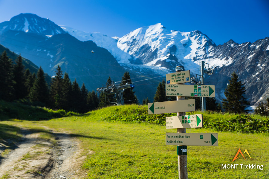
Start / FinishChamonix or Courmayeur
Day 1: Arrival in CourmayuerYou arrive in Courmayeur on your own and check in at the basecamp hotel. Courmayeur is a well-known Alpine resort, located in the upper part of the Aosta Valley at the foot of the Mont Blanc massif. It is one of Europe’s most popular mountain climbing centers and serves as a starting point for ascents of Mont Blanc and the TMB trail that surrounds it. |
Day 2: Italian Val FerretAscent 960 m. Descent 530 m. Distance 13 km. Walking time 5 hours. The hike commences from Courmayeur itself. On the first day, the route climbs onto the mountain ridge that stretches to the north-east, parallel to the Mont Blanc massif. Between this ridge and Mont Blanc lies the Val Ferret valley, and from the ridge itself Mont Blanc is visible “as if it is in the palm of your hand.” The ascent takes about two hours, after which the scenic vistas continue as the hike passes along the ridge, culminating in a beautiful panoramic view of Mont Blanc. From the trail, you will be able to glimpse the base of Mont Blanc through narrow gorges that rise upward towards the glaciers. |
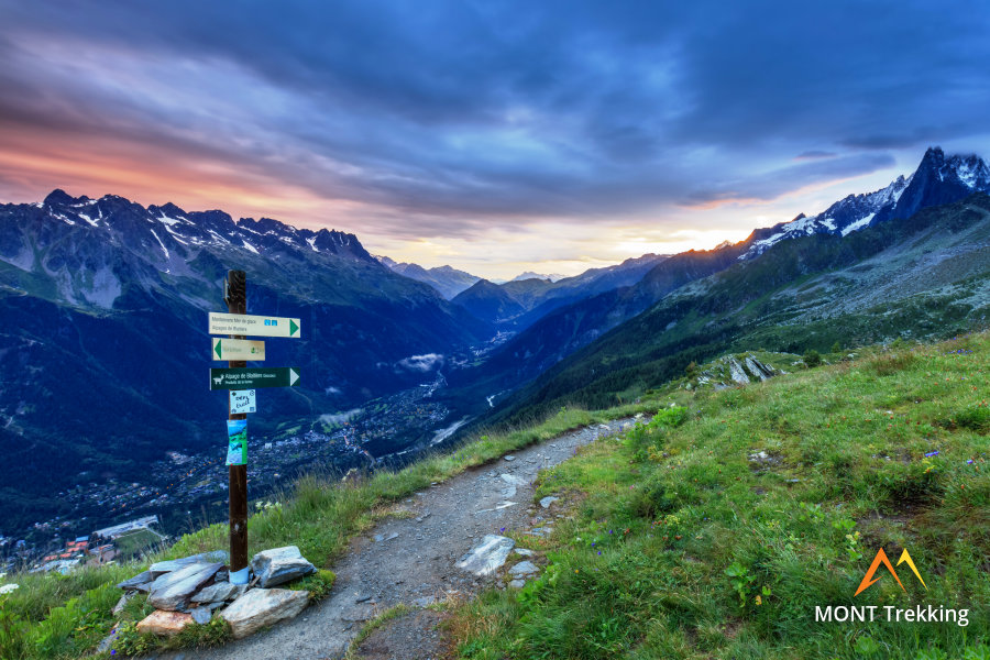
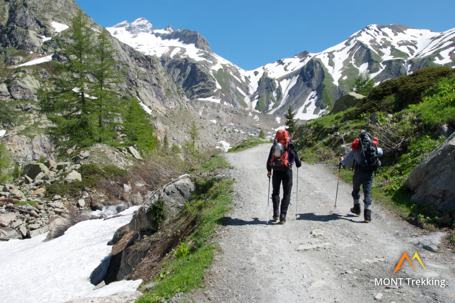
Day 3: Grand Ferret PassAscent 890 m. Descent 930 m. Distance 17 km. Walking time 6 hours. On today's route is our first mountain pass – Grand Col Ferret at 2537 meters. Beyond Grand Col Ferret lies the border between Italy and Switzerland. Almost the entire day’s route passes through the highlands, and only towards the end of the day does it descend into the forest belt in the Swiss Valley of Val Ferret. In general, there are a few high-altitude areas on the TMB rout but the crossing through the Gran Col Ferret pass encompasses one of the longest of them. |
Day 4: Lake ChampexAscent 480 m. Descent 610 m. Distance 15 km. Walking time 5 hours. Having passed through the Val Ferret valley, you will spend the night by the Lac de Champex. The landscapes around the lake are reminiscent of Canada’s Rockies, and so this area has acquired the name “Little Canada”. Lac de Champex is surrounded by thick spruce forests that cover all of the adjacent slopes. It complements the surrounding peaks beautifully, and around it you will find plenty of good spots for landscape photography. |
Day 5: Northern Extremety of Mont BlancAscent 760 m. Descent 960 m. Distance 16 km. Walking time 6 hours. Today, the route bends around the northern extremity of the Mont Blanc massif, a path that lies entirely in Swiss territory. In fact, some consider Le Catogne mountain, along the slopes of which the trail passes, to be part of the Mont Blanc massif itself, while others believe that it belongs to the Pennine Alps. For the purposes of the trek, it doesn’t really matter. The most important thing is that today holds a pleasant and easy-to-navigate hike through locations that are typical of Switzerland; a route free of dominating features, leading through the forest and alpine meadows. |
Day 6: Chamonix ValleyAscent 940 m. Descent 730 m. Distance 11 km. Walking time 5 hours. Beginning in Switzerland, today the TMB trail leads to the upper region of the French valley of Chamonix. A steep climb, which takes about three hours, lies ahead. For your efforts, however, you will be rewarded with a breathtaking panoramic view from the heights of Col de Balme, and the peaks of Mont Blanc will once again be in view. |
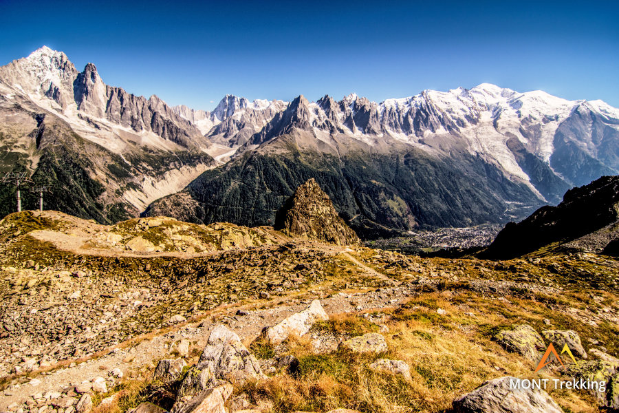
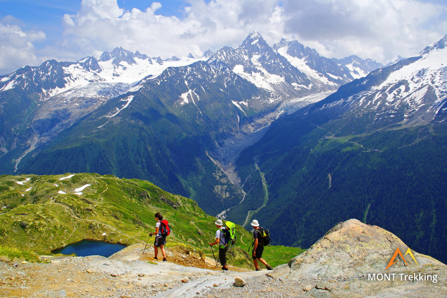
Day 7: Aiguilles Rouges MassifAscent 990 m. Descent 600 m. Distance 11 km. Walking time 5 hours. One of the most beautiful sections of the route around Mont Blanc is the trail through the Aiguilles Rouges massif, which stands in front of Mont Blanc and is separated from it by the Chamonix Valley. The Aiguilles Rouges highlands are characterized by a reddish hue, from which the massif acquired its name. This phenomenon occurs due to the composition of the rocks that form the massif; namely, gneiss that has a high iron content. Many lakes are situated in the Aiguilles Rouges highlands, including the famous Lac Blanc with its magnificent vistas of Mont Blanc. |
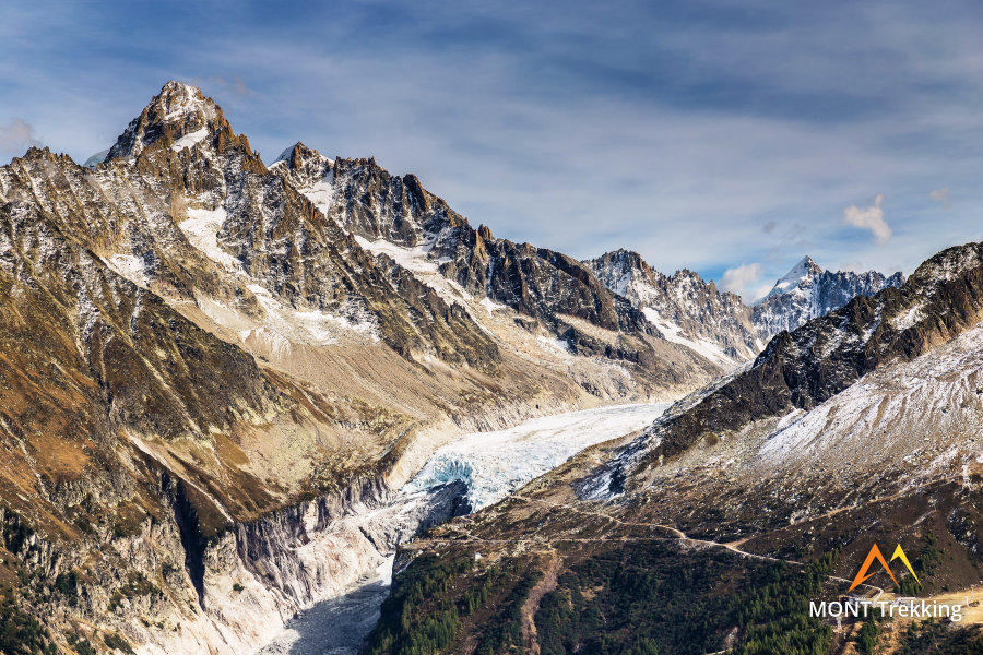
Day 8: TMB Panoramic TrailAscent 800 m. Descent 1670 m. Distance 16 km. Walking time 7 hours. Today’s extensive route passes along the trails on the slopes of the Aiguilles Rouges massif, opposite Mont Blanc. Along this section of the hike lies the popular viewing point of Le Brévent, an easily accessible upland with a broad panorama of Mont Blanc. Today, you will have the opportunity to observe the glaciers of Mont Blanc in detail, including the Glacier de Bossons, which has the most significant altitude difference in the Alps: its ice tongue is on a level with the forest belt, and yet it reaches around 1650 meters in height. |
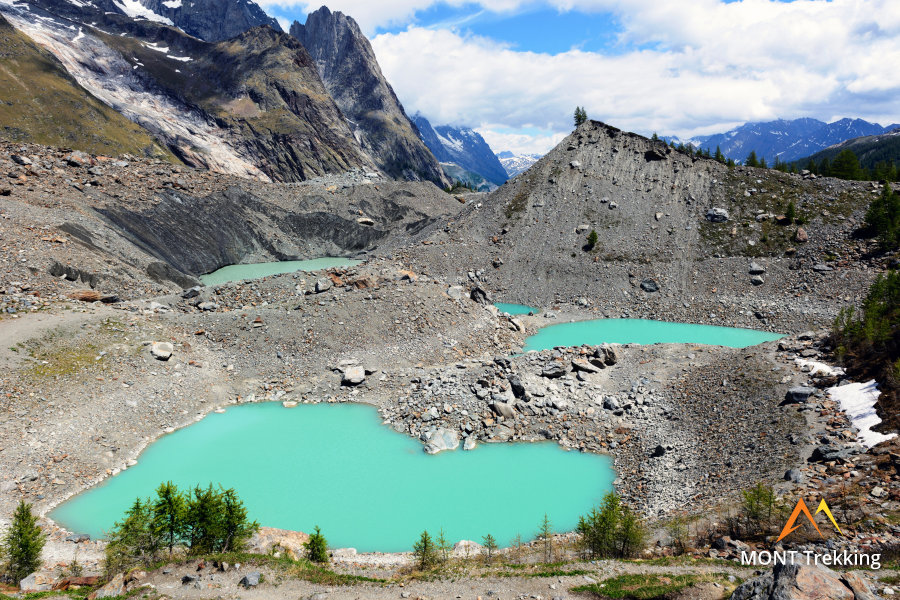
Day 9: Glaciers of Mont BlancAscent 760 m. Descent 1440 m. Distance 14 km. Walking time 6 hours. Today, you will have the opportunity to deviate from the most frequented main trekking route around Mont Blanc and travel directly along its slopes via a high path. At this point, the trail approaches very close to the glacier, but does not reach it, passing slightly below on a moraine. This track is identified by its great variety of landscapes, as, beyond the moraine, it passes through highlands, forests and alpine meadows. |
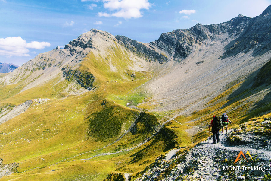
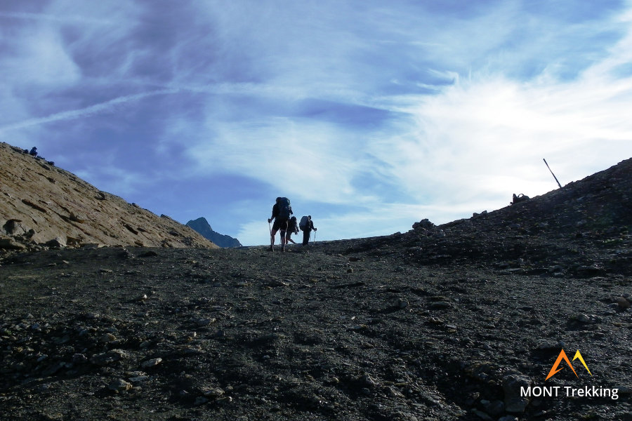
Day 10: Southern Extremety of Mont BlancAscent 1330 m. Descent 930 m. Distance 18 km. Walking time 8 hours. The trails to the south of Mont Blanc are relatively unfrequented, especially by comparison with the section of the route in the area of the Chamonix Valley and the slopes of the Aiguilles Rouges. Today, a long but easy-to-navigate hike lies before you that will take you from a lower gradient route towards the saddle on the southern slope of the massif. In the area of the saddle, you can deviate from the route to climb to the top of the Tête Nord des Fours, but this detour is only for the most physically able hikers. |
Day 11: Pyramides CalcairesAscent 970 m. Descent 540 m. Distance 17 km. Walking time 6 hours. Today, the route takes you back into Italy, once again crossing the border, which, as usual, traverses the highlands and goes through the mountain pass. This will be the last highland crossing on the itinerary. In the region of the mountain pass, the trail rises to a height of 2516 meters. Beyond the pass lies an unusual natural object: limestone pyramids “Pyramides Calcaires”, one of the main attractions of the Tour du Mont Blanc. |
Day 12: Grandes Jorasses and Giant’s ToothAscent 490 m. Descent 1250 m. Distance 13 km. Walking time 6 hours. The straightforward route on the last day of the hike begins on the outwash plains beneath the Le Blanche glacier and then passes through the uplands opposite Mont Blanc. These provide a wonderful viewing platform at about 2000 meters.You will be able to survey the series of peaks that make up the Grandes Jorasses, as well as the alone-standing “Giant’s Tooth”, a calling card of the Trek around Mont Blanc. Towards the end of the day, the route descends into Courmayeur. |
Day 13: Departure from CourmayeurAfter 130 km of ascents, descents and great views, your Tour du Mont Blanc comes to an end. Today, after a breakfast at your basecamp hotel you can start you |
Tour du Mont Blanc with a start in Chamonix You can choose to start you TMB in Chamonix. It is an equally convenient TMB starting point. If you choose Chamonix as the starting point, you will have a basecamp hotel in Chamonix and walk exactly the same TMB legs that are described in the itinerary starting from Courmayeur. The difficulty level of the trip remains Level 3. |
Courmayeur. With Turin being the closest airport, a slightly more distant Milan Malpensa is served by a significantly larger number of airlines. It takes around 4 hours to reach Courmayeur from Milano Malpensa by train and/or bus. Travel time from Turin Airport is in a range 2:30 - 3:00 hours. You may also choose Milan Bergamo airport that is served by numerous low-cost airlines: travel time to Courmayeur from this airport is around 4:30 - 5:00.
Chamonix. Geneva is the only well-connected airport in the region. Its takes around 1h 40m hours to reach Chamonix by bus.
We can help you plan the route from the airport and provide you with the schedules: please contact us before you book the flights.
Proper hiking boots are a must for the mountains. We recommend high boots because they support the ankle better than any low boots and provide better stability on a rocky terrain. The weather conditions in Pennine Alps, Graian Alps, and especially in the Mont Blanc area, change rapidly: you must have warm clothes with you even in the middle of the summer: waterproof and windproof jacket, fleece jacket, long trekking pants and a cap. A raincoat, poncho or other type of rainwear is necessary. Other necessary items are the toiletries, light clean footwear to use in the huts, sunglasses and water bottles or bladders for a total capacity of 2-3 liters. Your trip documents will include a detailed packing list specifically prepared for your itinerary. We kindly ask everyone to read it carefully and be properly prepared for the hiking trip.
Hut-Based Tour. The first and last nights of your trip are in one of our basecamp hotels. While hiking, you will stay overnight in the mountain huts. You can count on the following services in the mountain huts: a bed in a shared room or in a private room (must be booked in advance), shower with hot water, toilets, meals, and a possibility to buy take away water and snacks such as sandwiches and chocolate. Shared rooms are equipped with bunk beds with mattresses, pillows and blankets. Bed linen is not provided in shared bedrooms: you must have a sleeping bag liner with you. Typically, it is a light cotton bag. Warm sleeping bag is unnecessary, since there are blankets in the bedrooms. In private rooms you are often offered bed linen, thus a sleeping bag liner is not required. If you book private rooms, we inform you on whether you need to bring a sleeping bag liner. Most huts have a heating system, but it is normally not required in the summer months. You will need clean footwear for the huts: light slides are an ideal solution. For detailed information on the huts please read Mountain Huts in the Alps.
Hotel-Based Tour. You will stay overnight in hotels in the basecamp location and on the route. When a hotel accommodation is not available in one or more locations we book a room in an inn of a good comfort level.
In hut-to-hut hiking tours you are served a breakfast and a dinner in the huts and mountain hotels on the route.
Normally, the breakfast is served from 7am to 9am. It usually includes an unlimited quantity of coffee and tea, bread, butter, jam, honey and chocolate spread. In addition, some huts offer ham, cheese and muesli for breakfast. After breakfast we recommend filling your thermos with hot water or tea: ask the staff, and it will be for free in most huts.
The dinner time in the mountain huts is 7pm or 7:30pm for all guests. A typical dinner in a hut is very rich and includes a starter, the first course (such as pasta, risotto, dumplings), the second course (meat with a side dish) and a dessert. Any drinks at dinner (water, wine, beer, tea, coffee) are not free and should be ordered and paid separately.
It is possible to stop for lunch in the mountain huts and villages on the way, but this option is not available in all days of the trip. These days we recommend to take a light snack (sandwiches, yoghurt, chocolate, water) from the hut where you have stopped for the overnight.
Our guided hiking tours are led by professional guides, each with years of guiding and wilderness experience and with passion for mountains. They permanently work in the region of the exact hiking tour, have professional licenses, are experts in emergency situations, regularly upgrade their qualifications and work in accordance with national regulations.
For self-guided hiking, it is necessary to be properly dressed, follow the safety rules and make realistic time calculation for day crossings – preferably according to the hiking schedule that we provide. Our self-guided hiking trips are planned so that they do not require specific skills or gear, unless it is clearly specified in the tour description. You can expect well-maintained trails equipped with direction signs. Exposed sections of the trail are secured on the self-guided routes: it makes them safe provided that you follow the basic safety rules for hiking in the mountains.
Mountains are a natural environment with a high level of risk, so we insistently ask all participants to read the safety rules and emergency procedures: Safety Considerations. If you have questions about the safety rules, please contact us +39 0463 63 60 80.
Insurance. It is important to have an appropriate insurance that covers the hiking activity. You don't need to include the climbing activity in your insurance, unless you are planning to climb during the hike.
Visa. We will provide you with a booking confirmation for all days of your trip. If you need an Italian or French visa, you can enclose this document with your visa application.
We organize hiking tours in Mont Blanc area from July till mid-September. The best time to hike around Mont Blanc is the second half of July and August: the weather is more stable, and there is no snow on the passes.
The Graian Alps which include Mont Blanc area is the most high-altitude environment of Europe. This fact influences the weather conditions in the region making it prone to sudden temperature shifts. In summer at midday clouds accumulate above the peaks what causes rain and decrease in temperature. It is windy on the mountain passes and ridges. At an elevation of 2,000 m (6,560 ft) the maximum temperature is 17° C (62° F). The valleys at 1,000 – 1,400 m (3,280 – 4,590 ft) warm up to 20-22° C (68-72° F). In the evening and in the morning in the highlands it is rather chilly, meanwhile in the valleys it is fresh, and at night it never gets hot in the valleys.