







Home/Rhaetian Alps Hiking Tours/Stelvio National Park Classic
Enjoy a break from civilization hiking is one of the wildest regions of the Alps
Walk on away from crowded trails: you will rarely see other hikers in Stelvio even in August
Cross three glaciers and enjoy beautiful views from the high passes of Stelvio
Ascend the Cima Sternai peak with an impressive 360-degree panorama of Ortler-Cevedale group
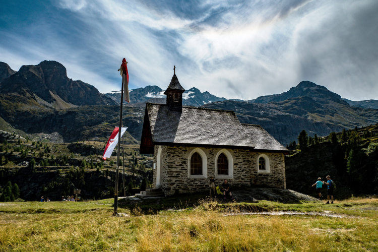
Sleep in some of the most hospitable huts of the Eastern Alps
Enjoy traditional Suoth Tyrolean cuisine
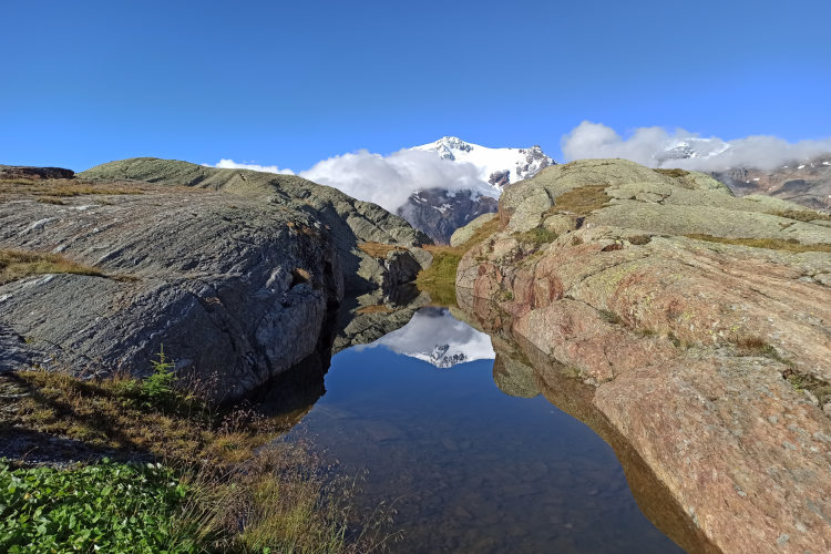
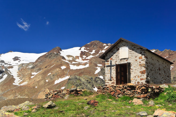
Popularly known as the land of lakes and glaciers, Stelvio National Park covers the entire Ortler-Cevedale mountain range that is home to the highest mountains in the Eastern Alps. Much of this itinerary follows the least-traveled scenic trails to the east of the Ortler summit at elevations of 2,400 to 3,000 m where you will cross the central and eastern ridges of Cevedale.
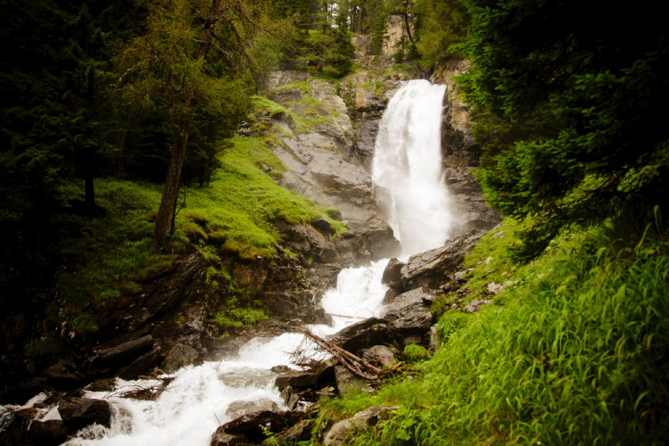
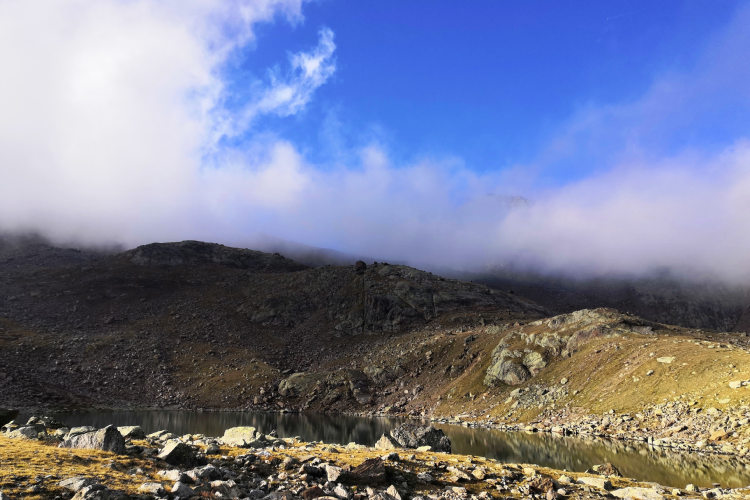
On the way you will traverse several glaciers, including the grand Careser Glacier perched above a lake of the same name. Mountain passes along the route are at elevations of around 3,000 meters. The highest point of the hike, both figuratively and literally, is the Cima Sternai peak (3,443 m). The hiking schedule includes a dedicated day for ascending this mountain. Along the route you will be seeing numerous high-altitude lakes, snow patches on northern slopes of ridges that last through the summer, cascading mountain streams, and resounding waterfalls. The itinerary will take you past a key landmark of the region – the Saent Waterfalls that you will admire from a wooden bridge opposite it.
The hike consists of six treks with overnighting at mountain huts along the route. No special training is needed for this route, but good physical shape is a must. On daytime treks we will walk 5 to 7 hours every day.
StyleHut to Hut Hiking
Tour Duration8 days / 7 nights
Start / FinishVal di Sole
Validity of prices: Summer 2026.
Private guided tour: the price is based on a minimum of 4 participants.
Private guided and self-guided tours are private tours on the dates of your choice.
See tab Prices for minimum and maximum group size, included services, single supplements and other details.
Day 1: Val di SoleYou arrive in the Val di Sole valley on your own or with an optional private transfer and check in at one of our basecamp hotels in the town of Malé. It is a typical old Alpine township at the center of the valley when you can enjoy a pleasant evening and feel the freshness of the mountain air. |
Day 2: Saent WaterfallsAscent 1090 m. Descent 50 m. Hiking distance 7 km. 5 hours hiking. After the guide rounds us up at the hotel in the morning, a bus takes you to the upper Val di Rabbi valley that is the starting point of this hiking trip. Today you make an ascent to the Saent Valley that is the gateway to high areas of the Ortler-Cevedale group. The itinerary takes you past the Saent waterfalls – a popular tourist attraction that is as far as most tourists venture in these parts. The Saent waterfalls consist of several cascades with a total vertical drop of some 90 meters. A wooden bridge blends into the landscape to span the river in front of the topmost and tallest cascade. The trail then winds upslope through rosebay thickets that are home to woodchuck colonies before leading you over a barren rocky landscape to first mountain hut on this route. |
Day 3: Saent PassAscent 700 m. Descent 850 m. Hiking distance 10 km. 7 hours hiking. You will start the day with an ascent to the Passo di Saent pass – one of the few points where the ridge can be crossed. It separates the Saent Valley from the Martell Valley. The pass elevation is 2,965 m. Right ahead of the pass, the trail gets fairly steep, and it takes some effort to scale it. The pass offers a spectacular view of the valley and nearby summits. An ice tongue of a glacier dips into a hollow under the pass in the northwest and feeds a few small lakes. On the other side of the pass you cross a typical high-mountain rocky landscape with glacier lakes and next to no vegetation. Later, as you descend into the valley through the gorge, the landscape changes, giving way to green meadows and streams. You go down to the green belt and arrive at the hut after traversing slopes sparsely overgrown by woods. |
Day 4: At the Foot of CevedaleAscent 780 m. Descent 460 m. Hiking distance 8 km. 5 hours hiking. Today you climb the main ridge of the Cevedale range. The lower leg of the itinerary takes you through picturesque locales with meadows and mountain streams coursing through them. Here you cross a stone dike built by residents of the Val Martello valley in the 19th century after a series of destructive floods. In those days, glaciers would reach as deep as the bottom of the gorge, but today hike uphill over the moraines remaining after them without too much trouble. To cross the Cevedale ridge, you need to scale the Forcola glacier that covers the slopes up to the very peak of Cevedale. To cross the glacier the guide will take you on the eastern route with a gentle upward slope. While on the glacier you will the snow-white Cevedale Peak ahead of you. Looking back, you will see a spectacular panorama of peaks of the Ortler-Cevedale group towering above the Val Martello valley. |
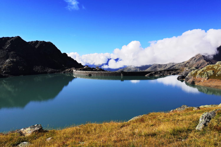
Day 5: Careser Lake and GlacierAscent 600 m. Descent 900 m. Hiking distance 13 km. 6 hours hiking. Today’s itinerary includes two particularly interesting landmarks – the Careser Glacier and a lake of the same name. The lake is set at an elevation of 2,603 m. It was formed by a dam built back in 1931 along with a small power plant that runs to this day. Your trail runs over slopes above the lake before turning up toward the Careser Glacier which you will cross near the very ridge at elevations of 3,000 - 3,200 m. The Careser Glacier is the biggest albeit also the easiest glacier to cross on this route. As you approach the glacier, it remains hidden until you almost step on it, at which point it opens up unexpectedly in a wide front that completely blocks our view of the horizon. It takes roughly an hour to cross the glacier. Once on the other side, you descend to the hut. |
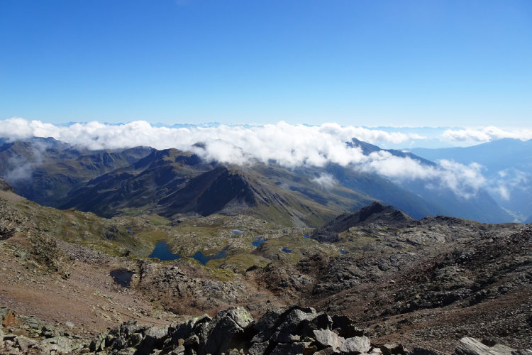
Day 6: Sternai PeakAscent 1000 m. Descent 1000 m. Hiking distance 11 km. 7 hours hiking. Today you leave the hut early on a radial trek that includes climbing the Cima Sternai peak (3,444 m). The highest point on the eastern ridge of the Cevedale range, it offers a 360-degree panoramic view of the region. The path to the summit takes you past the Sternai Lakes and over a glacier of the same name. After traversing the glacier, you climb to a nameless mountain saddle, scale the ridge and take it to the very peak. The ridge part of the itinerary features one of the most scenic hiking trails in this part of the Alps. It became accessible to hikers quite recently after being equipped for safety. An ascent to the peak takes 4 hours. We might need to get going at the crack of dawn if the weather conditions so dictate. |
Day 7: Corvo LakesAscent 500 m. Descent 1600 m. Hiking distance 14 km. 7 hours hiking. On the last day of the hike you make it to the Corvo Lakes before descending into the Saent Valley where your trip began a few days prior. After the high-altitude locales of the last few days with their glaciers and snow-capped mountains, the trail to the Corvo Lakes takes you over warm southern slopes and lake hollows sheltered against the wind. You get to ascend to the ridge of the eastern Cevedale range that separates the Italian provinces of Trentino from South Tirol. Proceeding along the ridge, you skirt several peaks and descend to a group of lakes the biggest of which is Lago Corvo. The trail from the ridge down to the lakes runs over a very exposed slope that offers a splendid view of picture-perfect panoramas. On the other side of the lakes you come upon a mountain hut where we take a rest break. After cooling off, you descend into the valley. |
Day 8: Val di SoleThe trip ends here. On this hike you covered the eastern portion of the Ortler-Cevedale group – the second highest mountain group in all of the vast Eastern Alps region. On the way, you saw the Saent waterfalls, crossed three glaciers, scaled Sternai Peak (3,444 m), crossed the main ridge of the Cevedale range twice, and saw Lake Careser against the backdrop of the gigantic Vedretta de la Mare glacier. The itinerary took you through the high-altitude areas with a harsh climate where hikers are few and far between even at the height of the season. This is one of the least-traveled Alpine regions where you can still enjoy a break from civilization. |
Guided group hike This hike slightly differs from the main itinerary in the Stelvio National Park. It includes all glacier crossings of the main itinerary but excludes the ascent to Cima Sternai – the hardest part of the main itinerary. The route starts with an ascent to the lakes of Corvo, where you will have time to explore the area because your group will stay overnight in the nearby hut. From the Corvo lakes, the route deepens in Ortles-Cevedale, climbs to the Passo Saent pass, and passes through the Forcola and Careser glaciers (days #3, 4 and 5 of the main itinerary). You will descend to the valley via the Saent waterfalls (day #2 of the main itinerary in the opposite direction). |
Validity of prices: Summer 2026.
The prices are per person and include the VAT tax.
Private guided and self-guided treks are private tours on the dates of your choice.
The indicated tour duration includes the days of arrival and departure. Hotel accommodation on the day of arrival and night before departure is included in the price.
Private guided tours are only open to your group. The price listed on the tour page is for groups of 4 members. You can set a larger or a smaller group – please contact us for a price.
The closest airport to the Stelvio-Ortler region is Verona. It takes around 4 hours to arrive by train and bus from the Verona airport to the valleys of Stelvio: Val di Sole, Val Venosta and the city of Merano.
Other possible airports are Venice, Bologna, Innsbruck, Munich and Milan.
We can help you plan the logistics and provide you with train and bus schedules: please contact us before you buy book the flights.
Good hiking boots with a possibility to attach crampons are a must for the our hiking trips with glaciers crossings. You must have warm clothes with your: waterproof and windproof jacket, fleece jacket, long trekking pants and a cap. A raincoat, poncho or other type of rainwear is necessary. The packing list includes personal sanitary items, light clean footwear to use in the huts, sunglasses and water bottles or bladders for a total capacity of at least 2 liters. Your trip documents will include a detailed packing list specifically prepared for your itinerary. We kindly ask everyone to read it carefully and be properly prepared for the hiking trip.
The first and last nights of your trip are in one of our basecamp hotels. While hiking, you will stay overnight in the mountain huts. You can count on the following services in the mountain huts: a bed in a shared room or in a private room (must be booked in advance), shower with hot water, toilets, meals, and a possibility to buy take away water and snacks such as sandwiches and chocolate. Shared rooms are equipped with bunk beds with mattresses, pillows and blankets. Bed linen is not provided in shared bedrooms: you must have a sleeping bag liner with you. Typically, it is a light cotton bag. Warm sleeping bag is unnecessary, since there are blankets in the bedrooms. In private rooms you are often offered bed linen, thus a sleeping bag liner is not required. If you book private rooms, we inform you on whether you need to bring a sleeping bag liner. Most huts have a heating system, but it is normally not required in the summer months. You will need clean footwear for the huts: light slides are an ideal solution. For detailed information on the huts please read Mountain Huts in the Alps.
In hut-to-hut hiking tours you are served a breakfast and a dinner in the huts and mountain hotels on the route.
Normally, the breakfast is served from 7am to 9am. It usually includes an unlimited quantity of coffee and tea, bread, butter, jam, honey and chocolate spread. In addition, some huts offer ham, cheese and muesli for breakfast. After breakfast we recommend filling your thermos with hot water or tea: ask the staff, and it will be for free in most huts.
The dinner time in the mountain huts is 7pm or 7:30pm for all guests. A typical dinner in a hut is very rich and includes a starter, the first course (such as pasta, risotto, dumplings), the second course (meat with a side dish) and a dessert. Any drinks at dinner (water, wine, beer, tea, coffee) are not free and should be ordered and paid separately.
Lunch. During most day crossings there will be no huts on the way where you could stop for lunch. We recommend taking a packed lunch from the hut in the morning. A typical packed lunch includes 1 or 2 sandwiches, yoghurt, chocolate bar, water, and it normally costs 7 - 8 euros. Tell the staff in the evening that you would like to take a packed lunch. Alternatively, on some days of the route, you can reach the next mountain hut in 4-5 hours and have lunch there.
Our guided hiking tours are led by professional guides, each with years of guiding and wilderness experience and with passion for mountains. They permanently work in the region of the exact hiking tour, have professional licenses, are experts in emergency situations, regularly upgrade their qualifications and work in accordance with national regulations.
Mountains are a natural environment with a high level of risk, so we insistently ask all participants to read the safety rules and emergency procedures: Safety considerations. If you have questions about the safety rules, please contact us +39 0463 63 60 80.
Insurance. It is important to have an appropriate insurance that covers the hiking activity. You don't need to include the climbing activity in your insurance, unless you are planning to climb during the hike.
Visa. We will provide you with a booking confirmation for all days of your trip. If you need the Italian visa, you can enclose this document with your visa application.
The hiking season in the Rhaetian Alps starts at the end of June and finishes in the middle of September. The best period for hiking is from mid-July till the last week of August when the weather is normally stable. Till the end of June vast snowfields may remain at the altitude above 2200 m (7,220 ft) and block the passes. In September the temperature drops, and snow is not unusual in the Rhaetian Alps and especially in the Ortler and Bernina groups. The September snow melts away quickly after the weather conditions improve, but it causes troubles if you must walk on a snow-covered terrain, because the snow hides the trail.
During the summer months of July and August the Rhaetian Alps are still prone to sudden temperature and weather shifts. It is necessary to be prepared for an unexpected rain or thunderstorm and have appropriate warm clothes and rainwear.
In the exposed areas at a level of 2,400 m (7,870 ft) and above the temperature does not exceed 15° C (59° F) in a warm day. On the passes at 3,000 m (9,840 ft) the maximum temperature can reach 10° C (34° F). It is warmer in those areas that are protected from the wind and on the sunny slopes even at a high altitude. In a very cold day at 2,700 m and above sparse snow can fall even in August, but this is unusual. Nights at the high altitude are always fresh, frosts are possible above 2,900 m (9,510 ft) throughout the entire summer. At the same time, in the nearby valleys at the altitudes of 800 – 1,200 m (2,620 – 3,940 ft) the daytime temperature can reach 27° C (81° F) in a hot day.