


Home/Rhaetian Alps Hiking Tours/Glaciers of Adamello
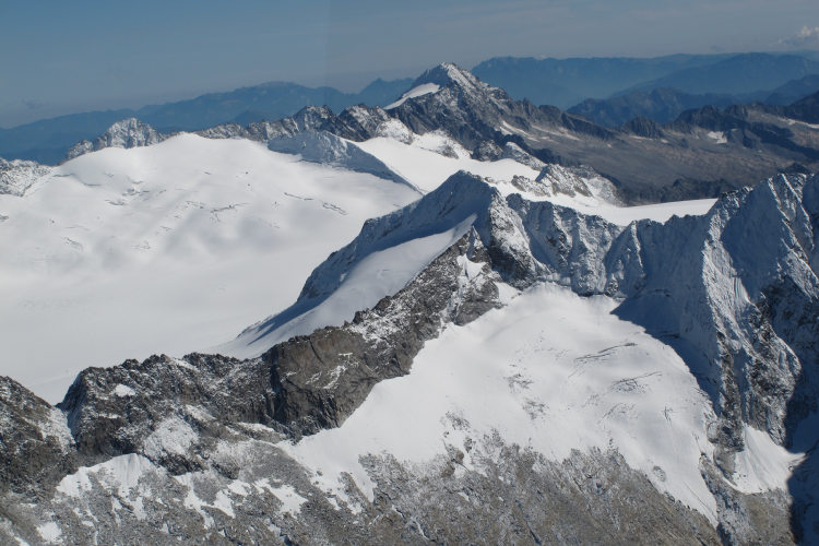
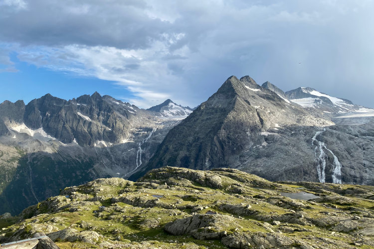
Serene beauty of the Adamello mountain range.
Historical high-altitude paths of World War I
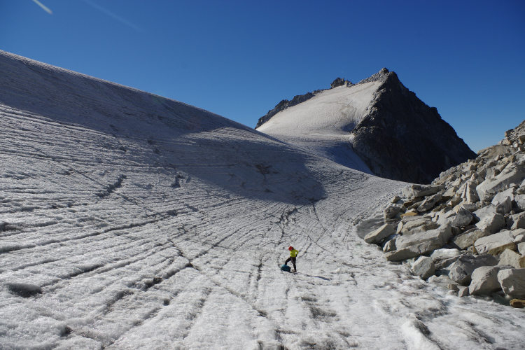
Thrilling glacier crossings
Distant but comfortable huts in scenic spots
"Sentiero dei Fiori", the breathtaking path and ferrata along the WWI frontline
Experienced and knowledgeable local mountain guides
This is a high-altitude hike in the Adamello mountain range, which once was the natural theater of violent fighting during the First World War.
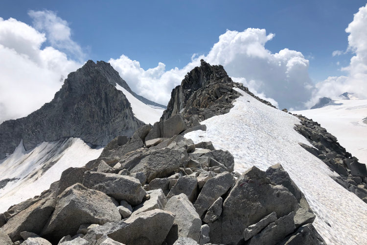
The footprints of historical facts which once animated the location can still be recognized along the scenic WWI Adamello itinerary. The route combines various terrains, so good physical preparation is required to complete it. You will be facing the via ferrata Sentiero dei Fiori (lit: Flowers’ Trail) and hike along rocky paths and aerial ridges to reach the dominant Cresta Croce and Corno Bianco. Over 3000m, you will be crossing glaciers at high altitude with crampons and other necessary equipment.
This adventurous hiking route reaches the major locations of the "Guerra Bianca" (lit. White War), which was fought in the mountains of Northern Italy. It was a brutal conflict that took the lives of at least 160.000 men. One might be surprised at how military actions set in the mountains, over glaciers surrounded by peaks, can be so brutal. However, during World War I, the mountains were just an extension of the general battlefield. Cannons were brought up to the positions at high altitudes. Trenches were cut and equipped in the rocks. Positions were connected by paths, many of which are now via-ferratas. Many soldiers died during winter because of the rigid temperatures. Spartan conditions at high altitude were further complicated by severe winter weather and, in the worst cases, avalanches. Adamello holds the memory of many soldiers lost during the conflict. Parts of artillery, weapons and bellic remains still come to the surface of the progressively melting glaciers.
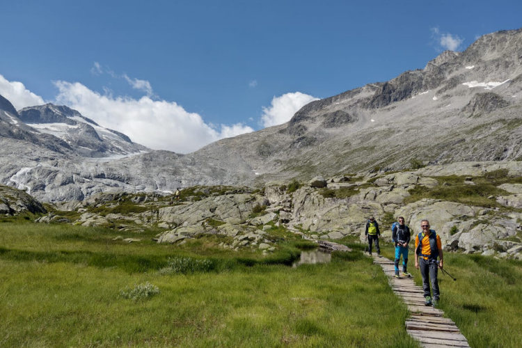
While hiking in Adamello, you can learn new facts about World War I and see high-mountain landscapes that have remained unchanged since the war. Participation in this trek requires good hiking experience and at least basic mountaineering experience. You will be hiking at altitudes above 2800 meters for three days, cross glaciers and walk along a ferrata, medium in difficulty but long distance. A good fitness level is necessary to enjoy this hike.
You will be accompanied by a local mountain guide. For glaciers and ferrata, you will be provided with the necessary gear. The base camp hotels for this trek are in Val di Sole at the foot of Adamello. During the hike, you will stop overnight in manned mountain huts in scenic locations at high altitude.
StyleHut to Hut Hiking
Activity3 hiking days
Tour Duration5 days / 4 nights
Start / FinishVal di Sole
Validity of prices: Summer 2026.
Private guided tour: the price is based on a minimum of 4 participants.
Private guided and self-guided tours are private tours on the dates of your choice.
See tab Prices for minimum and maximum group size, included services, single supplements and other details.
Day 1: Arrival in Val di SoleYou arrive in the splendid Val di Sole on your own. The name of the valley translates as Valley of Sun, even though the word "sole" comes from the celtic divinity of water, Sulis. Val di Sole is rich in streams, waterfalls and rivers, which is probably why it got its name. The first evening in Val di Sole will let you acclimate, discover the culinary flavors and traditions of the valley or simply rest and prepare for the hike. |
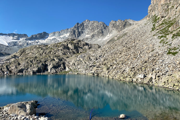
Day 2: Via ferrata Sentiero dei FioriAscent 590 m. Descent 720 m. Altitude 2450 - 2980 m. Distance 7 km. Walking time 5 hours (2h30 via ferrata). After an equipment check, you will reach Passo Paradiso with a cableway. Even after more than 100 years, we can still see WWI fortifications around Passo Paradiso and Passo del Tonale. Following the declaration of war on the 24th of May 1915, the Austro-Hungarian army took this entire area, Conca del Presena, within a few days. The Italian army made the first, tragic and pointless, attempt to take it back in June 1915. Later in August the fates changed, and Italians managed to conquer back the ridge along which Sentiero dei Fiori runs. On the eastern side, there were the Austrians. On the western side, the Italians were fortifying and maintaining their positions for the following three years of the war. They fought at altitudes of over 3000 meters facing worst scenarios during winter 1916-17, when extreme temperatures and the avalanches took more lives than the fighting. While proceeding along Sentiero dei Fiori, you will cross gorges on suspension bridges and climb iron ladders. There are scenic viewpoints, such as the "Eagle’s nest", old trenches and fortifications. The ferrata runs along the route which once the Alpine troops used to connect positions. One of the most iconic locations of the via ferrata is the so-called Gendarme di Casamadre, a huge rock formation which can be reached and overcome thanks to two long suspended bridges. From Passo Lago Scuro, where once was one of the biggest military camps at high altitude, you will reach the homonym lake and your hut after about 2 hours. |
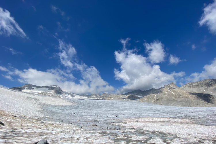
Day 3: Cresta CroceAscent 890 m. Descent 310 m. Altitude 2450 - 3320 m. Distance 7 km. Walking time 6 hours. Ghiacciaio dell'Adamello, the largest glacier of the Italian Alps, is on your way today. It is so large that its various parts have their own names. The area you will cross today is known as Vedretta del Mandron. You’ll cross it roped up with other members of your group and with crampons on your feet. Further on your way is the Passo della Lobbia pass at 3015 meters and the summit of Cresta Croce, the highlight of the day. The path to Cresta Croce takes you along the glacier and through stunning high-altitude landscapes with impressive views. The summit of Cresta Croce rises to 3276 meters and is one of the dominants of Adamello. There are many points of interest along your route today. There is a massive granite cross dedicated to Pope John Paul II. There once was a wooden cross, which was substituted in 1998 after the Pope visited Adamello. He was truly in love with the mountains. His connection with the Adamello mountain range was especially strong, probably, because his father fought in World War I. Pope John Paul II stayed overnight at Rifugio Ai Caduti dell’Adamello during his visit to Adamello. To honor his memory, "The Pope’s Room" has been in the hut since then. It is empty and closed to visitors. When walking along the ridge to Cresta Croce, you will reach a WWI position with a 149G cannon called "Ippopotamo" (lit. hippopotamus). It is a 6-ton field artillery piece pulled by soldiers from Temù at 1144 meters to its actual location at 3275 meters. It took them 78 days. You will finish the day in the coziness of a welcoming hut and will need good rest before the final glacier crossing awaits you tomorrow. |
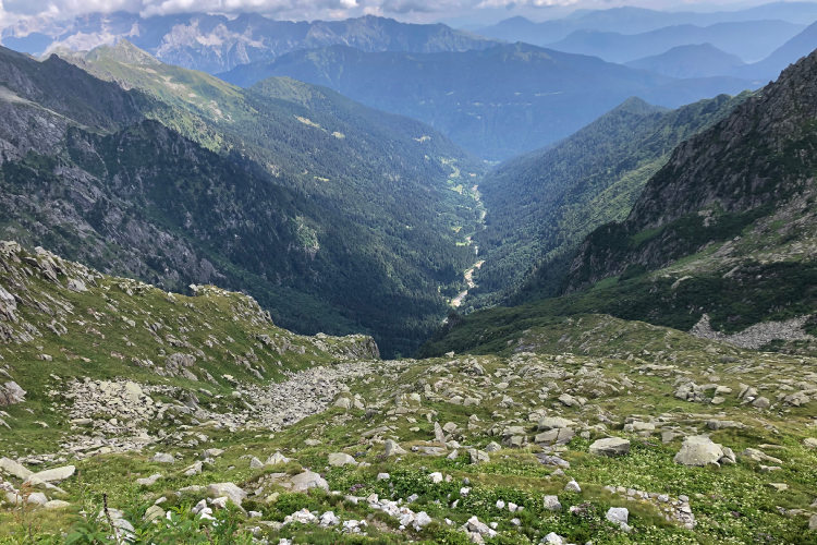
Day 4: Pian di NeveAscent 480 m. Descent 1890 m. Altitude 1550 - 3170 m. Distance 17 km. Walking time 8 hours. The highest part of the Ghiacciaio dell'Adamello glacier is called Pian di Neve. You will ascend on the ice and snow of Pian di Neve, walking right under the summit of Corno Bianco, which stands out and watches over you from its 3434 meters. "It is a huge block, large enough to supply materials for half-a-dozen fine mountains. But it is in fact only one. For a length and breadth of many miles the ground never falls below 9500 feet. The vast central snow-field feeds glaciers pouring to every point of the compass." This is how D.W. Freshfield described Corno Bianco. On the 25th of August 1864, he became the first man to summit Presanella, another dominant peak in the region, from where he looked at Corno Bianco from afar. Despite Pian di Neve having lost many square kilometers of its surface since then, it is still impressively huge. Its thickness currently reaches 200 meters. It is a wide, white and relatively flat mass of ice and snow that, sadly, is estimated to disappear completely in about 30 years due to global warming. Having crossed Pian di Neve, you will stop for a short break in Zanon Morelli bivouac and then descend along a steep trail to Rifugio Garibaldi. Ice and rocks will give way to meadows, then green forests and shiny lakes, showing you two faces of the same mountain range. Perhaps the soldiers of the First World War felt such a contrast, periodically descending from dangerous positions through calm pastures to the pass, where they could again feel at peace. This is the final hiking day of the trip. You will be back in your base camp hotel in Val di Sole for the night. |
Day 5: Departure from Val di SoleThe trek has come to an end. You hiked in an area exceptionally rich in history despite being so remote, so we hope it was a memorable hike. Today you can choose to depart right after the breakfast in your hotel in the morning or to rest in the valley a little longer on your own. |
Validity of prices: Summer 2026.
The prices are per person and include the VAT tax.
Private guided and self-guided treks are private tours on the dates of your choice.
The indicated tour duration includes the days of arrival and departure. Hotel accommodation on the day of arrival and night before departure is included in the price.
Private guided tours are only open to your group. The price listed on the tour page is for groups of 4 members. You can set a larger or a smaller group – please contact us for a price.
The closest airport to the Stelvio-Ortler region is Verona. It takes around 4 hours to arrive by train and bus from the Verona airport to the valleys of Stelvio: Val di Sole, Val Venosta and the city of Merano.
Other possible airports are Venice, Bologna, Innsbruck, Munich and Milan.
We can help you plan the logistics and provide you with train and bus schedules: please contact us before you buy book the flights.
Good hiking boots with a possibility to attach crampons are a must for the our hiking trips with glaciers crossings. You must have warm clothes with your: waterproof and windproof jacket, fleece jacket, long trekking pants and a cap. A raincoat, poncho or other type of rainwear is necessary. The packing list includes personal sanitary items, light clean footwear to use in the huts, sunglasses and water bottles or bladders for a total capacity of at least 2 liters. Your trip documents will include a detailed packing list specifically prepared for your itinerary. We kindly ask everyone to read it carefully and be properly prepared for the hiking trip.
The first and last nights of your trip are in one of our basecamp hotels. While hiking, you will stay overnight in the mountain huts. You can count on the following services in the mountain huts: a bed in a shared room or in a private room (must be booked in advance), shower with hot water, toilets, meals, and a possibility to buy take away water and snacks such as sandwiches and chocolate. Shared rooms are equipped with bunk beds with mattresses, pillows and blankets. Bed linen is not provided in shared bedrooms: you must have a sleeping bag liner with you. Typically, it is a light cotton bag. Warm sleeping bag is unnecessary, since there are blankets in the bedrooms. In private rooms you are often offered bed linen, thus a sleeping bag liner is not required. If you book private rooms, we inform you on whether you need to bring a sleeping bag liner. Most huts have a heating system, but it is normally not required in the summer months. You will need clean footwear for the huts: light slides are an ideal solution. For detailed information on the huts please read Mountain Huts in the Alps.
In hut-to-hut hiking tours you are served a breakfast and a dinner in the huts and mountain hotels on the route.
Normally, the breakfast is served from 7am to 9am. It usually includes an unlimited quantity of coffee and tea, bread, butter, jam, honey and chocolate spread. In addition, some huts offer ham, cheese and muesli for breakfast. After breakfast we recommend filling your thermos with hot water or tea: ask the staff, and it will be for free in most huts.
The dinner time in the mountain huts is 7pm or 7:30pm for all guests. A typical dinner in a hut is very rich and includes a starter, the first course (such as pasta, risotto, dumplings), the second course (meat with a side dish) and a dessert. Any drinks at dinner (water, wine, beer, tea, coffee) are not free and should be ordered and paid separately.
Lunch. During most day crossings there will be no huts on the way where you could stop for lunch. We recommend taking a packed lunch from the hut in the morning. A typical packed lunch includes 1 or 2 sandwiches, yoghurt, chocolate bar, water, and it normally costs 7 - 8 euros. You need to tell the hut staff in the evening that you would like to take a packed lunch.
Our guided hiking tours are led by professional guides, each with years of guiding and wilderness experience and with passion for mountains. They permanently work in the region of the exact hiking tour, have professional licenses, are experts in emergency situations, regularly upgrade their qualifications and work in accordance with national regulations.
Mountains are a natural environment with a high level of risk, so we insistently ask all participants to read the safety rules and emergency procedures: Safety considerations. If you have questions about the safety rules, please contact us +39 0463 63 60 80.
Insurance. It is important to have an appropriate insurance that covers the hiking activity. You don't need to include the climbing activity in your insurance, unless you are planning to climb during the hike.
Visa. We will provide you with a booking confirmation for all days of your trip. If you need the Italian visa, you can enclose this document with your visa application.
The hiking season in the Rhaetian Alps starts at the end of June and finishes in the middle of September. The best period for hiking is from mid-July till the last week of August when the weather is normally stable. Till the end of June vast snowfields may remain at the altitude above 2200 m (7,220 ft) and block the passes. In September the temperature drops, and snow is not unusual in the Rhaetian Alps and especially in the Ortler and Bernina groups. The September snow melts away quickly after the weather conditions improve, but it causes troubles if you must walk on a snow-covered terrain, because the snow hides the trail.
During the summer months of July and August the Rhaetian Alps are still prone to sudden temperature and weather shifts. It is necessary to be prepared for an unexpected rain or thunderstorm and have appropriate warm clothes and rainwear.
In the exposed areas at a level of 2,400 m (7,870 ft) and above the temperature does not exceed 15° C (59° F) in a warm day. On the passes at 3,000 m (9,840 ft) the maximum temperature can reach 10° C (34° F). It is warmer in those areas that are protected from the wind and on the sunny slopes even at a high altitude. In a very cold day at 2,700 m and above sparse snow can fall even in August, but this is unusual. Nights at the high altitude are always fresh, frosts are possible above 2,900 m (9,510 ft) throughout the entire summer. At the same time, in the nearby valleys at the altitudes of 800 – 1,200 m (2,620 – 3,940 ft) the daytime temperature can reach 27° C (81° F) in a hot day.