
Guaranteed Group Departures 2026

Hiking trips without a guide and a group with overnight stays in mountain huts
Hiking trips with scheduled group departures – local mountain guides and groups of 6 to 8 members
Individually planned private hiking trips on the dates of your choice
Guided custom day hikes and excursions
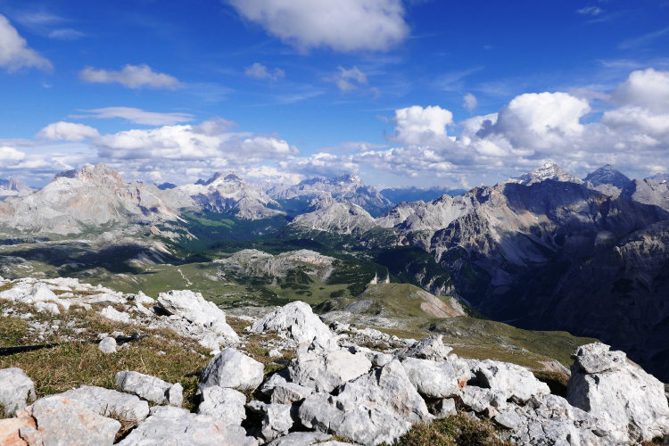
All Dolomites, including Tre Cime, Lagazuoi, Cinque Torri, Sella, Marmolada, Cortina d'Ampezzo and more
Pennine Alps, Graian Alps including Gran Paradiso, and Aiguilles Rouges
Stelvio National Park, Ortler, Cevedale, Adamello, Bernina, Texel
Ranges of northern Garda, Monte Baldo, lake Ledro, Monte Bondone
Home/Dolomites Hiking Tours/Alta Via 1 Dolomites
Mountain huts are fully booked for most dates in 2026
Please use the Reservation Form or Question Form to contact us for available dates.
In addition to the dates listed below, new opportunities occasionally appear due to cancellations at mountain huts.
Currently available self-guided trips:
• 20 Aug - 28 Aug | 9 Day Self Guided Tour
The most famous hut-to-hut hike in the Dolomites connecting its best-known landmarks
Choose between the classic 11 Day Tour and its shorter 9- and 10-day route variants
Have your hiking itinerary planned by the local experts to avoid via-ferrata
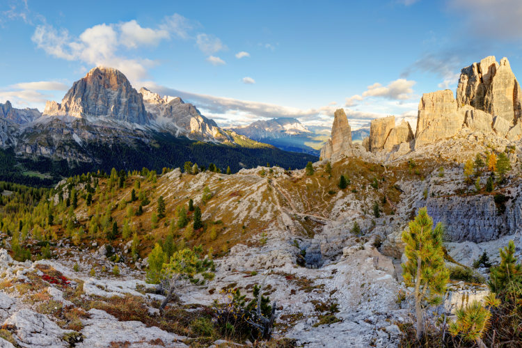
Enjoy the famous panorama of the Dolomites from atop of the Lagazuoi massif
Walk along the impressive 5-km-long west face of Civetta
Feel the friendly atmosphere of the alpine mountain huts set in scenic locations
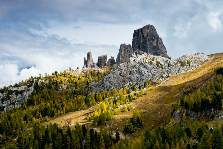
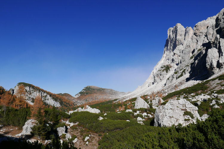
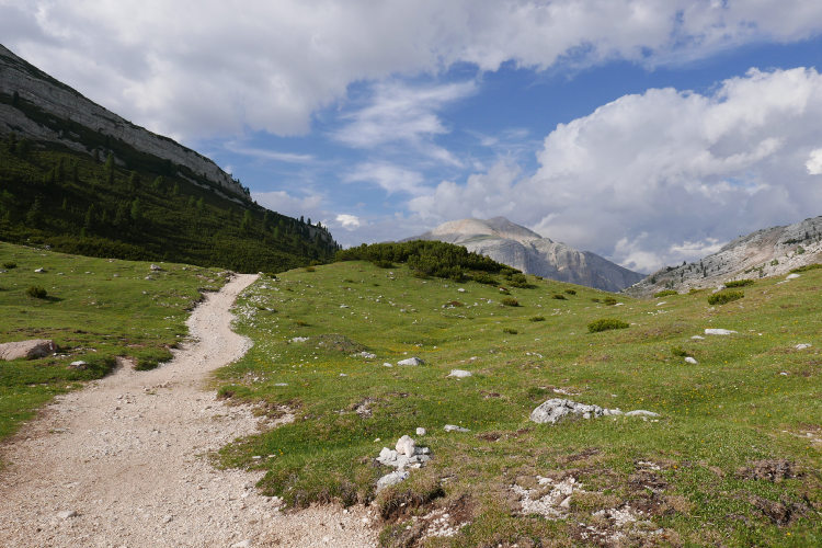
Alta Via 1 is the most famous hiking High Route not just in the Dolomites but in the Alps overall. It dates back to 1969 when the Alta Via 1 itinerary was first published and received its actual name. The classic Alta Via 1 runs from the Braies lake in South Tyrol to the town of Belluno at the southern edge of the Dolomites. This multi-day hiking route links several well-known landmarks of the Dolomite mountains including Lake Braies, Lagazuoi, Cinque Torri formation, Monte Pelmo, and the Civetta-Moiazza Group. These are the true calling cards of the Dolomites that make Alta Via 1 so popular.
You can choose between three variants of the Alta Via 1 itinerary that differ in length and duration: we offer the 9, 10 and 11 Day Tours. The longest 11 Day Tour includes 9 full hiking days and 110 km of trail thus covering the classic Alta Via 1 with the exception of several via-ferrata segments. All three itineraries start at Lake Braies and follow the classic Alta Via 1 route but feature varying finishing points.
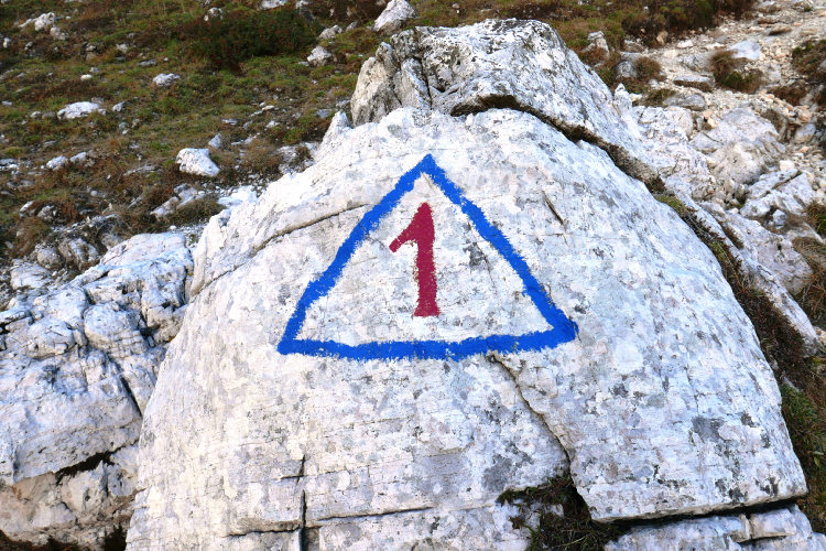
Alta Via N.1 is available as a private guided and self-guided trek with accommodation at manned mountain huts. Climbing skills are not required for this hike, but a good level of general physical training is necessary to enjoy it. You must be comfortable walking 5 – 7 hours a day with occasional stops. Being the most popular Haute Route of the Alps, Alta Via 1 runs along trodden trails that are well-maintained and well-marked. The route passes mainly above the forest belt at an altitude of 2000 – 2300 meters. The landscapes along Alta Via 1 vary from sparse forests and meadows to high mountains with lifeless rocky terrain at the highest points of the route.
The most stable weather conditions on the route are in July and August. In June, winter snow may remain on the passes. September is characterized by bright colors, excellent visibility and generally good and warm weather, but the passage of a cold front in September can cause snowfall at altitudes of 1700 m and subsequent deterioration of hiking conditions for 1 – 2 days.
We recommend an early booking for Alta Via 1 due to a high demand of the hut accommodation on the route and its limited availability.
If time does not allow you to complete the entire Alta Via 1, there are shorter options: Alta Via 1 North and Alta Via 1 South, which cover the northern and southern halves of the classic route, respectively.
StyleHut to Hut Hiking
DifficultyLevel 3![]()
Activity7 - 9 hiking days![]()
Tour Duration9 - 11 days / 8 - 10 nights
Start / FinishCortina d'Ampezzo, Toblach / Belluno, Zoldo
Validity of prices: Summer 2026. The prices are subject to change without notice.
Private guided tour: the price is based on a minimum of 4 participants.
Private guided and self-guided tours are private tours on the dates of your choice.
See tab Prices for minimum and maximum group size, included services, single supplements and other details.
Day 1: Arrival in Cortina d'Ampezzo or ToblachYou arrive in Toblach or Cortina d'Ampezzo on your own, check in at the basecamp hotel and rest up before the hike. Of the two possible basecamp locations for this hike, Cortina is the larger and more famous resort, located closer to Venice airport. It hosts a variety of cultural and sporting events throughout the summer season. The Toblach resort is considerably smaller, situated in the German-speaking province of South Tyrol, and is located closer to the start point of the route. Tomorrow, you will need to travel for 30 minutes in total from Toblach, instead of the 1h 20m from Cortina. However, the airports are situated much further from Toblach than from Cortina. |
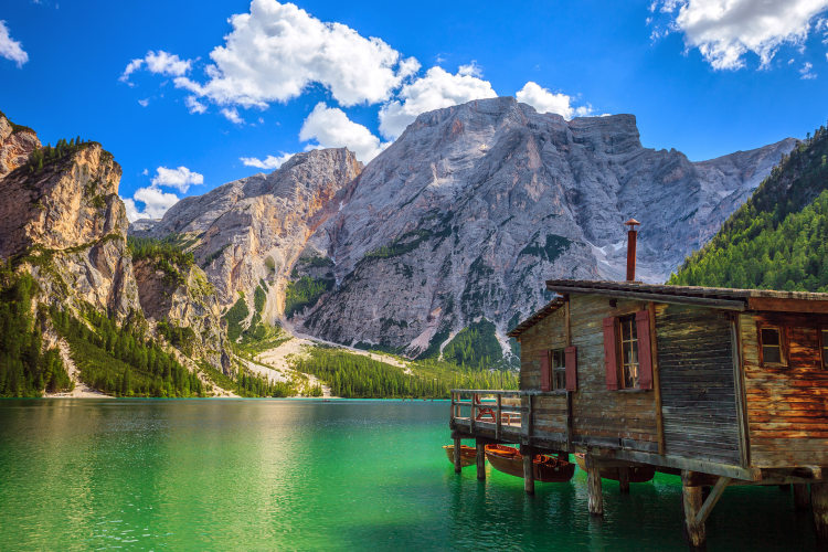
Day 2: Lake BraiesAscent 960 m. Descent 300 m. Altitude 1500 - 2300 m. Distance 10 km. Walking time 5 hours. The route commences from Lake Braies. This is a true pearl of the Dolomites and South Tyrol, and, in addition, is one of the largest and deepest lakes in the Dolomites: 1,2 km in length, 300 m wide and 36 m deep. Lake Braies was formed as a result of a landslide that blocked the flow of the mountain stream that bears its name, and owes its popularity to the exceptional beauty of its surroundings. The lake is filled with pure, clear water, which takes on a rich emerald hue in sunny weather. It is surrounded on three sides by the Dolomite massifs, and the south side of the lake looks out onto the vertical slope of the Croda del Becco peak, in the direction of which is the Alta Via 1 route. |
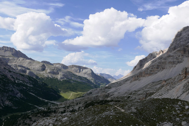
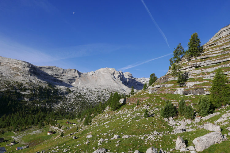
Day 3: Fanes-Sennes-Braies Natural ParkAscent 550 m. Descent 650 m. Altitude 1500 - 2100 m. Distance 11 km. Walking time 5 hours. Today, the route passes through the Fanes-Sennes-Braies Nature Park. The latter encompasses several massifs of the Dolomites, a defining feature of which is their distinctive karst topography. The karst landscapes in Fanes-Sennes-Braies were formed as carbonic acids and water dissolved the limestone deposits, which existed during the Jurassic period, over the following millennia. Many and various types of karst formations can be found in the Nature Park: shafts, grooves, limestone pavements, basins, cavities, caves, and so on. In one of these caves were discovered the remains of a cave bear that inhabited these areas 40 - 60 thousand years ago. |
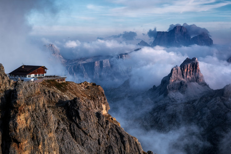
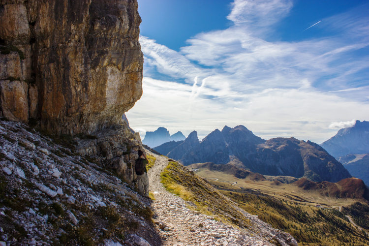
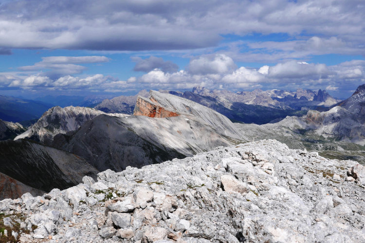
Day 4: Lagazuoi MassifAscent 1120 m. Descent 440 m. Altitude 2000 - 2800 m. Distance 13 km. Walking time 6 hours. From the Fanes-Sennes-Braies Nature Park, the route leads to the Lagazuoi massif. This is famous for its "observation platform" with a 360-degree panorama of the Dolomites. From its peak, you can see the Nuvolau, Croda da Lago and Monte Pelmo groups and, on the distant horizon, the Marmolada, Sella, Sassolungo, and Pale di San Martino. In fair weather, it is undoubtedly worth taking some pictures here as a memento. For Italians, the Lagazuoi is of great historical significance; during the First World War, the Italian and Austro-Hungarian armies clashed here. The excavations and explosions in enemy tunnels altered the original appearance of the massif to a degree, leaving craters and deep clefts. If you wish, you can stay and inspect the system of military tunnels, which stretch for around 1,1 km, but do bear in mind that most of these tunnels are impassable, and in order to access many of them experience of via-ferratas is required. |
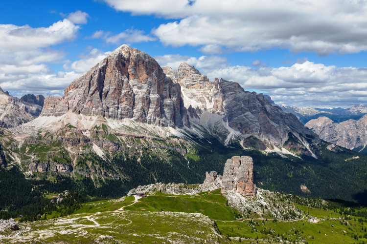
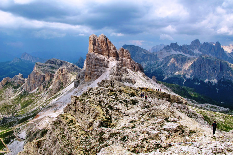
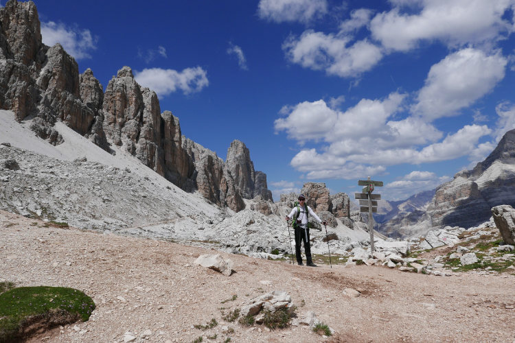
Day 5: Cinque TorriAscent 790 m. Descent 1470 m (with the lift 840 m). Altitude 2000 - 2600 m. Distance 15 km. Walking time 7 hours. The Cinque Torri massif, from the Italian for "five towers", is one of the most famous locations on the Alta Via No. 1 itinerary, and perhaps the most unusual group in the Dolomites in general. It was formed when a single massif fragmented into five parts during the formation of the modern Alps. The towers of the Cinque Torri stand proud over the surrounding alpine meadows by more than 100 meters. Each of them has its unique shape and own name. |
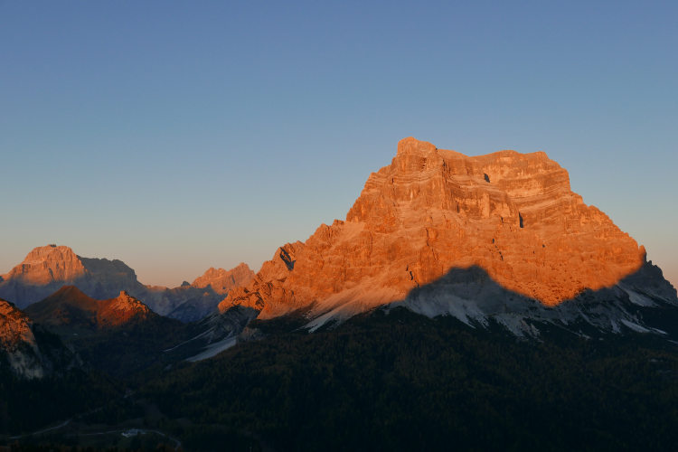
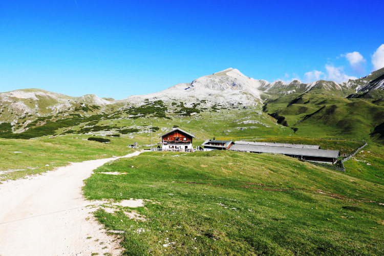
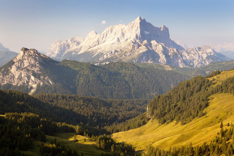
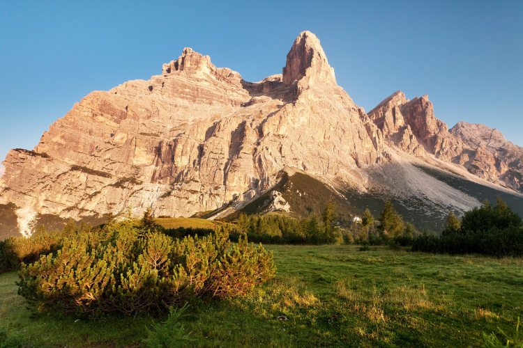
Day 6: Monte PelmoAscent 450 m. Descent 930 m. Altitude 1800 - 2400 m. Distance 13 km. Walking time 5 hours. Today, the route approaches the next of the Dolomites’ landmarks: The Monte Pelmo massif. From the south-eastern side, Monte Pelmo has a uniquely trapezoidal shape. There are no trails ascending Monte Pelmo; this massif is only accessible to mountain climbers. The Alta Via 1 route passes under the vertical faces of Monte Pelmo, along trails that boast stunning views. In addition, petrified dinosaur footprints from the Triassic period can be seen here, dating from around 200 - 250 million years ago. The day comes to a close at the north end of the Civetta group in a conveniently located hut that provides a beautiful panoramic view of Monte Pelmo and other massifs at sunset. |
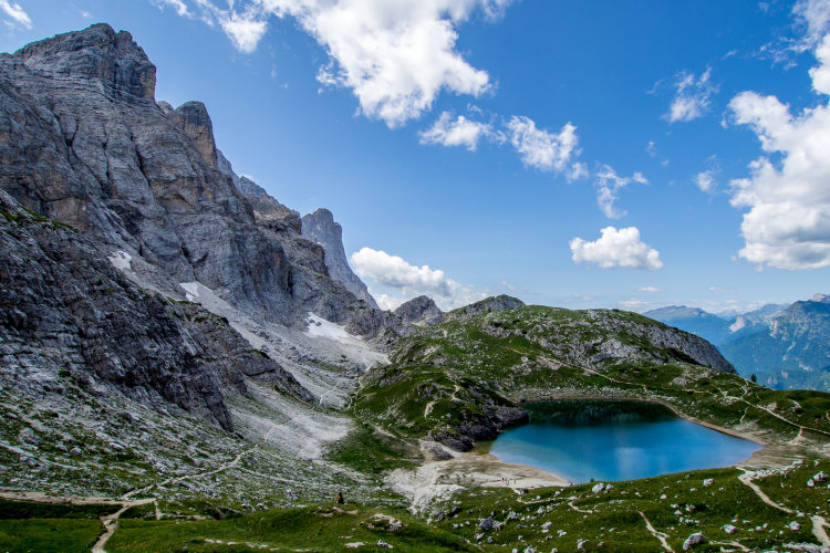
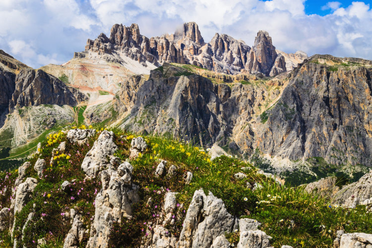
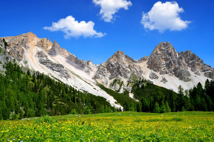
Day 7: Civetta and Lake ColdaiAscent 950 m. Descent 470 m. Altitude 1700 - 2250 m. Distance 11 km. Walking time 5 hours. The following morning, the route departs from the picturesque Lake Coldai, which is located in a shallow hollow in the north of the Civetta group. Views of the lake against a backdrop of Civetta’s steep rocks can often be seen in alpine calendars. The group is famous for its 5-kilometer west face, which reaches more than 1 km in height. Around 100-300 meters in total separates the trail from the mountain face at this point, making this section of the Alta Via 1 one of its most impressive hiking paths. |
Day 8: Moiazza GroupAscent 1020 m. Descent 1450 m. Altitude 1400 - 2100 m. Distance 14 km. Walking time 7 hours. Today, the path bends around the Moiazza massif, which forms one common mountain group with Civetta, and one of the largest groups in the Dolomites. At this point, the hiking route passes through a beautiful and serene landscape, slightly higher than the border of the forest belt, and gradually descending into the coniferous forest. At the beginning of the path, from the uplands that are opposite the north face of Civetta, you can take in the panoramic vista of the Dolomites to the east, encompassing the Marmolada and Sella groups. The Moiazza massif features the same sharp formations that were observed yesterday evening while passing along the north face of Civetta, but here the vertical cliffs seemingly "grow" from the level of the forest, something that creates impressive and contrasting images of classic alpine landscapes. |
Day 9: San Sebastiano and Pramper GroupsAscent 590 m. Descent 560 m. Altitude 1500 - 2000 m. Distance 13 km. Walking time 5 hours. The route gradually leaves this area behind for more secluded spots. On the path for today are the San Sebastiano and Pramper groups, but less than a quarter of the hikers who set off from Lake Braies reach this far. For exactly this reason, these mountains are famed for their less-frequented trails and wild, undisturbed natural environment. The slopes here are steeper than those of the mountain groups in the north of the Alta Via 1. There are, therefore, fewer hiking tracks here, and the higher altitude routes away from the main Alta Via 1 trail are via-ferratas, some of which are not even marked on maps. Here, you can see peaks that soar dramatically into the heavens, and, if you set out on the early enough, even wild animals, including chamois and roe deer. |
Day 10: Schiara GroupAscent 640 m. Descent 1740 m. Altitude 750 - 2450 m. Distance 11 km. Walking time 6 hours. On the last day of your journey, you will pass through the moraines that are typical of the southern Dolomites, as well as across the lunar landscape of the Schiara group’s highlands. Due to the fact that the mountain slopes are very steep in this part of the Dolomites, the scree that is found as you approach the mountain passes is also steep. The Schiara group are the most barren mountains on the Alta Via 1 route, and practically no one ventures beyond the route itself. The path ahead is a via-ferrata, and so this is the last day of the hike. In the afternoon, you will descend to the foot of the Schiara group, from where you will reach Longarone or Belluno with a transfer. |
Day 11: Departure from Zoldo or BellunoYour Alta Via N.1 hike is over. After a breakfast at the base camp hotel, you can start your way back to the airport. |
Alta Via 1 from Lake Braies to Civetta This route is 2 days shorter than the primary itinerary: there are 7 full hiking days. The overall difficulty level of this route is identical to the difficulty level of the main itinerary. You will finish your trek at Passo Duran, from where a transfer will be organized for you to Belluno. If you prefer an easier route on the final hiking day, you can step off the main itinerary in the Moiazza area, descend to the valley and finish the trek in Listolade from where you will be transferred to Belluno. |
Guided group trek from Lake Braies to Civetta-Moiazza For group tours in 2026 we planned the classic 9-day Alta Via 1 itinerary, detailed above up to Day 8. Day 1 – arrival in Cortina d’Ampezzo. Day 2 – transfer to Lake Braies and start of the trek. Days 2-8 are the days of hiking along the main route from Lake Braies to Lagazuoi, then to Cinque Torri and the Nuvolau Group, Monte Pelmo, and Civetta-Moiazza. We will finish the trek either at Passo Duran or in Listolade, depending on the level of physical fitness of all members of the group. For the final night we will transfer to Belluno. On this group trek, you will be accompanied by a local English-speaking UIAGM mountain guide who will help you get to know the Dolomites in general and the mountain groups through which the Alta Via 1 passes, the history, culture and culinary traditions of these places. |
Alta Via 1 from Lake Braies to San Sebastiano With 8 hiking days, this itinerary covers the classic Alta Via 1 itinerary and runs from Lake Braies through Lagazuoi, Nuvolau, Monte Pelmo, Civetta-Moiazza to the most remote San Sebastiano Group. After 7 days of hiking along the main route, on Day 9 you will reach San Sebastiano, step off the main route and hike through San Sebastiano towards the Zoldo valley, where our base camp hotels are located. Unlike the classic Alta Via 1 route, which bypasses San Sebastiano, this route goes deep into the mountain range, where you will be surrounded by wild, untouched nature, enjoy stunning views and meet just few, if any, other hikers. |
Validity of prices: Summer 2026.
The prices are per person and include the VAT tax.
The prices are subject to change without notice.
Private guided and self-guided treks are private tours on the dates of your choice.
The indicated tour duration includes the days of arrival and departure. Hotel accommodation on the day of arrival and night before departure is included in the price.
Self-guided tour. Supplement for trips for solo hikers:
9 Day Self Guided Tour | Solo supplement € 170
10 Day Self Guided Tour | Solo supplement € 170
11 Day Self Guided Tour | Solo supplement € 170
Private guided tours are only open to your group. The price listed on the tour page is for groups of 4 members. You can set a larger or a smaller group – please contact us for a price.
Group treks: you join a group of other hikers formed by us. Maximum group size and single supplement:
9 Day Tour Group A2 | Max 7 members | Single € 100
9 Day Tour Group A3 | Max 7 members | Single € 100
9 Day Tour Group A4 | Max 7 members | Single € 100
9 Day Tour Group A5 | Max 7 members | Single € 100
Validity of prices: Summer 2027.
The prices are per person and include the VAT tax.
The prices are subject to change without notice.
Private guided and self-guided treks are private tours on the dates of your choice.
The indicated tour duration includes the days of arrival and departure. Hotel accommodation on the day of arrival and night before departure is included in the price.
Self-guided tour. Supplement for trips for solo hikers:
9 Day Self Guided Tour | Solo supplement € 180
10 Day Self Guided Tour | Solo supplement € 180
11 Day Self Guided Tour | Solo supplement € 180
Private guided tours are only open to your group. The price listed on the tour page is for groups of 4 members. You can set a larger or a smaller group – please contact us for a price.
The base camp locations for this trip are Cortina d'Ampezzo and Toblach. Venice is the most convenient airport in the region. There are direct busses to Cortina from the Venice Marco Polo airport, and it takes around 2h 30m to arrive in Cortina. It takes 3h 30m to arrive to Toblach, and you will change the bus once. The Treviso airport is the second convenient option: the travel time is approximately the same. Other airports are significantly less convenient than Venice and Treviso. Depending on the schedule of your flight you may need to stay overnight in Venice to catch the bus.
You will finish the hike in Belluno, Longarone or Zoldo. These locations are also best connected to Venice Marco Polo Airport.
We can help you plan the logistics and provide you with train and bus schedules: please contact us before you buy the plane tickets.
Proper hiking boots are a must for the mountains. We recommend high boots because they support the ankle better than any low boots and provide better stability on a rocky terrain. Even in the middle of the summer in the Dolomites you must bring some warm clothes with you: waterproof and windproof jacket, fleece jacket, long trekking pants and a cap. A raincoat, poncho or other type of rainwear is necessary. Other necessary items are the toiletries, light clean footwear to use in the huts, sunglasses and at least 2 one-liter bottles for water. Your trip documents will include a detailed packing list specifically prepared for your itinerary. We kindly ask everyone to read it carefully and be properly prepared for the hiking trip.
The first and last nights of your trip are in one of our basecamp hotels. While hiking, you will stay overnight in the mountain huts. You can count on the following services in the mountain huts: a bed in a shared room or in a private room (must be booked in advance), shower with hot water, toilets, meals, and a possibility to buy take away water and snacks such as sandwiches and chocolate. Shared rooms are equipped with bunk beds with mattresses, pillows and blankets. Bed linen is not provided in shared bedrooms: you must have a sleeping bag liner with you. Typically, it is a light cotton bag. Warm sleeping bag is unnecessary, since there are blankets in the bedrooms. In private rooms you are often offered bed linen, thus a sleeping bag liner is not required. If you book private rooms, we inform you on whether you need to bring a sleeping bag liner. Most huts have a heating system, but it is normally not required in the summer months. You will need clean footwear for the huts: light slides are an ideal solution. For detailed information on the huts please read Mountain Huts in the Alps.
In hut-to-hut hiking tours you are served a breakfast and a dinner in the huts and mountain hotels on the route.
Normally, the breakfast is served from 7am to 9am. It usually includes an unlimited quantity of coffee and tea, bread, butter, jam, honey and chocolate spread. In addition, some huts offer ham, cheese and muesli for breakfast. After breakfast we recommend filling your thermos with hot water or tea: ask the staff, and it will be for free in most huts.
The dinner time in the mountain huts is 7pm or 7:30pm for all guests. A typical dinner in a hut is very rich and includes a starter, the first course (such as pasta, risotto, dumplings), the second course (meat with a side dish) and a dessert. Any drinks at dinner (water, wine, beer, tea, coffee) are not free and should be ordered and paid separately.
Lunch. It is possible to stop for lunch in the mountain huts on the route on most days of the hike. The lunch menu in the huts is similar to the dinner menu. Typically, there is a choice of pasta for 10 – 15 euros. Second dishes cost 15 – 20 euros.
Our guided hiking tours are led by professional guides, each with years of guiding and wilderness experience and with passion for mountains. They permanently work in the region of the exact hiking tour, have professional licenses, are experts in emergency situations, regularly upgrade their qualifications and work in accordance with national regulations.
For self-guided hiking, it is necessary to be properly dressed, follow the safety rules and make realistic time calculation for day crossings – preferably according to the hiking schedule that we provide. Our self-guided hiking trips are planned so that they do not require specific skills or gear, unless it is clearly specified in the tour description. You can expect well-maintained trails equipped with direction signs. Exposed sections of the trail are secured on the self-guided routes: it makes them safe provided that you follow the basic safety rules for hiking in the mountains.
Mountains are a natural environment with a high level of risk, so we insistently ask all participants to read the safety rules and emergency procedures: Safety Considerations. If you have questions about the safety rules, please contact us +39 0463 63 60 80.
Insurance. It is important to have an appropriate insurance that covers the hiking activity. You don't need to include the climbing activity in your insurance, unless you are planning to climb during the hike.
Visa. We will provide you with a booking confirmation for all days of your trip. If you need the Italian visa, you can enclose this document with your visa application.
The most stable weather conditions in the Dolomites are statistically from the second week of July till the middle of September. This period in the Dolomites is characterized by warm sunny weather and modest rainfall. Earlier in June, the weather is normally favorable, but it is less reliable, and the mountain passes may be blocked by snow remaining from the winter. In June we may have to change the route depending on the snow situation on the passes. The second half of September in Dolomites is a beautiful period, but the weather is again less predictable: the probability of incessant rain increases, and it may snow at the altitude above 2,000 meters.
It is never hot in the Dolomites at the elevation of 2,000 m (6,560 ft) and above where most of the hiking routes pass. In a sunny day in August the temperature at 2,000 m can reach 20° C (68° F) suring the warmest hours of the day. It is comfortable for hiking. In a cold cloudy day, the temperature can stay at around 10° C (34° F) during the entire the day. It is always chilly at night and early in the morning. Thunderstorms, often with hail, are typical for the warmest months (July and August). In the Dolomites valleys at the altitudes of 1,000 – 1,500 m (3,280 – 4,920 ft) the day temperature can reach 27° C (80° F). It is fresh in the valleys in the morning and evening, and it is not stuffy at night even in the hottest weeks of the summer.