
Guaranteed Group Departures 2026

Hiking trips without a guide and a group with overnight stays in mountain huts
Hiking trips with scheduled group departures – local mountain guides and groups of 6 to 8 members
Individually planned private hiking trips on the dates of your choice
Guided custom day hikes and excursions
All Dolomites, including Tre Cime, Lagazuoi, Cinque Torri, Sella, Marmolada, Cortina d'Ampezzo and more
Pennine Alps, Graian Alps including Gran Paradiso, and Aiguilles Rouges
Stelvio National Park, Ortler, Cevedale, Adamello, Bernina, Texel
Ranges of northern Garda, Monte Baldo, lake Ledro, Monte Bondone
Home/Dolomites Hiking Tours/Fassa to Pale di San Martino Trek
Exceptionally wide diversity of mountain landscapes
Quiet trails, pristine nature
More solitude than on most other trails in the Dolomites
Expansive panoramas from easily accessible local peaks
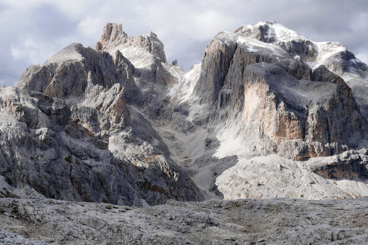
This itinerary will appeal to hikers who prefer trekking off the beaten path while exploring the magnificent Dolomites. The majestic Pale di San Martino and Fassa Dolomites are the symbols of the Dolomites, unique in their own way, UNESCO World Heritage Sites. In these mountains you can be sure of exciting hiking opportunities amid stunning natural beauty. In Fassa and Pale, you will find scenic hiking trails running through all types of alpine terrain, from green meadows to rocky high plateaus. These mountains have witnessed many historical events, including battles of the First World War, from which trenches, artillery positions and forts still remain in the region. The region is famous for its cultural heritage and folklore. Local folk tales and legends add charm to its landscapes. This hiking route together with our Fassa Dolomites Trek is often referred to as “The Trekking of the Legends” - the best name for an adventure through such an enchanting and storied mountain region.
Despite the challenging Monzoni Group in the middle, this is a fairly moderate Level 3 hut-to-hut hiking route. It starts in Val di San Nicolo, a tiny isolated valley branching off from Val di Fassa. From there, the itinerary heads south through Monzini along quiet trails to Pale di San Martino.
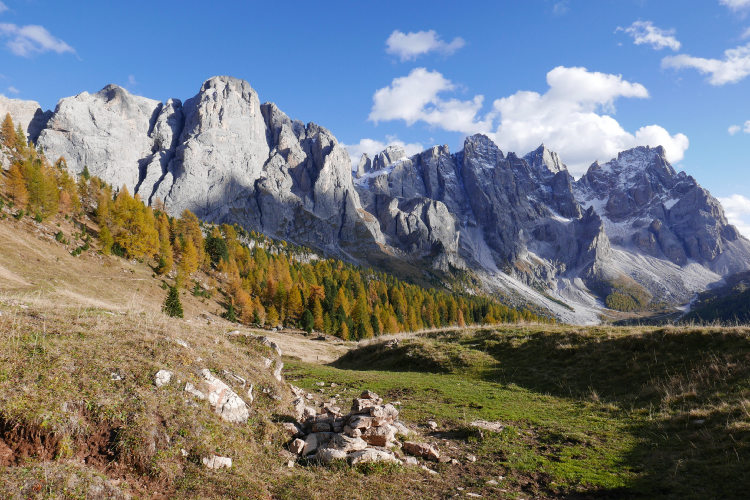
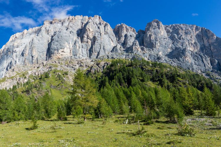
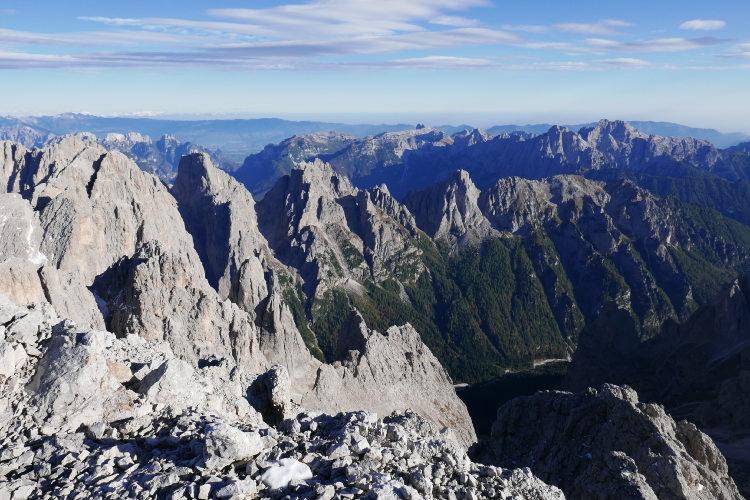
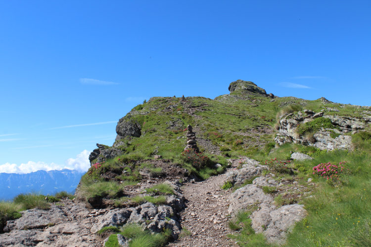
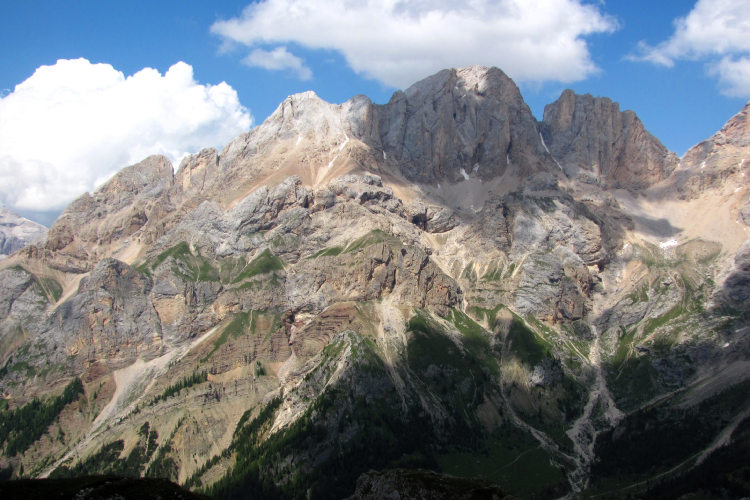
You will traverse through a great variety of landscapes on this trek. The Val di San Nicolo valley is an idyllic place, sheltered from any noise and even wind. The green meadows at the bottom of Val di San Nicolo are framed by a strip of coniferous forest, which at an altitude of 1800 - 2000 meters gives way to a high mountain landscape, first green and then rocky. Further on in the Monzoni Group, you will ascend to the highest point of the route, where the terrain is completely barren and rocky. Once you cross Passo di Cirele at 2683 metres, you will find yourself in a new landscape again – the southern slopes of the Monzoni Group are largely covered with scree. However on this route, the descent down the scree slope does not present any technical difficulty since it is a stable scree with a solid trail.
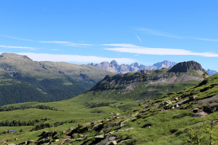
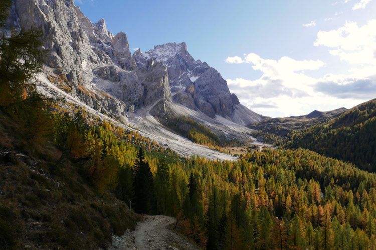
Leaving the Monzoni Group, you will traverse a vast area at a moderate altitudes between 1900 ans 2200 m, above the treeline and mostly open, with truly spectacular panoramas of the Dolomites. Here you will hike along the quietest trails, meeting almost no people until you reach the Passo Rolle pass. At Passo Rolle you will find yourself opposite the north-west face of Pale di San Martino – in a landscape of incredible beauty that you may recognise from Alpine postcards and calendars. But this is not all! The route continues into the granite-formed Lagorai Group, where landscape changes dramatically and where you can enjoy stunning views of Pale di San Martino and stop for a lunchbreak at Lake Colbricon in a peaceful atmosphere of silence, surrounded by sparse coniferous forest. From Lake Colbricon the itinerary descends to the charming town of San Martino di Castrozza at the foot of the Pale plateau.
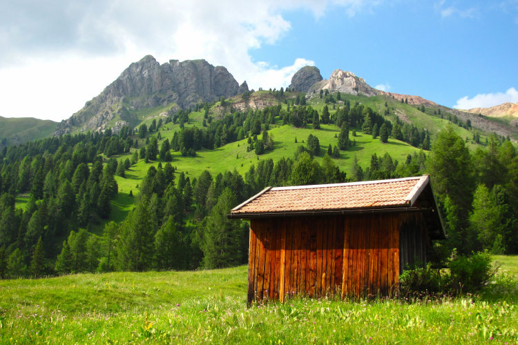
We organize this hiking tour as a private guided or self-guided trek. It follows well-marked and well-trodden trails. The trek does not require any special training or technical skills, but good physical fitness is essential. The trek will be enjoyable if you are comfortable to hike for 5-6 hours a day. If you prefer a self-guided trek, you must be able to navigate the terrain with a map and interpret weather forecasts, as on a self-guided trek on any other route. In terms of accommodation, the route features some of the most comfortable huts of the region with the option of private rooms when available.
If you are looking for an adventure that combines the classic Dolomite landscapes with untouched nature and quiet trails, then this route is the right choice.
If time permits, we recommend the 7-day option as it allows you to reach the Pale plateau, explore the rare lunar landscape at 2700 - 3000 meters and ascend the Cima Fradusta summit for a truly breathtaking 360-degree panorama.
StyleHut to Hut Hiking
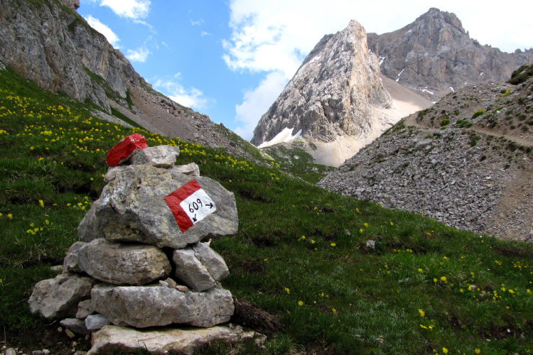
DifficultyLevel 3![]()
Activity4 - 5 hiking days![]()
Tour Duration6 - 7 days / 5 - 6 nights
Start / FinishVal di Fassa / San Martino di Castrozza
Validity of prices: Summer 2026. The prices are subject to change without notice.
Private guided tour: the price is based on a minimum of 4 participants.
Private guided and self-guided tours are private tours on the dates of your choice.
See tab Prices for minimum and maximum group size, included services, single supplements and other details.
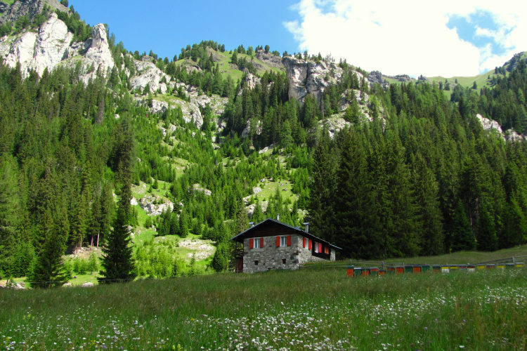
Day 1 : Arrival in Val di FassaYou arrive in the splendid Val di Fassa Valley on your own. Val di Fassa will greet you with charming views and a great mountaineering atmosphere. From the central part of the valley where you will stay overnight, you can see the peaks of the Monzoni group rising above the forest. You will explore Monzoni on the first two days of your hike, but for now the first evening in Val di Fassa will let you acclimate, enjoy splendid mountain views, taste the local cuisine and rest before the multi-day trek. |
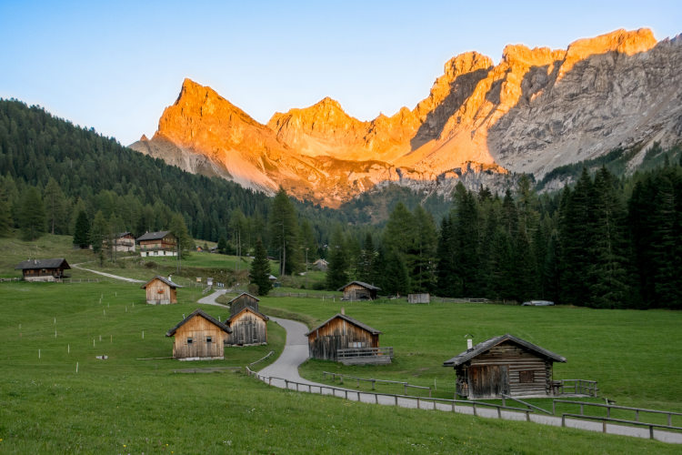
Day 2: Val San NicolòAscent 670 m. Descent 370 m. Altitude 1730 – 2340 m. Distance 9 km. Walking time 4 hours. Your hiking adventure begins with a short transfer to Vidòr, the gateway to the picturesque Val San Nicolò, where your trek begins. This small peaceful valley is renowned for its natural beauty, crystal-clear streams, dense coniferous forests, and colorful wildflowers. As you enter the valley, the trail ascends to the high-altitude Passo San Nicolò (2340m), an ideal spot for a well-deserved rest. The pass is known for an impressive panorama with Marmolada, Sella Group, Rosengarten, Pordoi, and Monzoni. Your today’s route ends at a cozy mountain hut located at the foot of Marmolada, where, as night falls, you can witness your first Enrosadira – the magical moment when the Dolomite Mountains glow in hues of pink and orange. |
Day 3 : Monzoni GroupAscent 680 m. Descent 790 m. Altitude 1910 – 2690 m. Distance 10 km. Walking time 5 hours. Today you will take a more challenging trail and reach the highest pass of the entire route, Pas de la Cirele, at 2683 m. Leaving behind the vertical south face of Marmolada, you’ll head towards the Monzoni Group. While less known than the other mountains around Val di Fassa, this mountain group is no less stunning. Much of the Monzoni is virtually impassable, so far fewer hikers venture into the Monzoni, making this mountain group the quietest in the Fassa Dolomites. Only in Monzoni in recent years can one still encounter ibexes. This mountain group is especially appreciated by geologists for its fascinating variety of rock formations. As you ascend along the trail and go deeper into Monzoni, the terrain gradually becomes typical high mountain. At the start of the day, you will be able to enjoy the warmth of green meadows changing into forests, while at the Passo Cirele pass only rocks will surround you. Beyond the pass you will descend along a scree slope, where, however, there is a solid and well-trodden path. By the end of the day, you will reach the meadows of the Passo San Pellegrino pass, where you will stay overnight. |
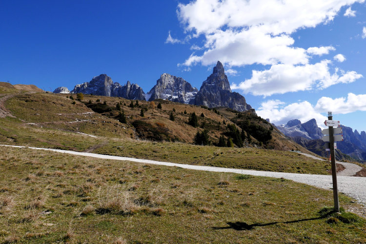
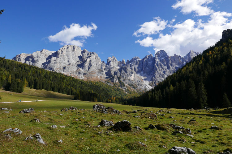
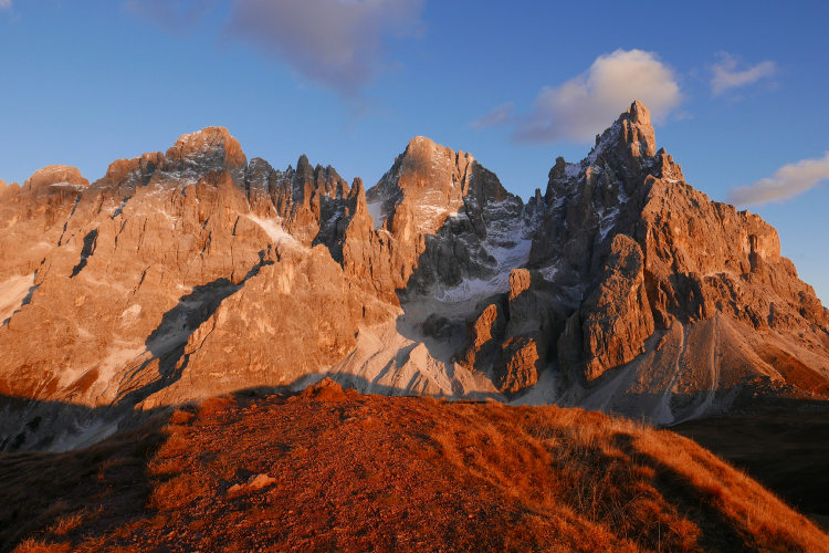
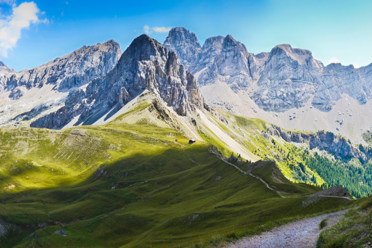
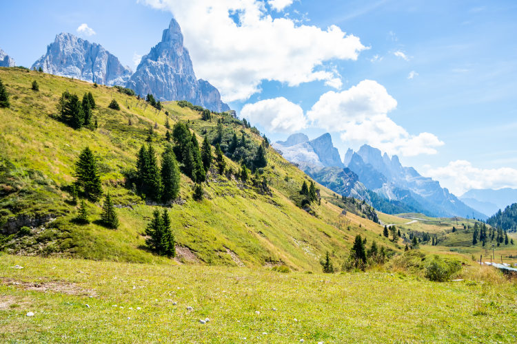
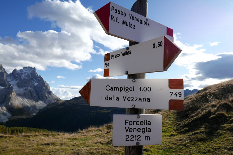
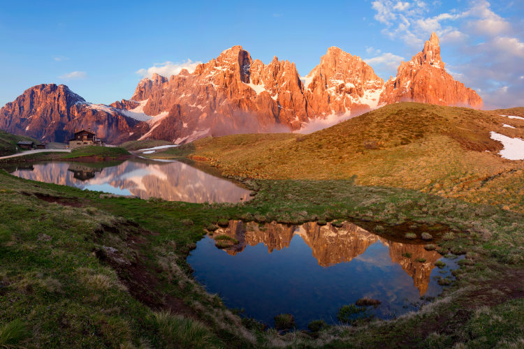
Day 4: Passo RolleAscent 850 m. Descent 700 m. Altitude 1970 – 2550 m. Distance 15 km. Walking time 6 hours. Leaving Passo San Pellegrino, your day will begin with a hike to Passo Valles. This mountain pass historically marks the boundary between the regions of Trentino and Veneto. Now a road runs through the pass, but the surrounding area remains surprisingly quiet and picturesque. Along the route, the vegetation gradually changes: from wide alpine meadows to forests of larches and conifers, creating a fascinating contrast between the intense green and the mountain rocks. Passo Valles is the point where you can stop for a short break at a nearby mountain hut and admire the surrounding landscapes. Beyond Passo Valles you will enter a trail that leads to the Passo Rolle pass through landscapes of exceptional beauty. For an hour and a half, you will hike south through a mostly open area, with sparse forest in front of you, against the backdrop of a thousand-meter-high western wall of Pale di San Martino, which rises into the sky with numerous peaks. You will reach Passo Rolle near Baita Segantini, a traditional alpine cottage located at 2170 meters in a vast grassy expanse beside a small lake, which beautifully mirrors the stunning Pale di San Martino. This is one of the most popular places among local photographers. From here, you can catch a glimpse of Cimon della Pala, also known as the "Matterhorn of the Dolomites." As the sun sets, the Enrosadira effect will set the Pale alight with hues of red, offering a mesmerizing and unforgettable sight – more captivating than any postcard. |
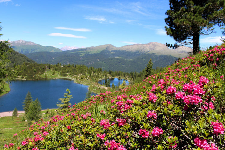
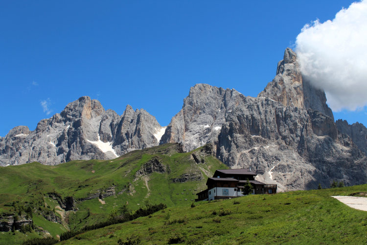
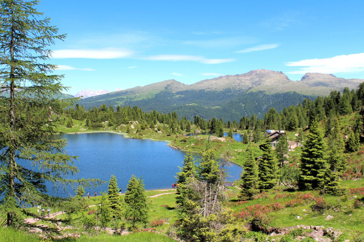
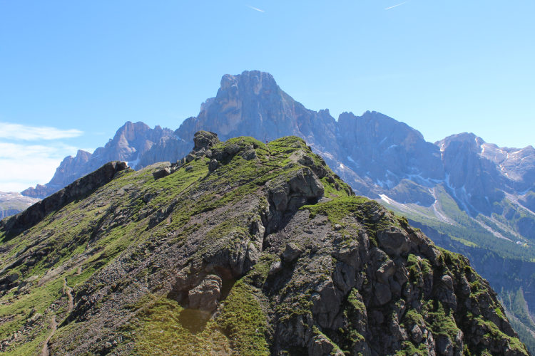
Day 5: Colbricon LakesAscent 320 m. Descent 930 m. Altitude 1470 – 2330 m. Distance 10 km. Walking time 5 h. Even though your trek is slowly coming to an end, there is still much to see. The final hiking day will reward you with views and landscapes that you could not see before in the Fassa Dolomites. From Passo Rolle you will head into the eastern Lagorai, a mountain group that is very different from those you have explored so far on this trek. Lagorai differs from the Dolomites in age and the rocks it is composed of. These are granite mountains. Lagorai is rich with water and vegetation. Your destination in Lagorai is the Colbricon Lakes. Your route to the lakes passes through the historically interesting place of Cavallazza. This area offers a wide panoramic view of the Pale di San Martino, the summits of the eastern Lagorai, and, to the north, as far as the south wall of the Marmolada. In addition, Passo Rolle as well as the Val Cismon valley are perfectly visible from here. During the First World War, such a dominant yet relatively easily accessible place attracted the opposing sides. The soldiers of the Austro-Hungarian army built fortifications here, traces of which have survived to this day. The hike to Cavallazza is both enjoyable and adventurous, not only because of the extraordinary views on a clear day but also because of the opportunity to see traces of recent history. One can still see WWI trenches and artillery positions at Cavallazza. The positions at this location allowed first the Austro-Hungarian and then the Italian armies to control the Passo Rolle pass and a significant part of the Val Cismon valley. From Cavallazza you will relatively quickly descend along the ridge to the Colbricon Lakes, which are especially beautiful when they come into view from above. Colbricon are two tiny lakes lying in a small depression, protected from the winds by a spruce forest and surrounding ridges. There is a mountain hut on the shore of one of them. Colbricon is a charming and serene place where we recommend planning a stop for lunch at the hut or a picnic before the final stage of the hike, which will take you to the town of San Martino di Castrozza. |
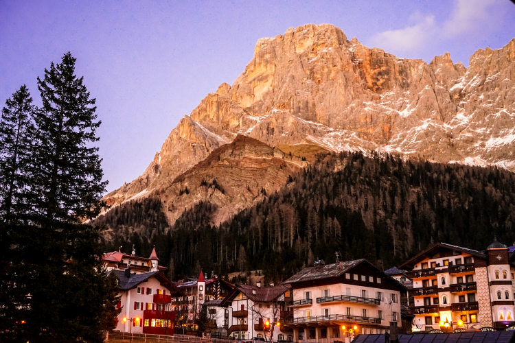
Day 6: Departure from San MartinoYour trek finished in San Martino di Castrozza, one of the first alpine resorts, which became famous back in the times when only aristocrats could afford holidays, especially in remote mountains. At that time, San Martino was also visited by people of art. San Martino inspired Richard Strauss and Arthur Schnitzler. Luckily for us, San Martino escaped the fate of many Alpine resorts of the time. It did not grow into a large village or become a mass tourist destination. San Martino remains charming, and its atmosphere is filled with the spirit of history, tradition and mountaineering. If you have time before you leave, you can spend a day relaxing in San Martino or take the lift up to Pale di San Martino to see the largest lunar plateau in the Dolomites. |
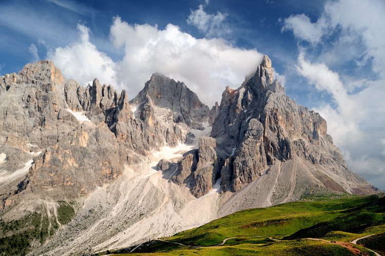
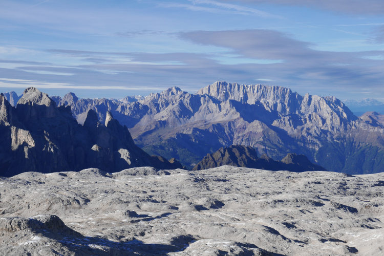
The classic itinerary with an extension to the Pale plateau This route variant allows you to explore the Pale di San Martino plateau famous for its lunar landscape. It is the largest high-altitude plateau of the Dolomites, many times larger than all the others. To reach it, you can choose to stay an additional night in a hotel in San Martino or in a good mountain hut up on the plateau. You will in any case need to use a cable lift to reach the plateau and have a full day to explore it. Our main itinerary on the plateau leads to the Cima Fradusta summit towering on its southern edge and offering an expansive 360-degree panorama of the plateau and the adjacent Dolomite mountain groups. |
Validity of prices: Summer 2026.
The prices are per person and include the VAT tax.
The prices are subject to change without notice.
Private guided and self-guided treks are private tours on the dates of your choice.
The indicated tour duration includes the days of arrival and departure. Hotel accommodation on the day of arrival and night before departure is included in the price.
Self-guided tour. Supplement for trips for solo hikers:
6 Day Self Guided Tour | Solo supplement € 150
7 Day Self Guided Tour | Solo supplement € 190
Private guided tours are only open to your group. The price listed on the tour page is for groups of 4 members. You can set a larger or a smaller group – please contact us for a price.
Validity of prices: Summer 2027.
The prices are per person and include the VAT tax.
The prices are subject to change without notice.
Private guided and self-guided treks are private tours on the dates of your choice.
The indicated tour duration includes the days of arrival and departure. Hotel accommodation on the day of arrival and night before departure is included in the price.
Self-guided tour. Supplement for trips for solo hikers:
6 Day Self Guided Tour | Solo supplement € 150
7 Day Self Guided Tour | Solo supplement € 190
Private guided tours are only open to your group. The price listed on the tour page is for groups of 4 members. You can set a larger or a smaller group – please contact us for a price.
The trek starts in Val di Fassa. Verona is the closest airport, there are regular flights from the UK, Germany, Denmark, France and Poland. It takes around 4 hours to arrive by train and bus from the Verona airport to the Fassa valley. Other airports: Munich, Innsbruck, Venice, Bergamo, Bologna, Milan.
The trek ends in San Martino di Castrozza a small town best connected to the Venice airport. There is a daily bus connection with the airport in July and August, while in June and September the direct bus connection is only available in weekends. A trip to the Venice airport takes between 3h 30m and 4h. Travel to other airports is less convenient and takes longer: Verona, Bergamo, Bologna.
We can help you plan the logistics and provide you with train and bus schedules: please contact us before you buy the plane tickets.
Proper hiking boots are a must for the mountains. We recommend high boots because they support the ankle better than any low boots and provide better stability on a rocky terrain. Even in the middle of the summer in the Dolomites you must bring some warm clothes with you: waterproof and windproof jacket, fleece jacket, long trekking pants and a cap. A raincoat, poncho or other type of rainwear is necessary. Other necessary items are the toiletries, light clean footwear to use in the huts, sunglasses and at least 2 one-liter bottles for water. Your trip documents will include a detailed packing list specifically prepared for your itinerary. We kindly ask everyone to read it carefully and be properly prepared for the hiking trip.
The first and last nights of your trip are in one of our basecamp hotels. While hiking, you will stay overnight in the mountain huts. You can count on the following services in the mountain huts: a bed in a shared room or in a private room (must be booked in advance), shower with hot water, toilets, meals, and a possibility to buy take away water and snacks such as sandwiches and chocolate. Shared rooms are equipped with bunk beds with mattresses, pillows and blankets. Bed linen is not provided in shared bedrooms: you must have a sleeping bag liner with you. Typically, it is a light cotton bag. Warm sleeping bag is unnecessary, since there are blankets in the bedrooms. In private rooms you are often offered bed linen, thus a sleeping bag liner is not required. If you book private rooms, we inform you on whether you need to bring a sleeping bag liner. Most huts have a heating system, but it is normally not required in the summer months. You will need clean footwear for the huts: light slides are an ideal solution. For detailed information on the huts please read Mountain Huts in the Alps.
In hut-to-hut hiking tours you are served a breakfast and a dinner in the huts and mountain hotels on the route.
Normally, the breakfast is served from 7am to 9am. It usually includes an unlimited quantity of coffee and tea, bread, butter, jam, honey and chocolate spread. In addition, some huts offer ham, cheese and muesli for breakfast. After breakfast we recommend filling your thermos with hot water or tea: ask the staff, and it will be for free in most huts.
The dinner time in the mountain huts is 7pm or 7:30pm for all guests. A typical dinner in a hut is very rich and includes a starter, the first course (such as pasta, risotto, dumplings), the second course (meat with a side dish) and a dessert. Any drinks at dinner (water, wine, beer, tea, coffee) are not free and should be ordered and paid separately.
Lunch. It is possible to stop for lunch in the mountain huts on the route on most days of the hike. The lunch menu in the huts is similar to the dinner menu. Typically, there is a choice of pasta for 10 – 15 euros. Second dishes cost 15 – 20 euros.
Our guided hiking tours are led by professional guides, each with years of guiding and wilderness experience and with passion for mountains. They permanently work in the region of the exact hiking tour, have professional licenses, are experts in emergency situations, regularly upgrade their qualifications and work in accordance with national regulations.
For self-guided hiking, it is necessary to be properly dressed, follow the safety rules and make realistic time calculation for day crossings – preferably according to the hiking schedule that we provide. Our self-guided hiking trips are planned so that they do not require specific skills or gear, unless it is clearly specified in the tour description. You can expect well-maintained trails equipped with direction signs. Exposed sections of the trail are secured on the self-guided routes: it makes them safe provided that you follow the basic safety rules for hiking in the mountains.
Mountains are a natural environment with a high level of risk, so we insistently ask all participants to read the safety rules and emergency procedures: Safety Considerations. If you have questions about the safety rules, please contact us +39 0463 63 60 80.
Insurance. It is important to have an appropriate insurance that covers the hiking activity. You don't need to include the climbing activity in your insurance, unless you are planning to climb during the hike.
Visa. We will provide you with a booking confirmation for all days of your trip. If you need the Italian visa, you can enclose this document with your visa application.
The most stable weather conditions in the Dolomites are statistically from the second week of July till the middle of September. This period in the Dolomites is characterized by warm sunny weather and modest rainfall. Earlier in June, the weather is normally favorable, but it is less reliable, and the mountain passes may be blocked by snow remaining from the winter. In June we may have to change the route depending on the snow situation on the passes. The second half of September in Dolomites is a beautiful period, but the weather is again less predictable: the probability of incessant rain increases, and it may snow at the altitude above 2,000 meters.
It is never hot in the Dolomites at the elevation of 2,000 m (6,560 ft) and above where most of the hiking routes pass. In a sunny day in August the temperature at 2,000 m can reach 20° C (68° F) suring the warmest hours of the day. It is comfortable for hiking. In a cold cloudy day, the temperature can stay at around 10° C (34° F) during the entire the day. It is always chilly at night and early in the morning. Thunderstorms, often with hail, are typical for the warmest months (July and August). In the Dolomites valleys at the altitudes of 1,000 – 1,500 m (3,280 – 4,920 ft) the day temperature can reach 27° C (80° F). It is fresh in the valleys in the morning and evening, and it is not stuffy at night even in the hottest weeks of the summer.