
Guaranteed Group Departures 2026


Hiking trips without a guide and a group with overnight stays in mountain huts
Hiking trips with scheduled group departures – local mountain guides and groups of 6 to 8 members
Individually planned private hiking trips on the dates of your choice
Guided custom day hikes and excursions
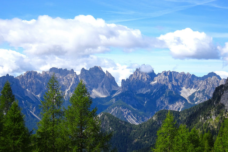
All Dolomites, including Tre Cime, Lagazuoi, Cinque Torri, Sella, Marmolada, Cortina d'Ampezzo and more
Pennine Alps, Graian Alps including Gran Paradiso, and Aiguilles Rouges
Stelvio National Park, Ortler, Cevedale, Adamello, Bernina, Texel
Ranges of northern Garda, Monte Baldo, lake Ledro, Monte Bondone
Home/Dolomites Hiking Tours/Friuli Dolomites Traverse
New itinerary 2026
The most remote and quiet region of the Dolomites
Untouched nature of the Dolomiti Friuli Nature Park
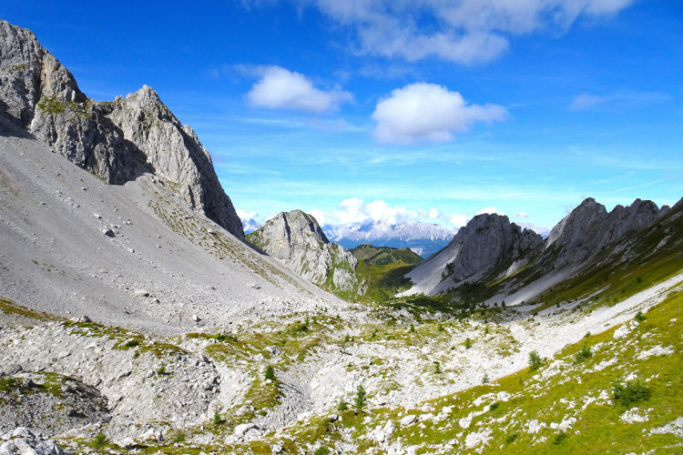
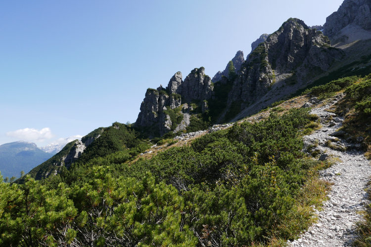
Frequent natural contrasts, highly varied landscapes and views
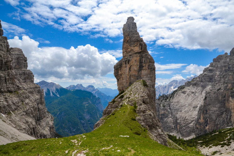
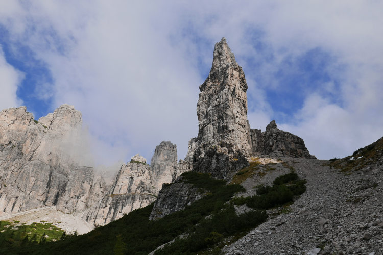
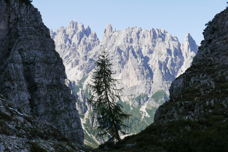
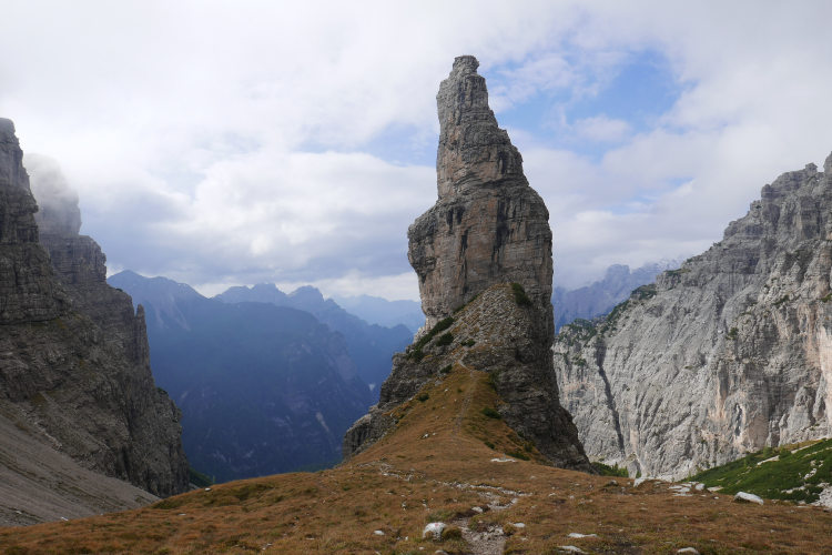
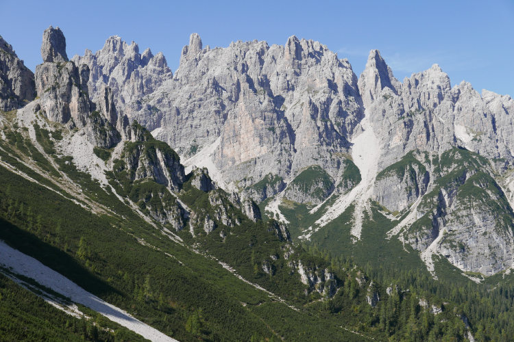
Campanile di Val Montanaia, a major symbol of the Dolomites
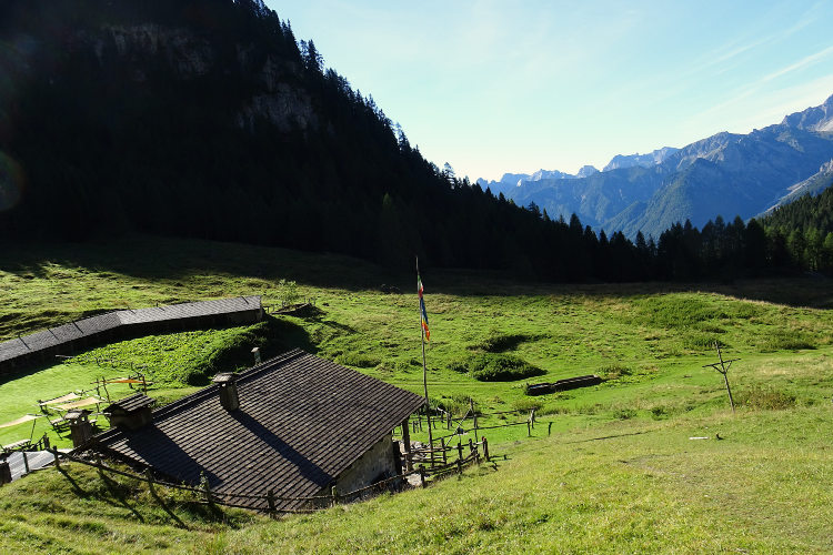
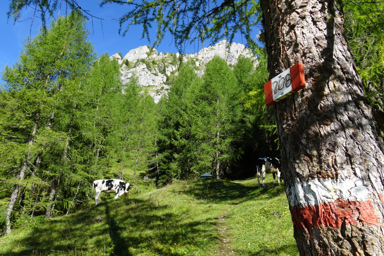
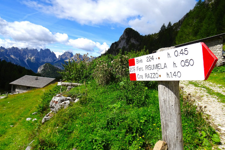
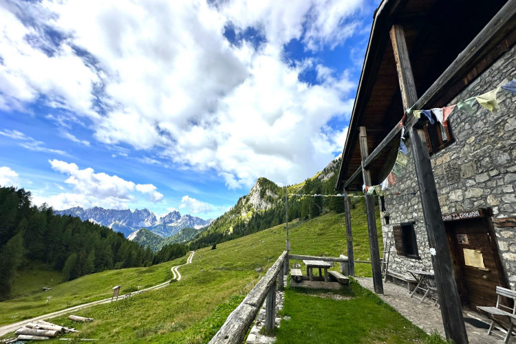
Small, cozy alpine mountain huts and traditional Casera refuges
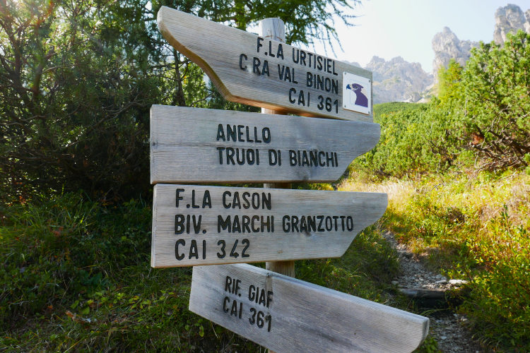
This hiking route runs off the beaten track and connects some of the most beautiful landmarks of the Friuli Dolomites. Throughout its length, the itinerary crosses ever-changing landscapes, taking you from one hut to the next.
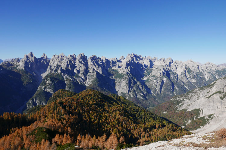
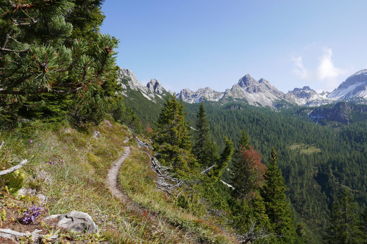
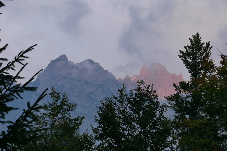
The Friuli Dolomites are a large mountain system, unique in its level of isolation from civilization, that is difficult to find anywhere else in the Dolomites. Historically, this region has never had a significant population. Cities, main roads and tourist centers are located at a considerable distance. The Friuli Dolomites still retain the spirit of wild mountains, just as they did a thousand years ago. Even the inclusion of the Friuli Dolomites on the UNESCO World Heritage List has not changed these mountains. There are no day tourists, no ski lifts, no noise from cars or motorbikes. The Friuli Dolomites remain the most remote and quiet region of the Dolomites.
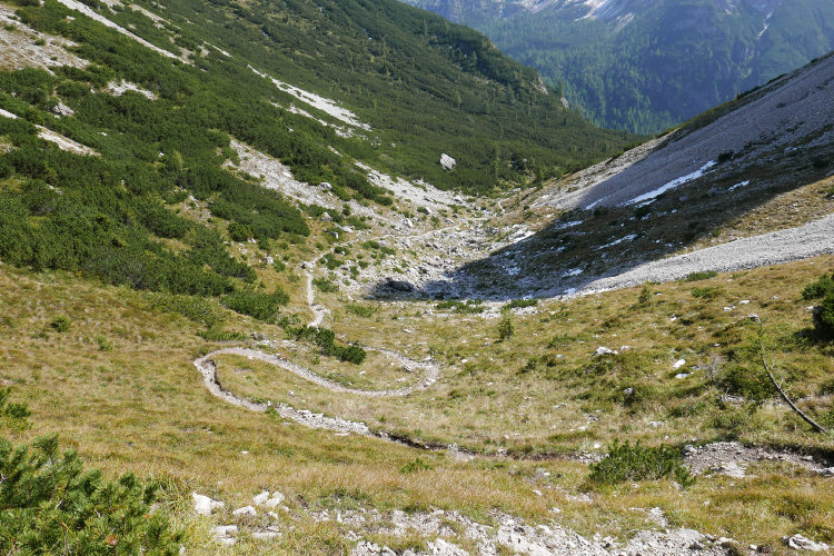
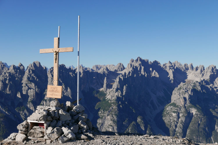
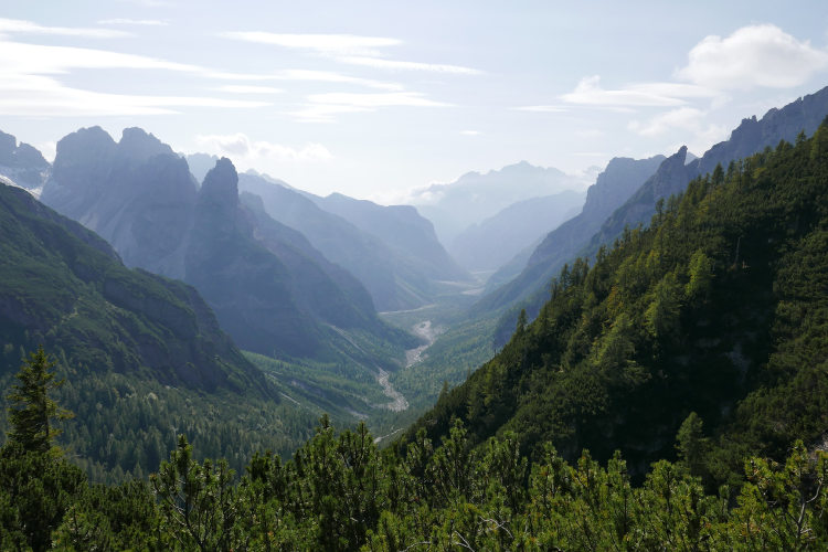
The itinerary starts in the central part of the Friuli Dolomites. On the very first hiking day you will find yourself deep in the mountains, where there is even no mobile phone reception. Departing from a fairly wide ravine, you will hike to the best-known landmark of the Friuli Dolomites – Campanile di Val Montanaia, a 240-meter-high natural formation resembling a bell tower. On your way further, the terrain will be changing several times a day. You will ascend to local peaks such as Monte Ferrara, from where the view takes in the entire region with the mountains stretching to the horizon. You will descend into forests full of sounds and aromas, climb open passes, and go around impassable chains of peaks on silent grassy slopes.
Frequent natural contrasts make hiking along this route particularly fascinating. In addition to the daily changing terrains and views, the route gradually takes you away from the area of the sharply rising peaks of the Pramaggiore, Monfalconi and Cridola into more open landscapes. The last two days of the trek will take you along the slopes of the opposite standing Tiarfin Massif, which is part of the Carnic Alps, a mountain system with a completely different geological structure than the Dolomites. From the open western slopes of Tiarfin, you can enjoy breathtaking panoramas of the Friuli Dolomites from a short distance, and at the end of the route you will descend to Forni di Sopra.
This itineary is designed for hikers with a fairly good level of fitness and preferably with some hiking experience. You will enjoy this trek if you are comfortable hiking for about 5-6 hours on mostly, but not always, well-trodden trails with a daily elevation gain of about 1000 meters.
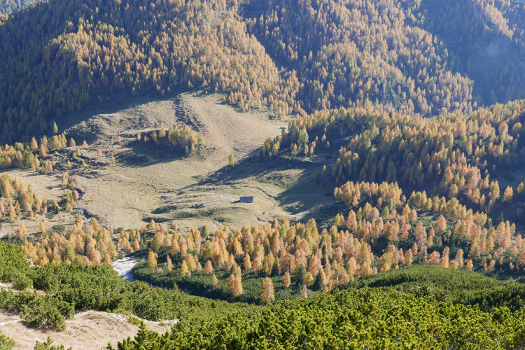
Along the route, you will stay overnight in traditional alpine mountain huts and “Casera” refuges. A Casera refuge is a small mountain hut in a building that was originally built as a dairy farm and then reconstructed. Such Casera are managed in the same way as mountain huts and offer the same services – comfortable beds, hot shower, breakfast and dinner. They are small in size and only rarely have space for more than 20 guests. Casera are cozy and generally more comfortable than traditional mountain huts, given their recent reconstruction and refurbishment.
The tour offers multiple route options varying in length. The main itinerary requires 5 full hiking days and allows you to explore the Friuli Dolomites at a normal hiking pace. We organize this tour as a private guided trek or as a self-guided trek. If you choose the private guided format, you will be accompanied by a professional, knowledgeable local mountain guide. On a self-guided trek, you will follow a pre-planned itinerary with overnight stops at pre-determined mountain huts.
The route is accessible from mid-June to mid-September, depending on weather conditions and the opening period of the mountain huts. We recommend planning this trek in advance, given the very limited capacity of the mountain huts along the route.
StyleHut to Hut Hiking
DifficultyLevel 3![]()
Activity4 - 5 hiking days![]()
Tour Duration6 - 7 days / 5 - 6 nights
Start / FinishLongarone / Forni di Sopra
Validity of prices: Summer 2026. The prices are subject to change without notice.
Private guided tour: the price is based on a minimum of 4 participants.
Private guided and self-guided tours are private tours on the dates of your choice.
See tab Prices for minimum and maximum group size, included services, single supplements and other details.
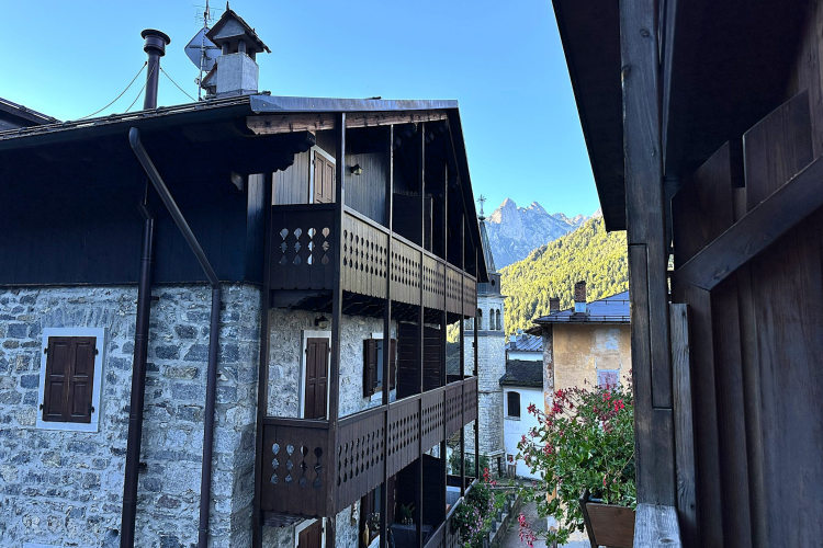
Day 1: Arrival in LongaroneToday, you arrive on your own in Longarone and check in at the base camp hotel. Longarone is a small town in the south-east of the Dolomites, logistically connected to the Venice region. It is one of the convenient gateways to the Dolomites. Little known today, Longarone was one of the towns destroyed by the Vajont dam disaster in 1963 and subsequently rebuilt. Upon arrival in Longarone, the rest of the day is free to rest, take time to study your route on maps, and prepare for the days ahead. |
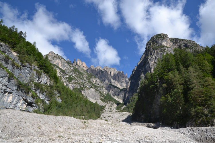
Day 2: Campanile di Val MontanaiaAscent 900 m. Descent 900 m. Altitude 1170 - 2060 m. Distance 6 km. Walking time 5 hours. The trip begins with a transfer deep into the mountains along the access road to the Rifugio Pordenone mountain hut. It is in one of the most remote areas of the Friuli Dolomites where you will not even have mobile phone coverage, and it is the ideal starting point for hikes to two of the region’s iconic landmarks – Campanile di Val Montanaia and Monte Ferrara. Given the distances, each of them requires a separate day. We recommend a hike to Campanile di Val Montanaia first. You can hike along this route light, leaving your backpack at the mountain hut. For the most part, the trail passes through a forest belt. As you ascend, the mixed forest quickly gives way to coniferous forests, dominated by larch. When you approach the “Campanile”, you find yourself on a stable scree covered with sparse dwarf pine. Closer to the base of the “Campanile” the rocky terrain gradually gives way to a green expanse in a stunning alpine amphitheater. Campanile di Val Montanaia is a uniquely shaped formation, which stands out sharply against the background of the surrounding landscape. Formed by erosion, this spire rises elegantly to a height of approximately 240 meters. In Italian, it is called “Campanile” (Bell Tower) for its characteristic shape. Another common name for it is "Stone Scream". It was first climbed in 1902, and today it is a true symbol for climbers. The “Campanile” stands in an alpine basin, and next to it there is a shelter – a good place for rest and to observe climbers. If you hear a bell ringing, it is the climbers who have reached the top and are ringing the summit bell. |
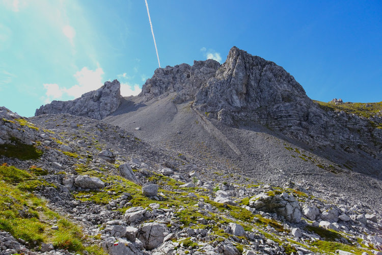
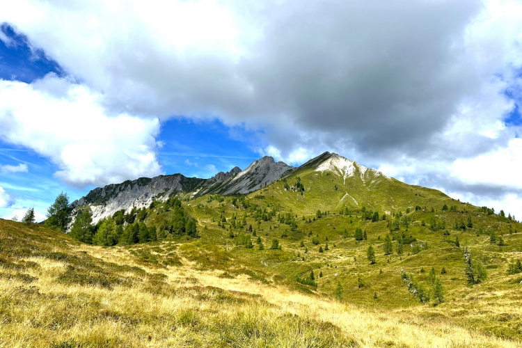
Day 3: Monte FerraraAscent 1090 m. Descent 1090 m. Altitude 1180 - 2260 m. Distance 12 km. Walking time 6-7 hours. Today it is time to reach the second landmark of the central Friuli Dolomites: Monte Ferrara. This mountain is 2258 meters high, and it is not the highest one in the area, but it offers a vast and exceptionally picturesque panorama of the Friuli Dolomites. At the same time, it is relatively easily accessible unlike most mountain tops in the Friuli Dolomites. Monte Ferrara is a natural observation deck with a panorama stretching across the Dolomites, Carnic Alps and Julian Alps. On a clear day, even the glaciers on the ridges of the Italian-Austrian border are visible from the summit. You will approach Monte Ferrara on a panoramic trail, where you will almost certainly not meet a single person for the entire day. The first stretch of the hike winds through the forest until a saddle at 1920 meters, beyond which you turn onto a trail to Monte Ferrara that most people do not know about. As you climb up from the saddle, you will emerge from the sparse larch trees into open terrain. The grassy slopes of Monte Ferrara offer an easy climb to the summit, from which you can see the entire chain of peaks of the Spalti di Toro as well as the Campanile di Val Montanaia that you reached the day before. |
Day 4: Truoi dai Sclops TrailAscent 830 m. Descent 670 m. Altitude 1170 - 1990 m. Distance 11 km. Walking time 5 hours. The route continues along one of the most scenic and little-traveled trails in the region: the Truoi dai Sclops. In the local Forni dialect, its name means "Path of the Gentianellas" and refers to the Gentiana Froelichii (Blue Gentian), an endemic plant found only in the southeastern Alps. This blue flower blooms abundantly along the route. The trail begins in Val Meluzzo, in a wide, flat ravine covered with sparse birch forest and resembling a transitional ecotone between taiga and tundra rather than an alpine forest. As the trail climbs, the landscape becomes more varied, and views of the Pramaggiore ridge and the peaks of Monfalcone di Forni open up. The area through which Truoi dai Sclops passes is an example of the rich geological diversity and biodiversity of the Dolomiti Friulane Nature Park. Truoi dai Sclops runs for a long time at an altitude of 1800 - 1900 meters along the sunny southern slope. The vegetation here is represented by groups of dwarf pine with rare larch trees and a wide variety of flowers including Blue Gentians. You will climb this slope to the pass, cross to the northern side of the ridge and, descending into the larch forest, reach the mountain hut. |
Day 5: Alta Via of SilenceAscent 920 m. Descent 620 m. Altitude 1300 - 1820 m. Distance 17 km. Walking time 6h30. Today, you will hike a long section of Alta Via No. 6 of the Dolomites, also known as the "Alta Via of Silence". The name perfectly describes the spirit of this route – this is a hike through remote, quiet and untouched landscapes, where solitude and nature still prevail. Leaving the hut, you leave behind the rugged Dolomitic environment to enter the idyllic yet equally wild southern side of the Carnic Alps. With gentle ups and downs, you cross the gravel slopes of Monte Cridola, immersed in a wild and silent mountain setting, surrounded by forests. As you walk toward Passo della Mauria, you descend to the forest belt and continue your hike in the vibrant atmosphere of a dense coniferous forest, rich in aromas and sounds. The forest trail ends with a climb to Casera Lavazeit where the scenery opens dramatically. You will continue along a natural balcony with views of the Tagliamento Valley and the Carnic Alps. This is a remarkable panoramic trail with wide and endless views. In clear days, you can even spot the impressive Tre Cime di Lavaredo in the distance. This trail runs through high meadows all the way to the mountain hut. |
Day 6: Monte TiarfinAscent 620 m. Descent 1410 m. Altitude 890 - 2310 m. Distance 12 km. Walking time 5h30. The final hiking day offers a section of the historic Via delle Malghe route, known in the local Fornese dialect as Truoi da las mons – the "Mountain Farm Route”. This scenic trail, over 20 km long, connects several dairy farms scattered along the slopes of Forni di Sopra. It was once used by local shepherds and farmers, who took their herds to the high-altitude pastures during the warmer months. The trail goes around the northern slope of Monte Tiarfin, the dominant mountain of the area. Leaving Casera Tartoi, you will ascend through a rocky area called the Agons di Tiarfin and reach a saddle at 2300 meters. Here, you will be rewarded with a 360-degree panorama with the Belluno Dolomites, Carnic Alps, Austrian glaciers in the north, and the Julian Alps stretching into neighboring Slovenia. The locals call this area “Agons”. This word of Friulian or Latin origin refers to sharp peaks, typical of the Dolomite skyline. From Agons a long descent begins, first steep to Casera Tragonia and then gentle into the valley. Beyond Casera Tragonia descent continues through dense forests until the trail leads you to the town of Forni di Sopra where your trek ends. |
Day 7: Departure from Forni di SopraIt is the final day of the trip, the departure day. If you have time in the morning, it is worth taking a short stroll around Forni di Sopra. The name "Forni di Sopra" refers to the geographical location of the town. "Forni" in Friuli is used to describe a small valley, while "Sopra" refers to its position above the valley below. Forni di Sopra is a quiet and absolutely non-touristy town despite being one of the nearest base camp locations for exploring the Friuli Dolomites. |
This is a route with a shortened stage in the central Friuli Dolomites This shortened version of the tour will only allow you to hike to one of the landmarks of the central Friuli Dolomites – Campanile di Val Montanaia or Monte Ferrara. You will spend one day in the area, but reaching both spots on the same day is too difficult, as they are located in diametrically opposite directions from the mountain hut. With this tour option, on Day 2 you will be in the central Dolomites and hike to Campanile di Val Montanaia or Monte Ferrara on your choice. Then, starting from Day 4, you will continue the trek as described in the main itinerary. |
Validity of prices: Summer 2026.
The prices are per person and include the VAT tax.
The prices are subject to change without notice.
Private guided and self-guided treks are private tours on the dates of your choice.
The indicated tour duration includes the days of arrival and departure. Hotel accommodation on the day of arrival and night before departure is included in the price.
Self-guided tour. Supplement for trips for solo hikers:
6 Day Self Guided Tour | Solo supplement € 170
7 Day Self Guided Tour | Solo supplement € 170
Private guided tours are only open to your group. The price listed on the tour page is for groups of 4 members. You can set a larger or a smaller group – please contact us for a price.
Validity of prices: Summer 2027.
The prices are per person and include the VAT tax.
The prices are subject to change without notice.
Private guided and self-guided treks are private tours on the dates of your choice.
The indicated tour duration includes the days of arrival and departure. Hotel accommodation on the day of arrival and night before departure is included in the price.
Self-guided tour. Supplement for trips for solo hikers:
6 Day Self Guided Tour | Solo supplement € 170
7 Day Self Guided Tour | Solo supplement € 170
Private guided tours are only open to your group. The price listed on the tour page is for groups of 4 members. You can set a larger or a smaller group – please contact us for a price.
Proper hiking boots are a must for the mountains. We recommend high boots because they support the ankle better than any low boots and provide better stability on a rocky terrain. Even in the middle of the summer in the Dolomites you must bring some warm clothes with you: waterproof and windproof jacket, fleece jacket, long trekking pants and a cap. A raincoat, poncho or other type of rainwear is necessary. Other necessary items are the toiletries, light clean footwear to use in the huts, sunglasses and at least 2 one-liter bottles for water. Your trip documents will include a detailed packing list specifically prepared for your itinerary. We kindly ask everyone to read it carefully and be properly prepared for the hiking trip.
Lunch. The route runs through the wilderness with no huts on the way to stop for lunch. There is a possibility of a packed lunch that you can order in the hut where you stay overnight. A typical packed lunch includes 1 or 2 sandwiches, yoghurt, chocolate bar, water, and it normally costs € 10 - 15.
In hut-to-hut hiking tours you are served a breakfast and a dinner in the huts and mountain hotels on the route.
Normally, the breakfast is served from 7am to 9am. It usually includes an unlimited quantity of coffee and tea, bread, butter, jam, honey and chocolate spread. In addition, some huts offer ham, cheese and muesli for breakfast. After breakfast we recommend filling your thermos with hot water or tea: ask the staff, and it will be for free in most huts.
The dinner time in the mountain huts is 7pm or 7:30pm for all guests. A typical dinner in a hut is very rich and includes a starter, the first course (such as pasta, risotto, dumplings), the second course (meat with a side dish) and a dessert. Any drinks at dinner (water, wine, beer, tea, coffee) are not free and should be ordered and paid separately.
Our guided hiking tours are led by professional guides, each with years of guiding and wilderness experience and with passion for mountains. They permanently work in the region of the exact hiking tour, have professional licenses, are experts in emergency situations, regularly upgrade their qualifications and work in accordance with national regulations.
For self-guided hiking, it is necessary to be properly dressed, follow the safety rules and make realistic time calculation for day crossings – preferably according to the hiking schedule that we provide. Our self-guided hiking trips are planned so that they do not require specific skills or gear, unless it is clearly specified in the tour description. You can expect well-maintained trails equipped with direction signs. Exposed sections of the trail are secured on the self-guided routes: it makes them safe provided that you follow the basic safety rules for hiking in the mountains.
Mountains are a natural environment with a high level of risk, so we insistently ask all participants to read the safety rules and emergency procedures: Safety Considerations. If you have questions about the safety rules, please contact us +39 0463 63 60 80.
Insurance. It is important to have an appropriate insurance that covers the hiking activity. You don't need to include the climbing activity in your insurance, unless you are planning to climb during the hike.
Visa. We will provide you with a booking confirmation for all days of your trip. If you need the Italian visa, you can enclose this document with your visa application.
The most stable weather conditions in the Dolomites are statistically from the second week of July till the middle of September. This period in the Dolomites is characterized by warm sunny weather and modest rainfall. Earlier in June, the weather is normally favorable, but it is less reliable, and the mountain passes may be blocked by snow remaining from the winter. In June we may have to change the route depending on the snow situation on the passes. The second half of September in Dolomites is a beautiful period, but the weather is again less predictable: the probability of incessant rain increases, and it may snow at the altitude above 2,000 meters.
It is never hot in the Dolomites at the elevation of 2,000 m (6,560 ft) and above where most of the hiking routes pass. In a sunny day in August the temperature at 2,000 m can reach 20° C (68° F) suring the warmest hours of the day. It is comfortable for hiking. In a cold cloudy day, the temperature can stay at around 10° C (34° F) during the entire the day. It is always chilly at night and early in the morning. Thunderstorms, often with hail, are typical for the warmest months (July and August). In the Dolomites valleys at the altitudes of 1,000 – 1,500 m (3,280 – 4,920 ft) the day temperature can reach 27° C (80° F). It is fresh in the valleys in the morning and evening, and it is not stuffy at night even in the hottest weeks of the summer.