





Home/Dolomites Hiking Tours/Fassa Dolomites
Hike the most exciting part of Alta Via N.2
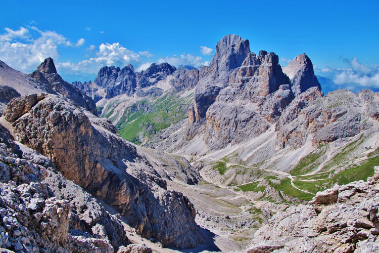
Explore the unique lunar landscape of Sella Group with out-of-this-world views
Sleep in comfortable huts with a possibility of private rooms and enjoy good meals
Walk through all kinds of mountain landscapes
Enjoy good potential to see alpine ibex in the wilderness of the Monzoni range
Hike deep into Antermoia - Rosengarten to see the stunning view of the Vajolet Towers
The Fassa Dolomites trek is one of the most famous classic hiking routes at the heart of the Dolomite Alps. The itinerary runs through mountain chains that have in many ways defined the Dolomites. It takes you on a week-long trek across six ranges of the Dolomites that encircle the Val di Fassa valley: the Monzoni, Marmolada, Sella, Sassolungo (Langkofel), Antermoia and Rosengarten.
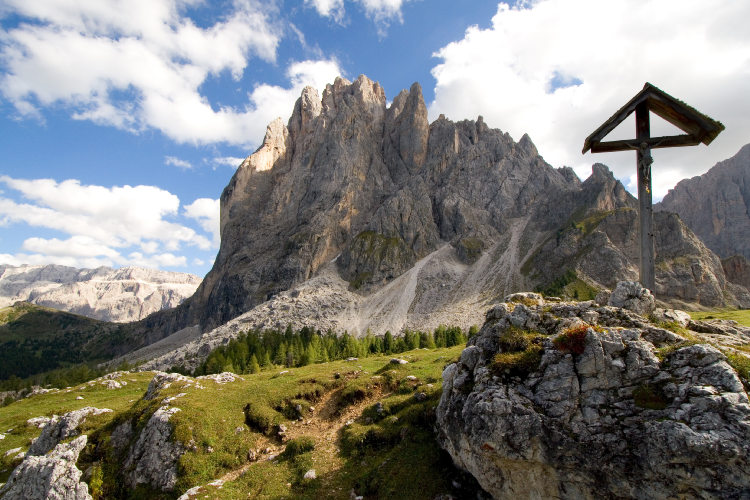
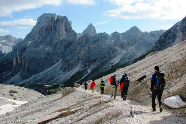
The trail mostly runs at elevations of 2,000 to 2,600 m through. You will walk through all kinds of mountain landscapes ranging from warm Alpine meadows in the tableland to harsh high-altitude regions of the Sella Group where the trail climbs to above 3,000 m. You will go up and down panoramic mountain ridges, admire the lunar landscape of the Sella Group, and venture into the lost world of the Antermoia massif.
You will overnight at serviced mountain huts offering traditional Alpine meals and equipped with hot showers. Most huts along this route are set in truly spectacular locations. Overall, the huts around Val di Fassa are considered among the best in the Alps.
This itinerary is available as a private guided or self-guided hiking trip. On a guided tour, you will be led by a local English-speaking mountain guide. On a self-guided tour, you can pace yourself and pursue your own interests according to a hiking schedule developed by MONT Trekking mountain guides. While no specific training is required for this hiking trip, a good physical shape is a must.
StyleHut to Hut Hiking
Tour Duration6 - 10 days / 5 - 9 nights
Start / FinishVal di Fassa
Validity of prices: Summer 2026.
Private guided tour: the price is based on a minimum of 4 participants.
Private guided and self-guided tours are private tours on the dates of your choice.
See tab Prices for minimum and maximum group size, included services, single supplements and other details.
Day 1: Val di FassaYou arrive on your own in Val di Fassa and check in at one of our basecamp hotels. The hotels are located in the lower half of the valley in the towns of Vigo, Pozza and Pera. At check in you collect the materials that we prepared for your hike. They include a specialized hiking map of the region 1:25000 and hiking schedule. |
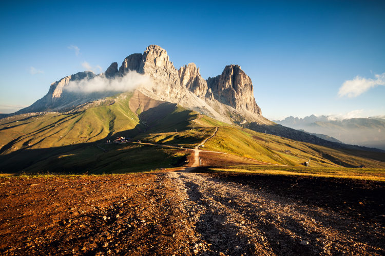
Day 2: Monzoni GroupAscent 790 m. Descent 680 m. Altitude 1920 - 2680 m. Distance 10 km. Walking time 5 hours. The main Fassa Dolomites itinerary starts at the Passo San Pellegrino pass at an elevation of 1,920 m, thus the day begins with a transfer from the hotel to the pass. The trail takes you up the slopes of the Monzoni Group – the first mountain chain of the Dolomites on your itinerary. The day before you could see the whitish peaks of the Monzoni from the valley down below, standing tall in stark contrast against the night sky, especially on a moonlit night. The trail skirting the southern slopes of the Monzoni gets very little foot traffic and thus offers a good chance of sighting the Alpine ibex here. They are not fearful of hikers and can “pose” for cameras for long periods of time. As you descend to the mountain hut in the Contrin valley, a stunning panoramic view of the Sassolungo Group – your destination two days away – opens up in all of its splendor. |
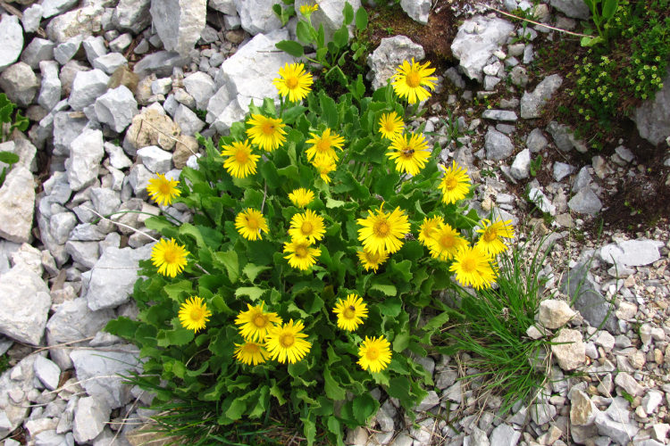
Day 3: At the Foot of MarmoladaAscent 1190 m. Descent 1180 m. Altitude 1490 - 2510 m. Distance 18 km. Walking time 7 hours. Today's itinerary takes you across several mountain passes and ends at Fedaia Lake at the end of the day. You bypass the untrekkable portion of the Marmolada Group over ridges in the east of the Monzoni. Here you descend into the grassy hollow of the Ciampac – a natural amphitheater of rare beauty with a magnificent view of the Sella Group across blooming Alpine meadows. The landscape changes abruptly in the latter half of the day as you embark on an easy albeit lengthy ascent up a scenic trail leading to the Fedaia Pass. Pilgrims had been using this trail since time out of mind as the main route to the Fassa Valley from the south. It runs mostly through forestland over the slope of a wide gorge at the foot of the Marmolada. The largest glacier of the Dolomite Alps has lasted to this day on the northern slopes of the Marmolada Group. It is feeding countless mountain streams that resoundingly course down the gorge slopes, creating a pleasant freshness along your path. |
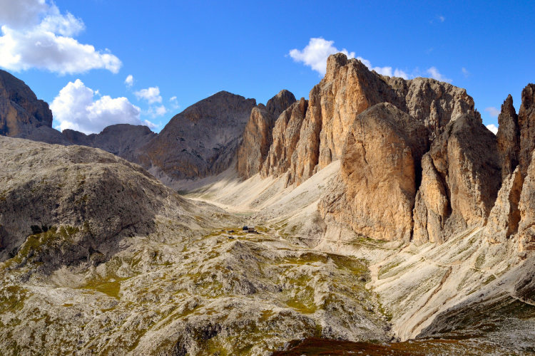
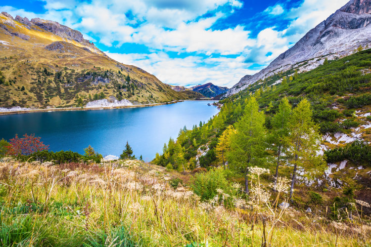
Day 4: Sella GroupAscent 1250 m. Descent 740 m. Altitude 2050 - 2680 m. Distance 12 km. Walking time 6 hours. Today you are headed to the Sella mountain group – a petrified coral atoll that had formed in a prehistoric ocean. The panoramic trail toward the Sella Group is known as the “Road of Merchants” – used by merchants and traveling salesmen on their way between the Fassa Valley and the Livinallongo Valley in the olden days. The trail runs over exposed slopes and the ridge of the mountain chain, offering a stunning view of the Marmolada glacier on the opposite side and the still azure waters of Fedaia Lake at the foot of the massif. Next to welcome you is the Sella Group – a grand mountain range with kilometer-high outer cliffs and just a few narrow gorges leading to the top. The Sella Group is famous for the lunar landscape of its highland regions. It is a highly dissected, rugged plateau at elevations of close to 3,000 m – a lifeless and truly otherworldly landscape that never fails to create a strong impression. |
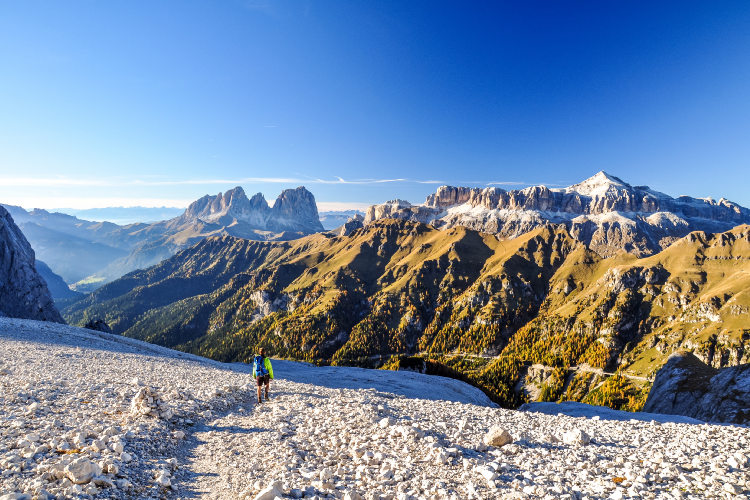
Day 5: Piz Boe SummitAscent 900 m. Descent 1220 m. Altitude 1850 - 3150 m. Distance 12 km. Walking time 7 hours. The route today is quite challenging but well worth the effort. In good weather conditions you can reach the Sella’s summit – the 3,152 meter-high Piz Boe. At the beginning of the day, do not miss the sunrise. The location of the hut on Sella is truly spectacular – it offers a fantastic panorama with several ranges of the Dolomites well visible at a short distance. On the way to Piz Boe you walk through the unique out-of-this-world lunar landscape of the Sella Group. It is a lifeless plateau with the elevations primarily between 2,500 and 2,900 m – very similar to what we see on the images from other planets. The descent from Sella is through a beautiful narrow gorge with the 1,000 meter-high vertical walls. You end the today’s trek at the foot of the Sassolungo group from where you can see another famous Dolomites sunset. |
Day 6: Sassolungo GroupAscent 870 m. Descent 780 m. Altitude 1970 - 2300 m. Distance 10 km. Walking time 6 hours. After two days of lengthy treks, today offers a chance to take it easy on a more relaxed leg of the hike. The itinerary skirts the Dolomite range of Sassolungo or Langkofel – a name that literally means “Long Rock”. Sassolungo is a compact mountain group that stands apart from the other massifs in the region, towering above the sloping Alpine meadows around it. Today's itinerary can be covered in one of two ways: by circumventing the entire Sassolungo or by going around only the south portion of this range and crossing it via the only trail that ascends to 2,700 m. The first option offers a chance to see all the mountain chains around the massif, the Gardena Valley, and the scenic Alpe di Siusi plateau. The second option is equally or even more impressive, taking you through a narrow gorge that bisects the massif at an elevation of close to 2,700 m. |
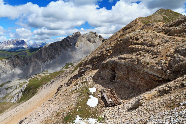
Day 7: Lost World of AntermoiaAscent 930 m. Descent 1290 m. Altitude 1950 - 2770 m. Distance 16 km. Walking time 7 hours. The Antermoia Group is a vast high-altitude region with next to no vegetation, featuring a high density of chaotically scattered peaks separated by just a few passable gorges. Antermoia offers some of relatively little-traveled trails, with no roads or chair lifts in the vicinity – a true escape from civilization, the mountain huts its only reminder. Here the trail ascends through the bottom of a glacier-polished eastern gorge where a scenic cold Lake Antermoia is perched at an elevation of 2,495 m. Yellowish cliffs towering 400 meters above the still waters of the lake form the backdrop for what is arguably one of the most dazzling locations along the entire itinerary. |
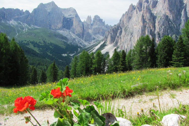
Day 8: Rosengarten RangeAscent 810 m. Descent 780 m. Altitude 1620 - 2550 m. Distance 10 km. Walking time 6 hours. Today's itinerary takes you from the wild, seldom-traveled gorges of the Antermoia Group to another Dolomite range – the Rosengarten. It is a petrified coral reef stretching for 10 km to the south. The Rosengarten is unique in that it has retained the almost intact shape of a coral reef, spared any major destruction over the past 230 million years. Here you will see one of the region's chief landmarks – the famous Torri di Vajolet group. It is a gigantic rock with a pinnacle split into several fragments to resemble the towers of a fairytale castle. The trail runs underneath the “towers” and ascends to the opposite slope that offers a more stunning view of Torri di Vajolet. Another magnificent landmark of today's itinerary is the panoramic “Sheepherders' Trail”. It runs over a ridge revealing a majestic panorama of the Rosengarten mountaintops, with talus slopes descending to the valley. At the end of the day, the itinerary brings you back to the now familiar hotel in Val di Fassa. |
Day 9: Val di FassaThe trip ends here. Most hikers remember the Fassa Dolomites for the unique lunar landscape of the Sella Group, colorful sunsets, exceptional diversity of landscapes and comfortable mountain huts in spectacular locations. |
A quick getaway with several route options including the Sella Group 6 Day Tour allows you to choose from several route options depending on which mountain groups you would like to explore. (A) The classic itinerary runs from Monzoni to Sella (days #2,3,4,5). You will stay overnight at 3 huts along the route, one of which will be in Sella. (B) Another route option we recommend is from Sella or Lake Fedaia to Rosengarten. On your first hiking day, you will cross Sella on a direct trail. The other 3 hiking days will be days #6,7,8 as in the description of the complete itinerary. Besides these two route options, there are other variants of the itinerary for 4 hiking days. We can design an easier route or harder route depending on your preferences. |
With 5 hiking days, you can reach most of the landmarks of the Fassa Dolomites There are two route options we recommend for the 7 Day Tour. (A) If you choose to explore all 6 mountain ranges of the Fassa Dolomites, we will shorten the legs in Sella and Sassolungo so that you can complete the trek in 5 hiking days. You will cross Sella on the shortest trail in 3 hours and hike through the slopes of Sassolungo on the direct southern trail (not around or across Sassolungo). Fast and very fit hikers can still hike across Sassolungo – the time permits it. (B) The second route option is from Monzoni to Sassolungo exactly the same as in the complete itinerary (hiking days #2,3,4,5,6). You final hiking day will be 1 hour longer because you will need to descend to the valley. Possibility of specific itinerary depends on the availability at huts. |
The 2025 itinerary for groups runs from Monzoni to Sassolungo The itinerary we planned for our groups in 2025 covers the first 3/4 of the complete classical Fassa trek, described day by day above. You will start at Passo San Pellegrino and hike across Monzoni and around the western edge of Marmolada to reach the Fedaia pass and lake. From Fedaia, you will head to Sella Group where you will stay overnight in a hut on the eastern tip of Sella at 2550 meters of altitude. Here you can enjoy one of the most impressive evening views of the Dolomites. You will reach Piz Boè, the Sella’s summit, on your 4th hiking day and cross the lunar landscape of the Sella plateau at altitudes of 2700 – 2900 m. Continuing beyond Sella, you will reach the Sassolungo group and, together with your guide, you will decide whether to cross it or go around it before descending into Val di Fassa. The route runs along trails of varying difficulty and passes through a wide variety of landscapes. You will be accompanied by a local UIAGM mountain guide, who has excellent knowledge of this route and the Dolomites in general, and speaks English. |
The classic “Trekking of the Legends” route The 8 Day Tours covers all six mountain ranges of the Fassa Dolomites but does not go into the Sella group as far as the complete 9 Day itinerary. Instead, it crosses Sella in its western part in 3 hours before descending toward Passo Sella. This itinerary is known as the “Trekking of the Legends” hiking route. It starts at the Passo San Pellegrino pass and goes through the entire chain of the dolomite ranges around Val di Fassa. This itinerary ends, depending on your choice, either at the Karerpass nearby the southern extremity of the Rosengarten range or in Val di Fassa. This is a normal Level 3 itinerary. |
“Trekking of the Legends” and the Alpe Lusia range The longest 10 Day Tour adds a crossing of the Alpe Lusia range to the primary itinerary. This requires and extra hiking day which is the first day of this hike. Alpe Lusia is a chain between the Monzoni range and Pale di San Martino (Pala Group). The trail in Alpe Lusia runs next to the crest of the main ridge and offers breathtaking panoramas with the Dolomites of Val di Fassa and the neighboring Pale di San Martino. This is a trip with 8 full hiking days. |
Validity of prices: Summer 2026.
The prices are per person and include the VAT tax.
Private guided and self-guided treks are private tours on the dates of your choice.
The indicated tour duration includes the days of arrival and departure. Hotel accommodation on the day of arrival and night before departure is included in the price.
Self-guided tour. Supplement for trips for solo hikers:
6 Day Self Guided Tour | Solo supplement € 160
7 Day Self Guided Tour | Solo supplement € 160
8 Day Self Guided Tour | Solo supplement € 160
9 Day Self Guided Tour | Solo supplement € 160
10 Day Self Guided Tour | Solo supplement € 160
Private guided tours are only open to your group. The price listed on the tour page is for groups of 4 members. You can set a larger or a smaller group – please contact us for a price.
Verona is the closest airport to Val di Fassa. There are regular flights to Verona from the UK, Russia, Germany, Denmark, France and Poland. It takes around 4 hours to arrive by train and bus from the Verona airport to the Fassa valley.
Innsbruck is also a convenient airport, but not many airlines operate flights to Innsbruck.
Other possible airports are Venice, Bologna, Munich and Milan.
We can help you plan the route from the airport and provide you with train and bus schedules: please contact us before you book the flights.
Proper hiking boots are a must for the mountains. We recommend high boots because they support the ankle better than any low boots and provide better stability on a rocky terrain. Even in the middle of the summer in the Dolomites you must bring some warm clothes with you: waterproof and windproof jacket, fleece jacket, long trekking pants and a cap. A raincoat, poncho or other type of rainwear is necessary. Other necessary items are the toiletries, light clean footwear to use in the huts, sunglasses and at least 2 one-liter bottles for water. Your trip documents will include a detailed packing list specifically prepared for your itinerary. We kindly ask everyone to read it carefully and be properly prepared for the hiking trip.
The first and last nights of your trip are in one of our basecamp hotels. While hiking, you will stay overnight in the mountain huts. You can count on the following services in the mountain huts: a bed in a shared room or in a private room (must be booked in advance), shower with hot water, toilets, meals, and a possibility to buy take away water and snacks such as sandwiches and chocolate. Shared rooms are equipped with bunk beds with mattresses, pillows and blankets. Bed linen is not provided in shared bedrooms: you must have a sleeping bag liner with you. Typically, it is a light cotton bag. Warm sleeping bag is unnecessary, since there are blankets in the bedrooms. In private rooms you are often offered bed linen, thus a sleeping bag liner is not required. If you book private rooms, we inform you on whether you need to bring a sleeping bag liner. Most huts have a heating system, but it is normally not required in the summer months. You will need clean footwear for the huts: light slides are an ideal solution. For detailed information on the huts please read Mountain Huts in the Alps.
In hut-to-hut hiking tours you are served a breakfast and a dinner in the huts and mountain hotels on the route.
Normally, the breakfast is served from 7am to 9am. It usually includes an unlimited quantity of coffee and tea, bread, butter, jam, honey and chocolate spread. In addition, some huts offer ham, cheese and muesli for breakfast. After breakfast we recommend filling your thermos with hot water or tea: ask the staff, and it will be for free in most huts.
The dinner time in the mountain huts is 7pm or 7:30pm for all guests. A typical dinner in a hut is very rich and includes a starter, the first course (such as pasta, risotto, dumplings), the second course (meat with a side dish) and a dessert. Any drinks at dinner (water, wine, beer, tea, coffee) are not free and should be ordered and paid separately.
Lunch. It is possible to stop for lunch at the mountain huts on the route. The lunch menu in the huts is similar to the dinner one. Typically, there is a choice of pasta for 7 – 10 euros and main dishes for 9 – 16 euros.
Our guided hiking tours are led by professional guides, each with years of guiding and wilderness experience and with passion for mountains. They permanently work in the region of the exact hiking tour, have professional licenses, are experts in emergency situations, regularly upgrade their qualifications and work in accordance with national regulations.
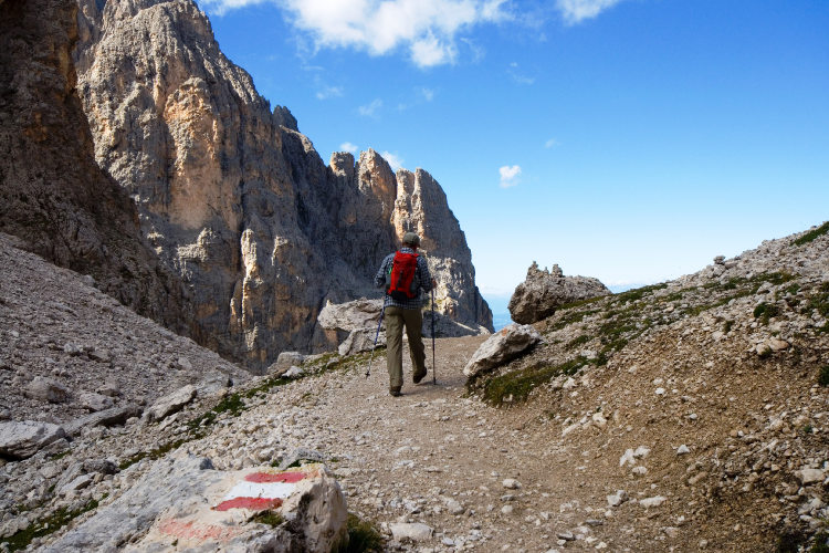
For self-guided hiking, it is necessary to be properly dressed, follow the safety rules and make realistic time calculation for day crossings – preferably according to the hiking schedule that we provide. Our self-guided hiking trips are planned so that they do not require specific skills or gear, unless it is clearly specified in the tour description. You can expect well-maintained trails equipped with direction signs. Exposed sections of the trail are secured on the self-guided routes: it makes them safe provided that you follow the basic safety rules for hiking in the mountains.
Mountains are a natural environment with a high level of risk, so we insistently ask all participants to read the safety rules and emergency procedures: Safety Considerations. If you have questions about the safety rules, please contact us +39 0463 63 60 80.
Insurance. It is important to have an appropriate insurance that covers the hiking activity. You don't need to include the climbing activity in your insurance, unless you are planning to climb during the hike.
Visa. We will provide you with a booking confirmation for all days of your trip. If you need the Italian visa, you can enclose this document with your visa application.
The most stable weather conditions in the Dolomites are statistically from the second week of July till the middle of September. This period in the Dolomites is characterized by warm sunny weather and modest rainfall. Earlier in June, the weather is normally favorable, but it is less reliable, and the mountain passes may be blocked by snow remaining from the winter. In June we may have to change the route depending on the snow situation on the passes. The second half of September in Dolomites is a beautiful period, but the weather is again less predictable: the probability of incessant rain increases, and it may snow at the altitude above 2,000 meters.
It is never hot in the Dolomites at the elevation of 2,000 m (6,560 ft) and above where most of the hiking routes pass. In a sunny day in August the temperature at 2,000 m can reach 20° C (68° F) suring the warmest hours of the day. It is comfortable for hiking. In a cold cloudy day, the temperature can stay at around 10° C (34° F) during the entire the day. It is always chilly at night and early in the morning. Thunderstorms, often with hail, are typical for the warmest months (July and August). In the Dolomites valleys at the altitudes of 1,000 – 1,500 m (3,280 – 4,920 ft) the day temperature can reach 27° C (80° F). It is fresh in the valleys in the morning and evening, and it is not stuffy at night even in the hottest weeks of the summer.