
Guaranteed Group Departures 2026

Hiking trips without a guide and a group with overnight stays in mountain huts
Hiking trips with scheduled group departures – local mountain guides and groups of 6 to 8 members
Individually planned private hiking trips on the dates of your choice
Guided custom day hikes and excursions
All Dolomites, including Tre Cime, Lagazuoi, Cinque Torri, Sella, Marmolada, Cortina d'Ampezzo and more
Pennine Alps, Graian Alps including Gran Paradiso, and Aiguilles Rouges
Stelvio National Park, Ortler, Cevedale, Adamello, Bernina, Texel
Ranges of northern Garda, Monte Baldo, lake Ledro, Monte Bondone
Home/Dolomites Hiking Tours/Seiser Alm - Rosengarten
Extraordinary diversity of the landscape and flora
Moderate distances between the huts requiring an average of 5 hours of net hiking time
Huts in picturesque locations with varied scenery
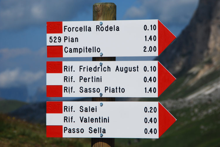
Possibility of adding a day hike to Seceda Spires from Val Gardena
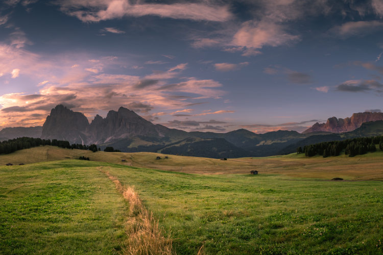
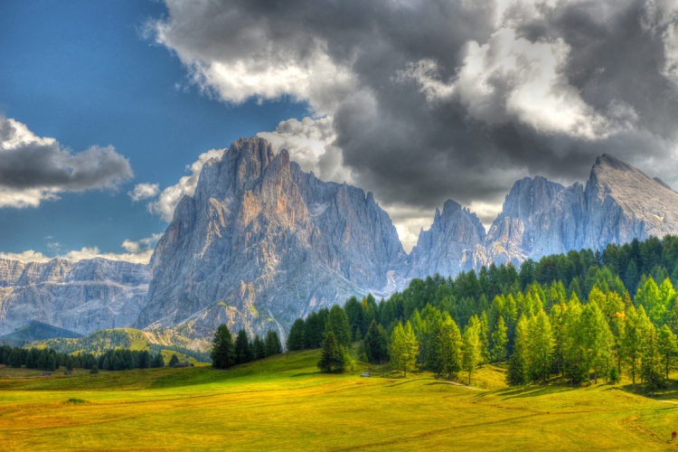
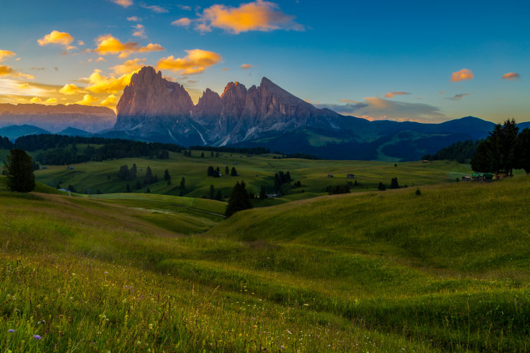
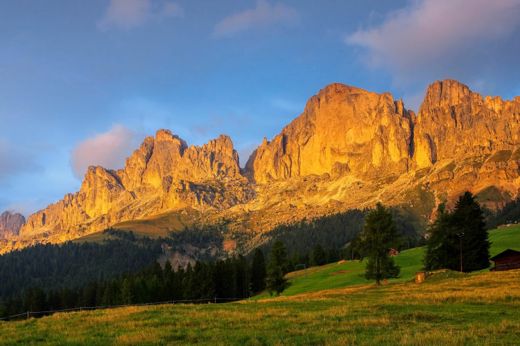
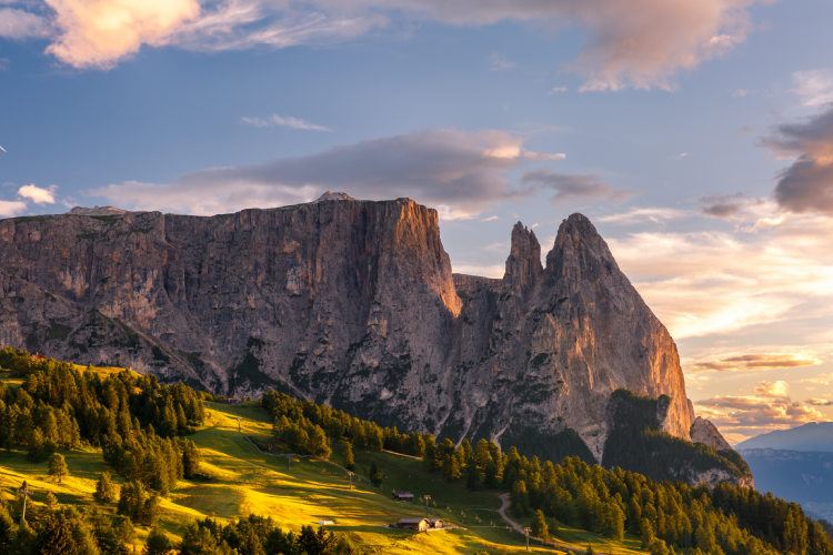
Enjoy the vibrant colors of the Rosengarten at sunset
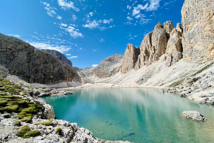
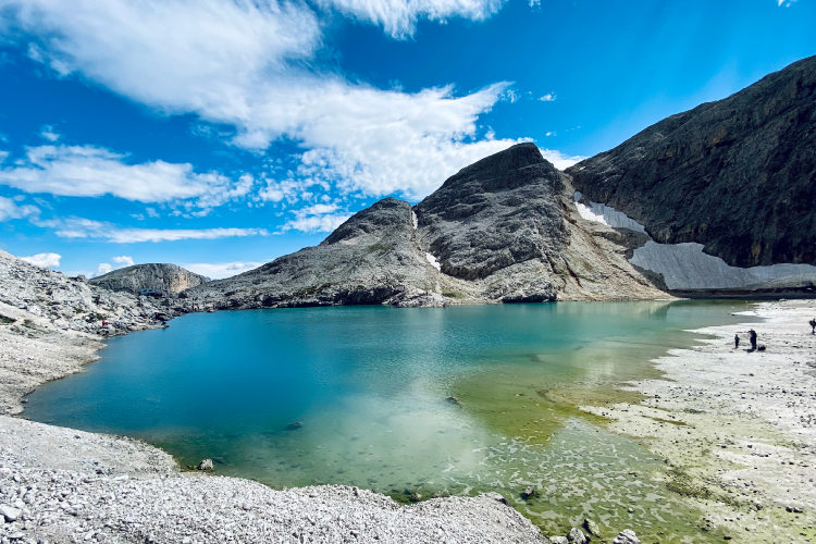
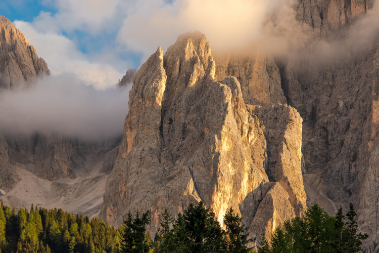
Exceptional diversity of the landscape and flora makes this itinerary so unique. In the Dolomites, it is rarely possible to plan a moderately difficult hut-to-hut hiking route covering all altitudinal zones. On your route from Seiser Alm to Rosengarten, you will hike through several distinct vegetation zones including coniferous forests, meadows, alpine tundra and lifeless rocky terrain at the nival level. Most high-altitude regions in the Dolomites are difficult to access. This itinerary, however, allows you to reach Antermoia on a normal hiking trail. The highest subgroup of Rosengarten, Antermoia features one of the most impressive lunar landscapes of the Dolomites with vertical limestone walls dating back to the Triassic period, younger moraine deposits and a lake of indescribable beauty.
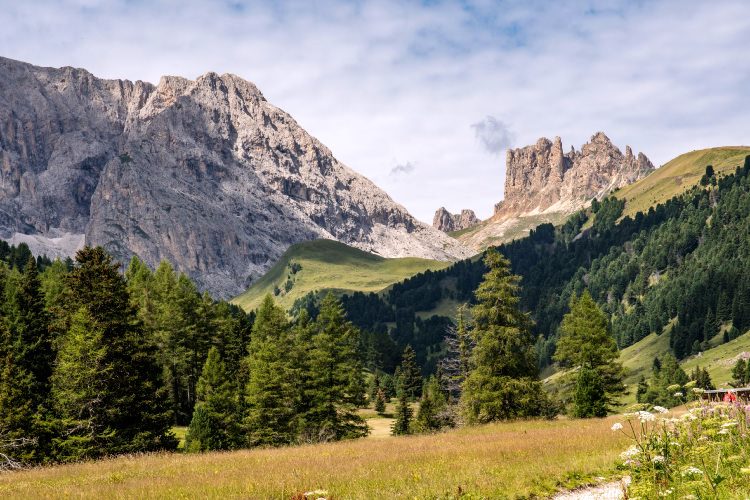
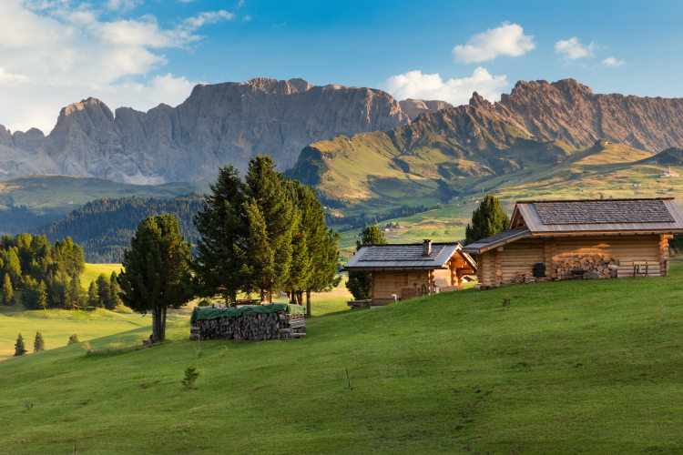
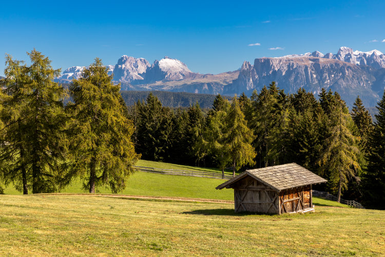
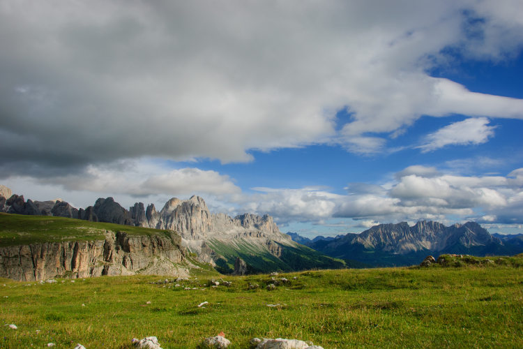
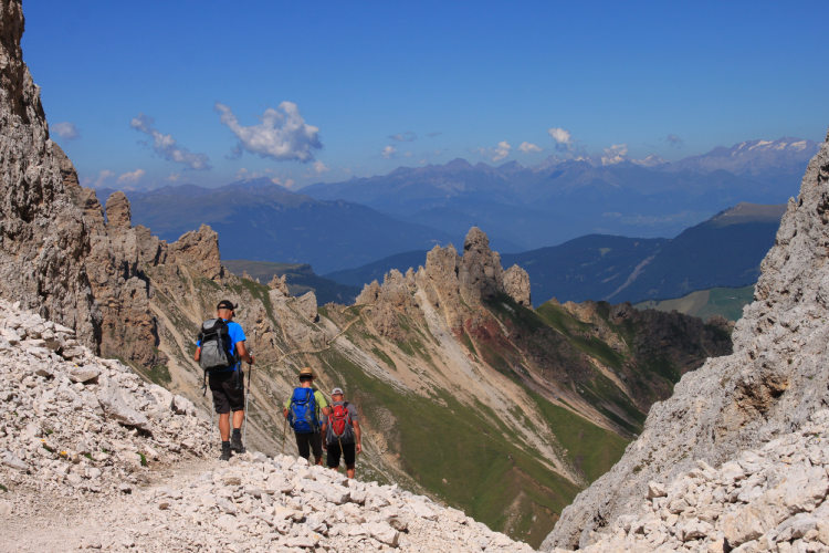
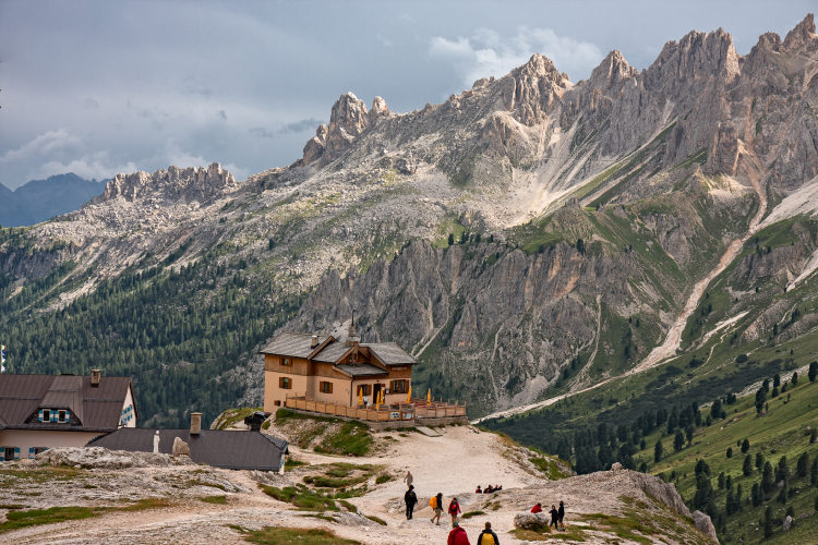
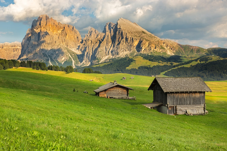
Most of the itinerary runs in the Schlern-Rosengarten Nature Park, the oldest in South Tyrol. Its emblem mountain is Schlern with the Santner Spitze tower, which is also the symbol of South Tyrol. You will start hiking on Seiser Alm, a vast plateau lying at an average altitude of 2000 meters covered with alpine meadows. The trail through Seiser Alm offers excellent views on Schlern that you will reach in the afternoon on your first hiking day. During the following two days, you will again be hiking across diverse landscapes as you descend from Schlern and head toward the Langkofel group. In Langkofel, there are two route options to choose from - the lower trail around Langkofel and the high trail running across Langkofel on rocky terrain and splitting the group into two subgroups - Langkofel and Plattkofel. At the foot of Plattkofel, attentive hikers will notice unusual pines that have grown strong on large boulders with the help of massive branched roots. This is black pine, a relic representative of the local ecosystem. From Langkofel, you will hike deep into the Rosengarten group where you will reach the Passo d'Antermoia pass at 2770 meters, the highest point of your itinerary. In Rosengarten, avid hikers may wish to do a side hike to the Torri del Vajolet towers, another highlight of the Dolomites, which, however, can only be reached via a difficult trail.
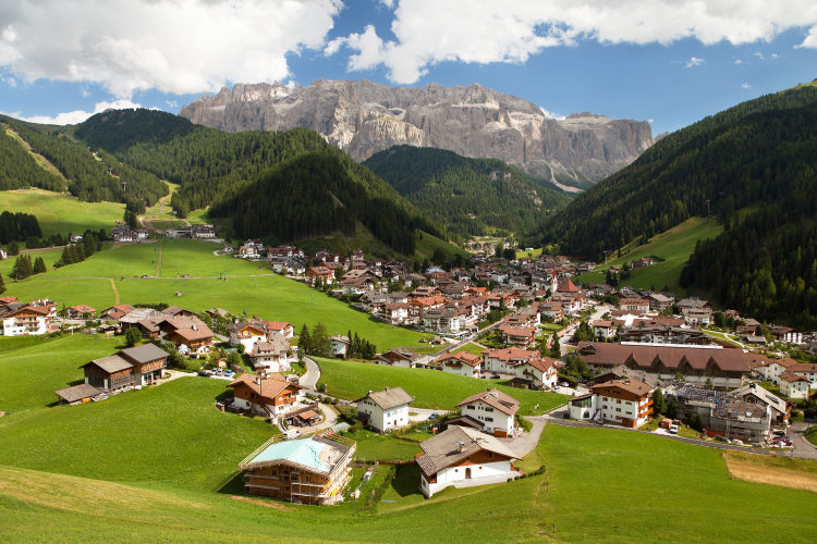
The base camp locations for this route are Val Gardena, where you will stay the night before the hike, and the Karerpass area, where the route ends.
For hikers willing to see the seceda Spires, a famous and truly impressive landmark of the Dolomites easily accessible from Val Gardena, it is possible to plan a day hike to Seceda before the hut-to-hut hike. It will extend your trip by 1 day, and you will stay an additional night in Val Gardena.
This is a Level 3 hut-to-hut itinerary running along normal hiking trails. It is suitable to anyone with a normal level of fitness and preferably with some hiking experience. You will be hiking 12 - 13 km a day, typically for 5 hours, excluding stops for lunch and for photography. There are optional side hikes for an hour or two, normally from the huts where you will stay overnight. You can choose between a self-guided and private guided hike.
Seiser Alm to Rosengarten is one of the best hut-to-hut itineraries for hikers preferring to explore the mountains without a hurry and to enjoy highly varied scenery. It is an excellent choice as a first hut-to-hut hiking experience in the Dolomites. Families with children and small groups with members of varying fitness level will be comfortable on this route as the slower hikers will still have enough time to complete the daytime treks without a hurry.
StyleHut to Hut Hiking
DifficultyLevel 3![]()
Activity3 - 5 hiking days![]()
Tour Duration5 - 7 days / 4 - 6 nights
Start / FinishVal Gardena / Karerpass, Carezza
Validity of prices: Summer 2026. The prices are subject to change without notice.
Private guided tour: the price is based on a minimum of 4 participants.
Private guided and self-guided tours are private tours on the dates of your choice.
See tab Prices for minimum and maximum group size, included services, single supplements and other details.
Day 1: Arrival in Val GardenaOn the first day, you arrive on your own in Val Gardena and check-in at one of our base camp hotels. We use hotels located in Ortisei, Selva and Santa Cristina. Having collected your trip package in the hotel, you can study the itinerary on the maps and enjoy the afternoon in Val Gardena. It is one of the most characteristic valleys of the Dolomites, historically inhabited by the Ladins, now a small ethnic group. The Ladins are, presumably, descendants of the Retes, who in pre-Roman times inhabited a significant area of the Alps. After the period of Romanization, followed by the movement of barbarian tribes from the north, the Ladins retained very small territories - primarily the most remote valleys, which at that time were not of interest to the conquerors. Today, these are the most picturesque valleys in the Dolomites. The Ladins have been able to preserve their language, culture and traditions over the centuries despite being surrounded by very influential cultures. This fact, combined with the splendid scenery, makes Val Gardena and the other Ladin valleys some of the main attractions of the Dolomites. Since the 1600s, Val Gardena has been famous for its woodcarving tradition. Walking through the streets of the resort towns and villages of Val Gardena, you will see many wooden sculptures and decorations. |
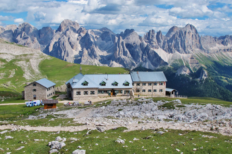
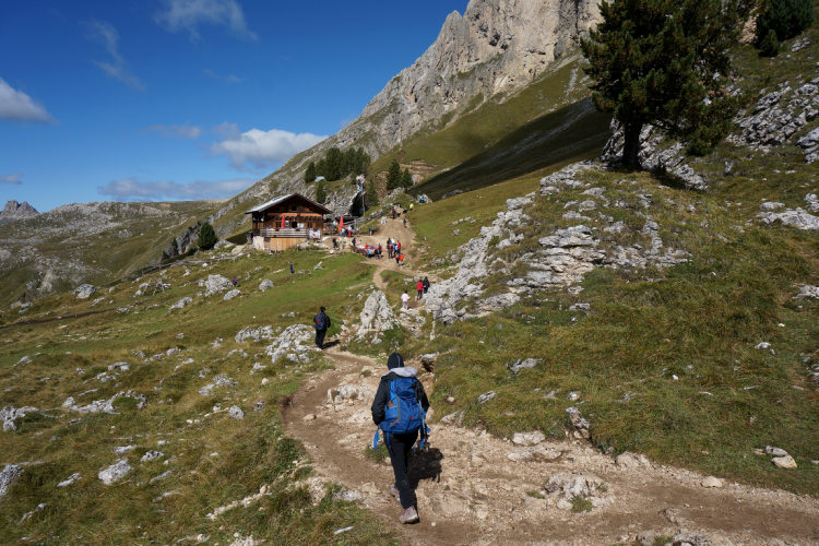
Day 2: Schlern MassifAscent 820 m. Descent 370 m. Altitude 1200 - 2450 m. Distance 13 km. Walking time 5 hours You will start the hike with a crossing of Alpe di Siusi or Seiser Alm, the Alps’ largest plateau. On the plateau at an altitude of 1700 to 2200 meters, the landscape is predominantly meadow with rare groups of pines, firs and larches. Seiser Alm was cleaned from forests hundreds of years ago and has been used as pastureland since then by the inhabitants of the villages at the foot of Seiser Alm. There are many tiny wooden chalets in the meadows. They are an important integral part of the landscape, not currently used for their main purpose, but carefully maintained. Several larger chalets are run as summer restaurants serving the local specialities. They are the right place to taste dumplings before you start ascending Schlern. It will take you 3 hours to cross the plateau and approach Sсiliar, which rises 700 meters above Seiser Alm. Leaving behind the green meadows, you will begin the ascent to Schlern, which will take about 2 hours. Your hut for the night is in an open and exceptionally picturesque location, just 100 meters below Monte Pez, the summit of Schiliar. Monte Pez is known as the Castle in the Clouds because of the relatively frequent atmospheric phenomenon when low clouds cover the lower part of the Schiliar but do not reach Monte Pez, which in such cases looks like a castle standing in the clouds. Monte Pez is easily reachable in 20 minutes from your hut on a normal trail. It opens a 360-degree panorama with a dozen mountain groups including Adamello, Ortler, Otztal, Stubai, Latemar, Catinaccio, Odle, Sella and Marmolada. The most impressive view from Monte Pez is towards Antermoia and Rosengarten, especially at sunset - not to be missed! |
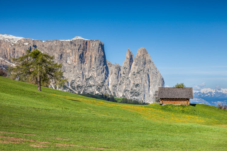
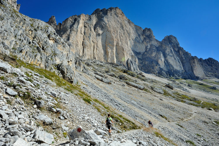
Day 3: Alpe di Tires and Cresta di SiusiAscent 500 m. Descent 630 m. Altitude 2170 - 2450 m. Distance 13 km. Walking time 5 hours The descent from Schlern to Alpe di Tires offers an incredible view of Antermoia, a mountain group that you will reach a little later on your route. Today, you will have the opportunity to see Antermoia at a distance, from which it looks like a cluster of towers. Another highlight of today’s crossing is a large formation called Alpe di Tires on the edge of Schlern and Seiser Alm. It rises vertically above the meadows of Seiser Alm and is best known for its iconic symbol, the 300-meter high Denti di Terrarossa or Teeth of Red Earth. The locals, mostly German-speaking, call it Rosszahne or the Horse’s Teeth. This is a very precise description of its appearance. Rosszahne is a series of sharp towers with a wildly jagged profile, a bit like a horse's teeth. Leaving the Alpe di Tires behind, you will walk for a couple of hours along Cresta di Siusi. It is a very pleasant and non fatiguing hike along a crest separating Seiser Alm and the slopes facing the Fassa valley. There are many excellent photo opportunities with views of Plattkofel, Sella and Marmolada. You will finish this daytime crossing at the foot of Plattkofel where there are a couple of nice mountain huts. |
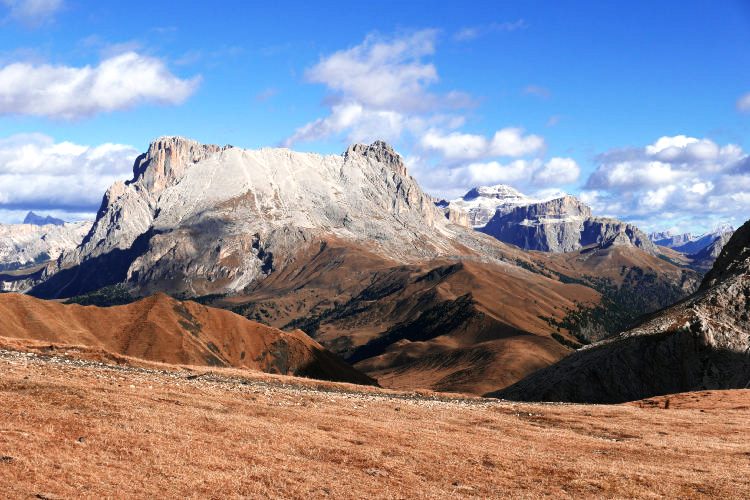
Day 4: Langkofel and PlattkofelAscent 590 m. Descent 550 m. Altitude 1970 - 2400 m. Distance 12 km. Walking time 5 hours The panoramic trail around Langkofel and Plattkofel mostly runs near the edge between meadows and higher rocky terrain. This fact makes today's crossing scenic and enjoyable because the trail is very open and offers breathtaking views of the neighboring Dolomite mountains - Puez Odle and Sella. For a short time at the beginning of the hike, you will still see Antermoia and Shiliar at a distance, but soon you will go down into the sparse woodlands of black pine. Pinus Nigra or black pine is a relict tree of preglacial origin. In the Dolomites, black pines grow on large limestone rocks, wrapping their roots around them and thus reaching a fertile layer. Black pines are not uncommon in the Dolomites, but at the foot of Plattkofel, they complete the beautiful landscape, making it incredibly picturesque. Plattkofel is one the the two main mountains of the Langkofel Group. The other one bears the name of the group - Langkofel. The Langkofel Group is a gigantic limestone rock formation that rises dramatically in the middle of the meadows. That is why its name is translated as Long Rock in all languages of the region. The Langkofel and Plattkofel are separated by a narrow gorge with almost vertical walls. The trail through this gorge is an alternative route for experienced and trained hikers, as it passes through demanding high mountainous terrain. At the foot of the Langkofel and opposite to the Sella Group, there is a truly magical place you will hike through called Citta dei Sassi or The Stone City. This area is characterized by thousands of large rocks and small pine trees growing between them. In addition, the impressive view of the Sella Group from the Stone City makes it spectacular to hike through. |
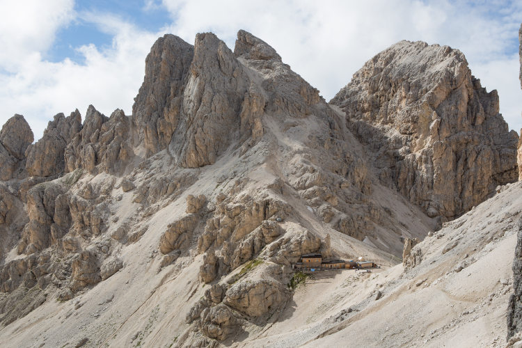
Day 5: Lake AntermoiaAscent 850 m. Descent 750 m. Altitude 1800 - 2500 m. Distance 14 km. Walking time 6 hours Today, you will hike from Langkofel to Antermoia through highly varied landscapes. The panoramic trail that skirts the Langkofel group from the south is now naturalistic, but it was built for a different purpose. In 1911, in anticipation of the First World War, Austrian soldiers built this trail on the orders of Frederick Augustus III, the last king of Saxony, to provide quick access from the Passo Sella pass to the Seiser Alm plateau. The trail is completely open to the south, southeast and southwest, allowing you to enjoy spectacular views all the way until you start descending into the high valley of Val Duron. The tranquility of Val Duron and its idyllic scenery with occasional pine trees scattered across the meadows will allow you to relax in less than an hour of walking up the valley. On the ascent from Val Duron, the landscape will change again. You will go through a coniferous forest to reach Antermoia, a rocky high-altitude region of the Rosengarten group. The landmarks of Antermoia are its dense clusters of high peaks and Lake Antermoia in a lifeless lunar landscape at an altitude of 2495 meters. The lake is all that remains of the glacier that occupied this rocky amphitheater several hundred years ago. Unlike many lakes of glacial origin, Lake Antermoia does not dry up in summer but it is constantly fed by springs. Many Ladin legends mention Lake Antermoia. Even its name comes from a legend and is associated with Antermia, a beautiful nymph who lived in the waters of the lake in the rose garden (Rosengerten in German) of the mythical King Laurino. Dwarves who populated these mountains admired the nymph from top of the peaks that surround the lake. Lake Antermoia and its rocky amphitheater are a great place to rest and take photos until the peaks hide the sun in the late afternoon. |
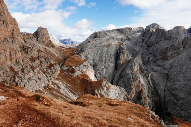
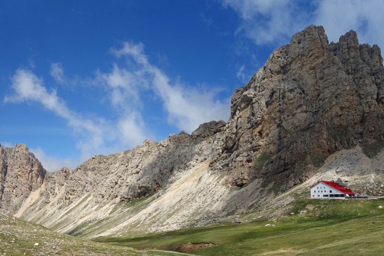
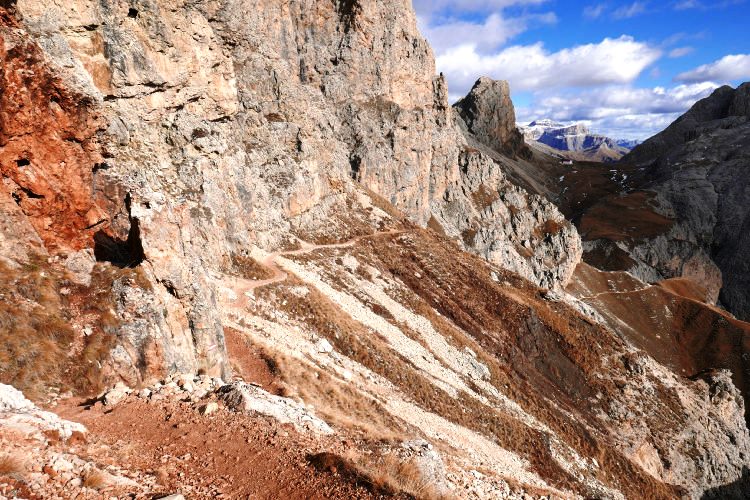
Day 6: RosengartenAscent 750 m. Descent 1140 m. Altitude 1620 - 2770 m. Distance 13 km. Walking time 6 hours The final hiking day starts with a steep and demanding ascent to the Passo d'Antermoia pass. For two hours you will be walking on rocky terrain. Here you will reach the highest altitude of your itinerary, 2770 meters. Passo d'Antermoia is a magical door to the prehistoric world that Rosengarten was once a part of. A petrified coral reef 230 million years old, Rosengarten stretches for 10 km from north to south. It has been preserved from the Triassic period to this day with minimal damage. In Rosengarten, you can see the reef’s inner lagoon and the cliffs along its edges. The vertical outer cliffs of the reef rise above the deep sea for more than a kilometer. The outer cliffs are the most famous view of the Rosengarten, one of the hallmarks of the Dolomites. Rosengarten is home to another emblematic landmark - Torri del Vajolet. It is a cluster of three peaks in the remote inner area of Rosengarten. You can explore this part of Rosengarten and reach Torri del Vajolet on an optional side hike, but you will need at least two hours for it, and you will hike along a steep path secured for safety. Your hike will end in the late afternoon at Karerpass, from where you can walk or travel by bus to your base hotel - in the area of the pass or in the Val di Fassa. |
Day 7: Departure from Val di FassaYour Seiser Alm - Rosengarten hike is over. After a breakfast at the basecamp hotel, you can start your way to the airport. |
Short hiking getaway bypassing the Langkofel Group In 3 hiking days you will cross Seiser Alm and reach Schlern and Rosengarten on the main trail. The starting and finishing locations are the same, but this itinerary bypasses the Langkofel Group |
Validity of prices: Summer 2026.
The prices are per person and include the VAT tax.
The prices are subject to change without notice.
Private guided and self-guided treks are private tours on the dates of your choice.
The indicated tour duration includes the days of arrival and departure. Hotel accommodation on the day of arrival and night before departure is included in the price.
Self-guided tour. Supplement for trips for solo hikers:
5 Day Self Guided Tour | Solo supplement € 160
7 Day Self Guided Tour | Solo supplement € 160
Private guided tours are only open to your group. The price listed on the tour page is for groups of 4 members. You can set a larger or a smaller group – please contact us for a price.
Validity of prices: Summer 2027.
The prices are per person and include the VAT tax.
The prices are subject to change without notice.
Private guided and self-guided treks are private tours on the dates of your choice.
The indicated tour duration includes the days of arrival and departure. Hotel accommodation on the day of arrival and night before departure is included in the price.
Self-guided tour. Supplement for trips for solo hikers:
5 Day Self Guided Tour | Solo supplement € 160
7 Day Self Guided Tour | Solo supplement € 160
Private guided tours are only open to your group. The price listed on the tour page is for groups of 4 members. You can set a larger or a smaller group – please contact us for a price.
The base camp locations are Val Gardena where you will start the hike and Karerpass, Carezza or Val di Fassa where you will finish.
Verona is the closest airport to Val Gardena, but it is relatively small. There are regular flights to Verona from most countries in Europe. It takes around 4 hours to arrive by train and bus from the Verona airport to Val Gardena. Innsbruck is also a convenient airport, but few airlines operate flights to Innsbruck. The nearest large international airport is Venice. More distant but still convenient airports are Bologna, Munich and Milan.
The same airports are preferable for traveling from Karerpass, Carezza and Val di Fassa after your hike.
We can help you plan the route from the airport and provide you with train and bus schedules: please contact us before you book the flights.
Proper hiking boots are a must for the mountains. We recommend high boots because they support the ankle better than any low boots and provide better stability on a rocky terrain. Even in the middle of the summer in the Dolomites you must bring some warm clothes with you: waterproof and windproof jacket, fleece jacket, long trekking pants and a cap. A raincoat, poncho or other type of rainwear is necessary. Other necessary items are the toiletries, light clean footwear to use in the huts, sunglasses and at least 2 one-liter bottles for water. Your trip documents will include a detailed packing list specifically prepared for your itinerary. We kindly ask everyone to read it carefully and be properly prepared for the hiking trip.
The first and last nights of your trip are in one of our basecamp hotels. While hiking, you will stay overnight in the mountain huts. You can count on the following services in the mountain huts: a bed in a shared room or in a private room (must be booked in advance), shower with hot water, toilets, meals, and a possibility to buy take away water and snacks such as sandwiches and chocolate. Shared rooms are equipped with bunk beds with mattresses, pillows and blankets. Bed linen is not provided in shared bedrooms: you must have a sleeping bag liner with you. Typically, it is a light cotton bag. Warm sleeping bag is unnecessary, since there are blankets in the bedrooms. In private rooms you are often offered bed linen, thus a sleeping bag liner is not required. If you book private rooms, we inform you on whether you need to bring a sleeping bag liner. Most huts have a heating system, but it is normally not required in the summer months. You will need clean footwear for the huts: light slides are an ideal solution. For detailed information on the huts please read Mountain Huts in the Alps.
In hut-to-hut hiking tours you are served a breakfast and a dinner in the huts and mountain hotels on the route.
Normally, the breakfast is served from 7am to 9am. It usually includes an unlimited quantity of coffee and tea, bread, butter, jam, honey and chocolate spread. In addition, some huts offer ham, cheese and muesli for breakfast. After breakfast we recommend filling your thermos with hot water or tea: ask the staff, and it will be for free in most huts.
The dinner time in the mountain huts is 7pm or 7:30pm for all guests. A typical dinner in a hut is very rich and includes a starter, the first course (such as pasta, risotto, dumplings), the second course (meat with a side dish) and a dessert. Any drinks at dinner (water, wine, beer, tea, coffee) are not free and should be ordered and paid separately.
Lunch. It is possible to stop for lunch in the mountain huts on the route. The lunch menu in the huts is similar to the dinner one. Typically, there is a choice of pasta for 7 – 10 euros. Second dishes are most often meat-based and cost 9 – 16 euros.
Our guided hiking tours are led by professional guides, each with years of guiding and wilderness experience and with passion for mountains. They permanently work in the region of the exact hiking tour, have professional licenses, are experts in emergency situations, regularly upgrade their qualifications and work in accordance with national regulations.
For self-guided hiking, it is necessary to be properly dressed, follow the safety rules and make realistic time calculation for day crossings – preferably according to the hiking schedule that we provide. Our self-guided hiking trips are planned so that they do not require specific skills or gear, unless it is clearly specified in the tour description. You can expect well-maintained trails equipped with direction signs. Exposed sections of the trail are secured on the self-guided routes: it makes them safe provided that you follow the basic safety rules for hiking in the mountains.
Mountains are a natural environment with a high level of risk, so we insistently ask all participants to read the safety rules and emergency procedures: Safety Considerations. If you have questions about the safety rules, please contact us +39 0463 63 60 80.
Insurance. It is important to have an appropriate insurance that covers the hiking activity. You don't need to include the climbing activity in your insurance, unless you are planning to climb during the hike.
Visa. We will provide you with a booking confirmation for all days of your trip. If you need the Italian visa, you can enclose this document with your visa application.
The most stable weather conditions in the Dolomites are statistically from the second week of July till the middle of September. This period in the Dolomites is characterized by warm sunny weather and modest rainfall. Earlier in June, the weather is normally favorable, but it is less reliable, and the mountain passes may be blocked by snow remaining from the winter. In June we may have to change the route depending on the snow situation on the passes. The second half of September in Dolomites is a beautiful period, but the weather is again less predictable: the probability of incessant rain increases, and it may snow at the altitude above 2,000 meters.
It is never hot in the Dolomites at the elevation of 2,000 m (6,560 ft) and above where most of the hiking routes pass. In a sunny day in August the temperature at 2,000 m can reach 20° C (68° F) suring the warmest hours of the day. It is comfortable for hiking. In a cold cloudy day, the temperature can stay at around 10° C (34° F) during the entire the day. It is always chilly at night and early in the morning. Thunderstorms, often with hail, are typical for the warmest months (July and August). In the Dolomites valleys at the altitudes of 1,000 – 1,500 m (3,280 – 4,920 ft) the day temperature can reach 27° C (80° F). It is fresh in the valleys in the morning and evening, and it is not stuffy at night even in the hottest weeks of the summer.